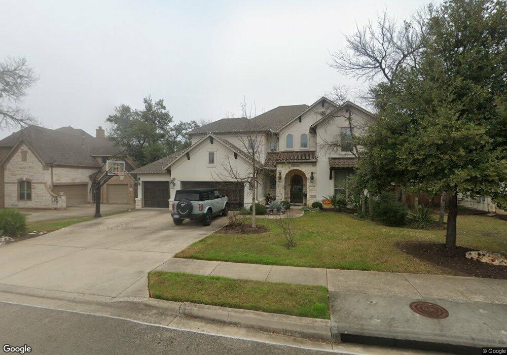
10409 Cannon Mark Way Austin, TX 78717
Avery Ranch NeighborhoodEstimated Value: $1,018,015 - $1,135,000
--
Bed
1
Bath
4,316
Sq Ft
$248/Sq Ft
Est. Value
About This Home
This home is located at 10409 Cannon Mark Way, Austin, TX 78717 and is currently estimated at $1,071,254, approximately $248 per square foot. 10409 Cannon Mark Way is a home with nearby schools including Purple Sage Elementary School, Pearson Ranch Middle, and McNeil High School.
Ownership History
Date
Name
Owned For
Owner Type
Purchase Details
Closed on
Apr 10, 2014
Sold by
Drees Custom Homes Lp
Bought by
Riggs Brent and Riggs Crystal
Current Estimated Value
Home Financials for this Owner
Home Financials are based on the most recent Mortgage that was taken out on this home.
Original Mortgage
$76,082
Outstanding Balance
$22,994
Interest Rate
4.43%
Mortgage Type
Stand Alone Second
Estimated Equity
$1,048,260
Create a Home Valuation Report for This Property
The Home Valuation Report is an in-depth analysis detailing your home's value as well as a comparison with similar homes in the area
Home Values in the Area
Average Home Value in this Area
Purchase History
| Date | Buyer | Sale Price | Title Company |
|---|---|---|---|
| Riggs Brent | -- | Austin Title Company Inc |
Source: Public Records
Mortgage History
| Date | Status | Borrower | Loan Amount |
|---|---|---|---|
| Open | Riggs Brent | $76,082 | |
| Open | Riggs Brent | $417,000 |
Source: Public Records
Tax History Compared to Growth
Tax History
| Year | Tax Paid | Tax Assessment Tax Assessment Total Assessment is a certain percentage of the fair market value that is determined by local assessors to be the total taxable value of land and additions on the property. | Land | Improvement |
|---|---|---|---|---|
| 2025 | $19,155 | $1,118,112 | $200,000 | $918,112 |
| 2024 | $19,155 | $1,021,664 | -- | -- |
| 2023 | $17,176 | $928,785 | $0 | $0 |
| 2022 | $18,783 | $844,350 | $0 | $0 |
| 2021 | $20,047 | $767,591 | $145,000 | $701,449 |
| 2020 | $17,752 | $697,810 | $133,196 | $564,614 |
| 2019 | $17,444 | $667,453 | $128,342 | $539,111 |
| 2018 | $16,624 | $660,048 | $101,650 | $558,398 |
| 2017 | $15,690 | $661,280 | $95,000 | $566,280 |
| 2016 | $16,058 | $642,758 | $95,000 | $547,758 |
| 2015 | $5,022 | $615,284 | $88,100 | $527,184 |
| 2014 | $5,022 | $207,603 | $0 | $0 |
Source: Public Records
Map
Nearby Homes
- 10701 Copper Basin Cove
- 11013 Avery Station Loop Unit 31
- 13604 Avery Trestle Ln Unit 17
- 14405 Laurinburg Dr
- 10610 Wills Loop
- 11200 Avery Station Loop Unit 13
- 13805 Wiregrass Way
- 10904 Brazoria Ln Unit 88
- 14016 Tyburn Trail
- 11612 Yeadon Way
- 14100 Laurinburg Dr
- 13920 Marathon Rd
- 12109 Maypole Bend
- 12315 Maypole Bend Unit 1002
- 11410 Culzean Castle Dr
- 14500 Homestead Village Cir
- 15508 Staked Plains Loop
- 14100 Avery Ranch Blvd Unit 103
- 14100 Avery Ranch Blvd Unit 403
- 11600 Santa Elena Ln
- 10405 Cannon Mark Way
- 10413 Cannon Mark Way
- 10417 Cannon Mark Way
- 10401 Cannon Mark Way
- 10408 Cambria Coast Run
- 10412 Cambria Coast Run
- 10412 Cannon Mark Way
- 14212 Montour Dr
- 10416 Cannon Mark Way
- 10408 Cannon Mark Way
- 10404 Cannon Mark Way
- 10500 Cambria Coast Run
- 10501 Cannon Mark Way
- 10404 Cambria Coast Run
- 10400 Cannon Mark Way
- 10504 Cambria Coast Run
- 10500 Cannon Mark Way
- 10505 Cannon Mark Way
- 14217 Montour Dr
- 10508 Cambria Coast Run