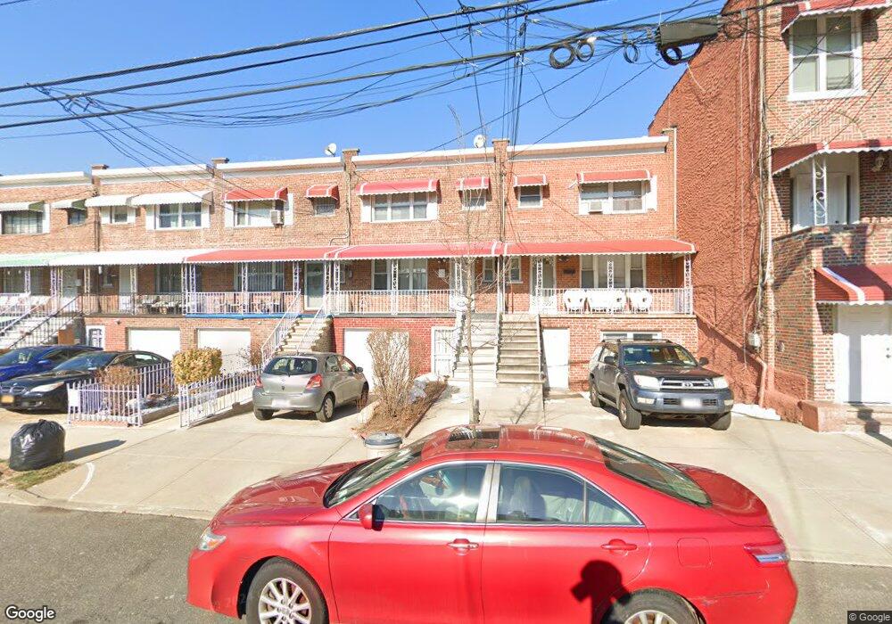
1041 E 212th St Bronx, NY 10469
Williamsbridge NeighborhoodEstimated Value: $574,543 - $659,000
Studio
--
Bath
1,757
Sq Ft
$354/Sq Ft
Est. Value
About This Home
This home is located at 1041 E 212th St, Bronx, NY 10469 and is currently estimated at $621,886, approximately $353 per square foot. 1041 E 212th St is a home located in Bronx County with nearby schools including P.S. 78 Anne Hutchinson, J.H.S. 144 Michelangelo, and New Covenant Christian School.
Ownership History
Date
Name
Owned For
Owner Type
Purchase Details
Closed on
Apr 11, 2005
Sold by
Lumpkin Peaches P and Lumpkin Richard
Bought by
Lumpkin Eric and Lumpkin Richard
Current Estimated Value
Purchase Details
Closed on
Jan 13, 1997
Sold by
Lumpkin Peaches P and Lumpkin Richard
Bought by
Lumpkin Peaches P and Lumpkin Richard
Create a Home Valuation Report for This Property
The Home Valuation Report is an in-depth analysis detailing your home's value as well as a comparison with similar homes in the area
Home Values in the Area
Average Home Value in this Area
Purchase History
| Date | Buyer | Sale Price | Title Company |
|---|---|---|---|
| Lumpkin Eric | -- | -- | |
| Lumpkin Eric | -- | -- | |
| Lumpkin Peaches P | -- | Commonwealth Land Title Ins | |
| Lumpkin Peaches P | -- | Commonwealth Land Title Ins |
Source: Public Records
Tax History
| Year | Tax Paid | Tax Assessment Tax Assessment Total Assessment is a certain percentage of the fair market value that is determined by local assessors to be the total taxable value of land and additions on the property. | Land | Improvement |
|---|---|---|---|---|
| 2025 | $5,012 | $27,933 | $5,938 | $21,995 |
| 2024 | $5,012 | $26,352 | $6,421 | $19,931 |
| 2023 | $5,067 | $26,352 | $6,203 | $20,149 |
| 2022 | $4,670 | $33,060 | $7,500 | $25,560 |
| 2021 | $4,889 | $32,280 | $7,500 | $24,780 |
| 2020 | $4,631 | $25,500 | $7,500 | $18,000 |
| 2019 | $4,301 | $25,500 | $7,500 | $18,000 |
| 2018 | $4,179 | $21,960 | $5,512 | $16,448 |
| 2017 | $4,143 | $21,794 | $6,777 | $15,017 |
| 2016 | $3,800 | $20,561 | $7,061 | $13,500 |
| 2015 | $2,402 | $19,398 | $7,490 | $11,908 |
| 2014 | $2,402 | $18,300 | $8,340 | $9,960 |
Source: Public Records
Map
Nearby Homes
- 1046 E 212th St
- 1032 E 212th St
- 1051 E 213th St
- 1021 E 213th St Unit 1
- 3617 Laconia Ave
- 3523 Laconia Ave
- 955 Tilden St
- 954 E 212th St
- 3613 Paulding Ave
- 953 Tilden St
- 1134 E 214th St
- 958 E 214th St
- 946 Tilden St
- 949 E 213th St
- 1031 E 215th St
- 940 E 212th St
- 949 E 214th St
- 1150 E 214th St
- 1007 E 215th St
- 933 Tilden St
- 1039 E 212th St
- 1043 E 212th St
- 1037 E 212th St
- 1047 E 212th St
- 1035 E 212th St
- 1031 E 212th St
- 1042 E 213th St
- 1044 E 213th St
- 1040 E 213th St
- 1036 E 213th St
- 1046 E 213th St
- 3567 Laconia Ave
- 1029 E 212th St
- 3565 Laconia Ave
- 3573 Laconia Ave
- 3569 Laconia Ave
- 3569 Laconia Ave Unit 1
- 1034 E 213th St
- 3575 Laconia Ave
- 1027 E 212th St
Your Personal Tour Guide
Ask me questions while you tour the home.