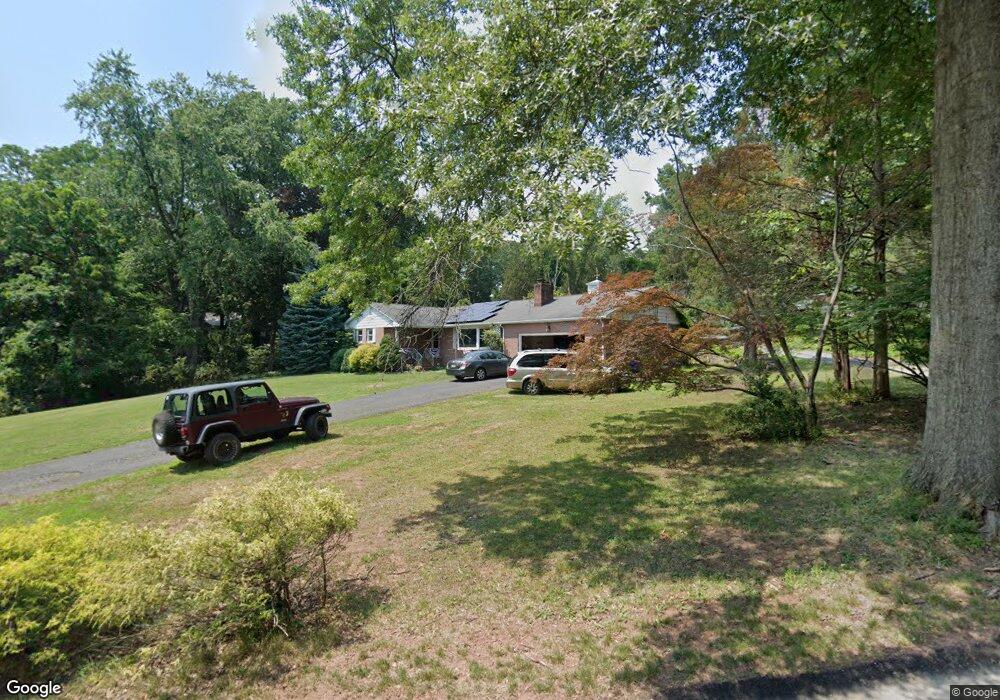
1041 Hoffman Rd Bridgewater, NJ 08807
Green Knoll NeighborhoodEstimated Value: $585,000 - $791,000
--
Bed
--
Bath
1,476
Sq Ft
$452/Sq Ft
Est. Value
About This Home
This home is located at 1041 Hoffman Rd, Bridgewater, NJ 08807 and is currently estimated at $667,435, approximately $452 per square foot. 1041 Hoffman Rd is a home located in Somerset County with nearby schools including Crim Primary School, Bridgewater-Raritan Middle School, and Hillside Intermediate School.
Ownership History
Date
Name
Owned For
Owner Type
Purchase Details
Closed on
Apr 12, 1999
Sold by
Koles Jean
Bought by
Mitchko Allen and Mitchko Pam
Current Estimated Value
Home Financials for this Owner
Home Financials are based on the most recent Mortgage that was taken out on this home.
Original Mortgage
$140,000
Outstanding Balance
$35,391
Interest Rate
7.02%
Estimated Equity
$632,044
Create a Home Valuation Report for This Property
The Home Valuation Report is an in-depth analysis detailing your home's value as well as a comparison with similar homes in the area
Home Values in the Area
Average Home Value in this Area
Purchase History
| Date | Buyer | Sale Price | Title Company |
|---|---|---|---|
| Mitchko Allen | $220,000 | -- |
Source: Public Records
Mortgage History
| Date | Status | Borrower | Loan Amount |
|---|---|---|---|
| Open | Mitchko Allen | $140,000 |
Source: Public Records
Tax History Compared to Growth
Tax History
| Year | Tax Paid | Tax Assessment Tax Assessment Total Assessment is a certain percentage of the fair market value that is determined by local assessors to be the total taxable value of land and additions on the property. | Land | Improvement |
|---|---|---|---|---|
| 2025 | $10,770 | $573,200 | $304,600 | $268,600 |
| 2024 | $10,770 | $552,000 | $304,600 | $247,400 |
| 2023 | $9,911 | $499,300 | $304,600 | $194,700 |
| 2022 | $9,337 | $454,800 | $304,600 | $150,200 |
| 2021 | $9,374 | $448,000 | $304,600 | $143,400 |
| 2020 | $9,341 | $446,100 | $304,600 | $141,500 |
| 2019 | $9,374 | $443,200 | $304,600 | $138,600 |
| 2018 | $9,290 | $440,300 | $304,600 | $135,700 |
| 2017 | $8,930 | $422,800 | $304,600 | $118,200 |
| 2016 | $8,630 | $414,700 | $304,600 | $110,100 |
| 2015 | $8,584 | $412,700 | $304,600 | $108,100 |
| 2014 | $8,492 | $402,100 | $304,600 | $97,500 |
Source: Public Records
Map
Nearby Homes
- 114 Branch Rd
- 13 Lawton Rd
- 1930 Mountain Top Rd
- 1 Holmes Ct
- 1600 Mountain Top Rd
- 499 Foothill Rd
- 7 Meyers Way
- 7 Monmouth Ave
- 36 Somerset Ave
- 1825 Kennesaw Way
- 356 Greenfield Rd
- 11 Ash St
- 93 Highland Ave
- 800 Star View Way
- 61 Stella Dr
- 700 Half Foothill Rd
- 1266 Mount Vernon Rd
- 42 Stryker Ct
- 20 Copper Hill Rd
- 30 Demond Place
- 1049 Hoffman Rd
- 1035 Hoffman Rd
- 1042 Hoffman Rd
- 1048 Hoffman Rd
- 560 Foothill Rd
- 1043 Hoffman Rd
- 1055 Hoffman Rd
- 556 Foothill Rd
- 1056 Hoffman Rd
- 552 Foothill Rd
- 564 Foothill Rd
- 104 Branch Rd
- 1060 Hoffman Rd
- 550 Foothill Rd
- 1069 Hoffman Rd
- 1052 Hoffman Rd
- 108 Branch Rd
- 566 Foothill Rd
- 559 Foothill Rd
- 555 Foothill Rd