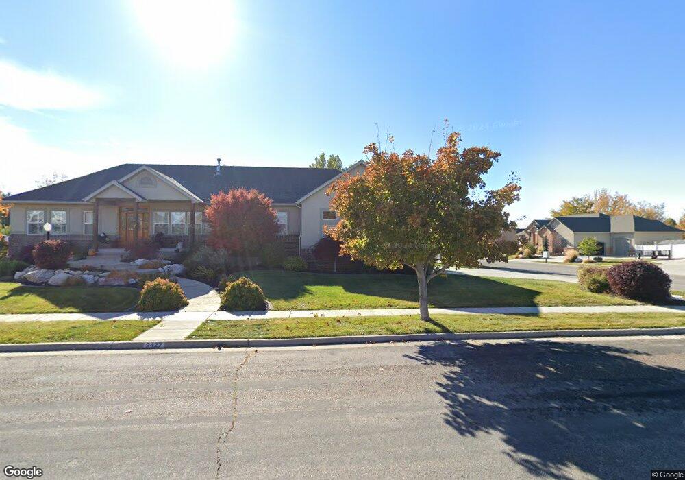
1041 S 2450 W Syracuse, UT 84075
Estimated Value: $586,000 - $748,000
--
Bed
5
Baths
1,893
Sq Ft
$366/Sq Ft
Est. Value
About This Home
This home is located at 1041 S 2450 W, Syracuse, UT 84075 and is currently estimated at $692,592, approximately $365 per square foot. 1041 S 2450 W is a home located in Davis County with nearby schools including Syracuse Elementary School, Syracuse Junior High School, and Syracuse High School.
Ownership History
Date
Name
Owned For
Owner Type
Purchase Details
Closed on
Oct 30, 2020
Sold by
Lasusa Cassi E and Bertoldi Ray L
Bought by
Lasusa Frank and Lasusa Cassi E
Current Estimated Value
Home Financials for this Owner
Home Financials are based on the most recent Mortgage that was taken out on this home.
Original Mortgage
$278,000
Outstanding Balance
$247,266
Interest Rate
2.9%
Mortgage Type
New Conventional
Estimated Equity
$445,326
Purchase Details
Closed on
Jul 9, 2019
Sold by
Brown David C and Brown Suzanne J
Bought by
Lasusa Cassi E and Bertoldi Ray L
Home Financials for this Owner
Home Financials are based on the most recent Mortgage that was taken out on this home.
Original Mortgage
$275,000
Interest Rate
3.9%
Mortgage Type
New Conventional
Purchase Details
Closed on
Sep 13, 2013
Sold by
Brown David C and Brown Suzanne
Bought by
The David C Brown And Suzanne J Brown Tr
Purchase Details
Closed on
Dec 20, 2004
Sold by
Jenson Robert and Jenson Christine E
Bought by
Brown David and Brown Suzanne
Home Financials for this Owner
Home Financials are based on the most recent Mortgage that was taken out on this home.
Original Mortgage
$30,000
Interest Rate
5.12%
Mortgage Type
New Conventional
Purchase Details
Closed on
Jul 30, 2004
Sold by
Jenson Robert L and Jenson Christine E
Bought by
Jenson Robert and Jenson Christine E
Home Financials for this Owner
Home Financials are based on the most recent Mortgage that was taken out on this home.
Original Mortgage
$282,000
Interest Rate
5%
Mortgage Type
New Conventional
Purchase Details
Closed on
Apr 30, 2003
Sold by
Benchmark Real Estate Co
Bought by
Jenson Robert L and Jenson Christine E
Home Financials for this Owner
Home Financials are based on the most recent Mortgage that was taken out on this home.
Original Mortgage
$270,000
Interest Rate
5.72%
Mortgage Type
Construction
Create a Home Valuation Report for This Property
The Home Valuation Report is an in-depth analysis detailing your home's value as well as a comparison with similar homes in the area
Home Values in the Area
Average Home Value in this Area
Purchase History
| Date | Buyer | Sale Price | Title Company |
|---|---|---|---|
| Lasusa Frank | -- | Accommodation | |
| Lasusa Cassi E | -- | Inwest Title Service | |
| The David C Brown And Suzanne J Brown Tr | -- | None Available | |
| Brown David | -- | None Available | |
| Jenson Robert | -- | Western States Title Co | |
| Jenson Robert L | -- | Founders Title Co |
Source: Public Records
Mortgage History
| Date | Status | Borrower | Loan Amount |
|---|---|---|---|
| Open | Lasusa Frank | $278,000 | |
| Closed | Lasusa Cassi E | $275,000 | |
| Previous Owner | Brown David | $30,000 | |
| Previous Owner | Brown David | $239,900 | |
| Previous Owner | Jenson Robert | $282,000 | |
| Previous Owner | Jenson Robert L | $270,000 | |
| Closed | Jenson Robert L | $1,000 |
Source: Public Records
Tax History Compared to Growth
Tax History
| Year | Tax Paid | Tax Assessment Tax Assessment Total Assessment is a certain percentage of the fair market value that is determined by local assessors to be the total taxable value of land and additions on the property. | Land | Improvement |
|---|---|---|---|---|
| 2025 | $3,785 | $365,200 | $126,474 | $238,726 |
| 2024 | $3,794 | $368,500 | $112,496 | $256,004 |
| 2023 | $3,571 | $632,000 | $156,281 | $475,719 |
| 2022 | $3,741 | $363,000 | $88,848 | $274,152 |
| 2021 | $3,349 | $503,000 | $132,217 | $370,783 |
| 2020 | $3,039 | $442,000 | $111,172 | $330,828 |
| 2019 | $3,065 | $440,000 | $119,559 | $320,441 |
| 2018 | $2,870 | $409,000 | $112,661 | $296,339 |
| 2016 | $2,648 | $197,890 | $43,052 | $154,838 |
| 2015 | $2,698 | $192,005 | $43,052 | $148,953 |
| 2014 | $2,700 | $195,802 | $43,052 | $152,750 |
| 2013 | -- | $162,172 | $37,001 | $125,171 |
Source: Public Records
Map
Nearby Homes
- 2000 Farmhouse Plan at Legacy Park - Collection
- 2000 Farmhouse Select Plan at Legacy Park - Collection
- San Marino Craftsman Plan at Legacy Park - Estates
- 2050 Craftsman Plan at Legacy Park - Collection
- 1825 Farmhouse Plan at Legacy Park - Collection
- 2200 Garden Plan at Legacy Park - Collection
- Lincoln Farmhouse Plan at Legacy Park - Estates
- Hamilton Traditional Plan at Legacy Park - Estates
- 1700 Farmhouse Plan at Legacy Park - Collection
- Tivoli Traditional Plan at Legacy Park - Estates
- Torino Farmhouse Plan at Legacy Park - Estates
- 2400 Farmhouse Plan at Legacy Park - Collection
- 2655 S 2430 W Unit 120
- 2665 S 2430 W Unit 118
- 2655 S 2430 W Unit 116
- 2633 S 2430 W Unit 113
- 2614 S 2430 W Unit 106
- 2663 S 2430 W
- 2117 W 1275 S
- 2840 W 1200 S