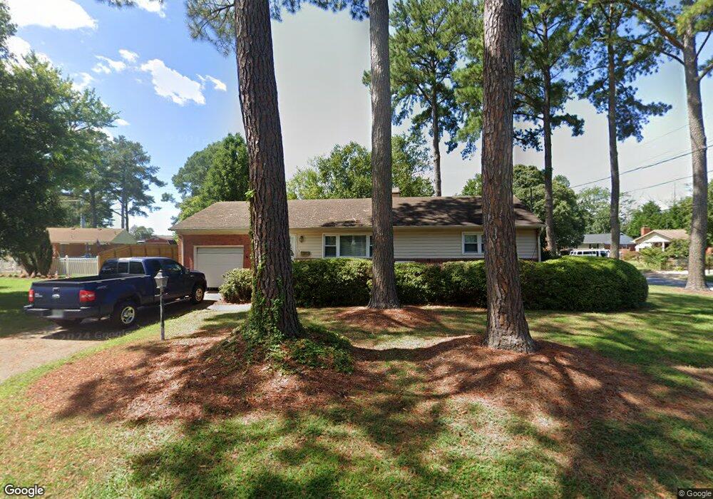
1041 Sanford Ave Virginia Beach, VA 23455
Bayside NeighborhoodEstimated Value: $299,000 - $360,000
3
Beds
1
Bath
1,340
Sq Ft
$249/Sq Ft
Est. Value
About This Home
This home is located at 1041 Sanford Ave, Virginia Beach, VA 23455 and is currently estimated at $333,364, approximately $248 per square foot. 1041 Sanford Ave is a home located in Virginia Beach City with nearby schools including Bayside Elementary School, Bayside 6th Grade Campus, and Bayside High School.
Ownership History
Date
Name
Owned For
Owner Type
Purchase Details
Closed on
Sep 19, 2013
Sold by
Tyree Edgar F
Bought by
Mcdaniel Michael F
Current Estimated Value
Home Financials for this Owner
Home Financials are based on the most recent Mortgage that was taken out on this home.
Original Mortgage
$173,700
Outstanding Balance
$129,723
Interest Rate
4.42%
Mortgage Type
New Conventional
Estimated Equity
$203,641
Create a Home Valuation Report for This Property
The Home Valuation Report is an in-depth analysis detailing your home's value as well as a comparison with similar homes in the area
Home Values in the Area
Average Home Value in this Area
Purchase History
| Date | Buyer | Sale Price | Title Company |
|---|---|---|---|
| Mcdaniel Michael F | $193,000 | -- |
Source: Public Records
Mortgage History
| Date | Status | Borrower | Loan Amount |
|---|---|---|---|
| Open | Mcdaniel Michael F | $173,700 |
Source: Public Records
Tax History Compared to Growth
Tax History
| Year | Tax Paid | Tax Assessment Tax Assessment Total Assessment is a certain percentage of the fair market value that is determined by local assessors to be the total taxable value of land and additions on the property. | Land | Improvement |
|---|---|---|---|---|
| 2025 | $2,298 | $272,700 | $135,000 | $137,700 |
| 2024 | $2,298 | $236,900 | $125,000 | $111,900 |
| 2023 | $2,197 | $221,900 | $110,000 | $111,900 |
| 2022 | $2,197 | $221,900 | $110,000 | $111,900 |
| 2021 | $1,881 | $190,000 | $102,000 | $88,000 |
| 2020 | $1,886 | $185,400 | $102,000 | $83,400 |
| 2019 | $1,871 | $178,600 | $102,000 | $76,600 |
| 2018 | $1,790 | $178,600 | $102,000 | $76,600 |
| 2017 | $1,764 | $176,000 | $93,000 | $83,000 |
| 2016 | $1,657 | $167,400 | $93,000 | $74,400 |
| 2015 | $1,743 | $176,100 | $99,800 | $76,300 |
| 2014 | $1,609 | $175,300 | $99,800 | $75,500 |
Source: Public Records
Map
Nearby Homes
- 5644 Lawson Hall Rd
- 1109 Spindle Crossing
- 1005 Hollins College Ct
- 1052 Old Canterbury Dr
- 5712 Gretna Rd
- 1284 Hillock Crossing
- 5545 Lambdin Arch
- 5605 State St
- 902 Monarch Dr
- 5537 Finespun Last
- 900 Monarch Dr
- 5609 Rossburn Dr
- 5522 Campus Dr
- 1004 Pastern Brief
- 5505 Merner Ln
- 5618 Baccalaureate Dr
- 5536 Frog Pond Ln
- 5528 Goose Pond Ln
- 809 Pencil Box Way
- 5589 Baccalaureate Dr
- 1032 Anoka Ave
- 1037 Sanford Ave
- 1028 Anoka Ave
- 1045 Sanford Ave
- 1040 Sanford Ave
- 1036 Sanford Ave
- 5712 Attica Ave
- 1044 Sanford Ave
- 1032 Sanford Ave
- 1037 Anoka Ave
- 1033 Sanford Ave
- 5720 Attica Ave
- 1041 Anoka Ave
- 5716 Attica Ave
- 1033 Anoka Ave
- 1049 Sanford Ave
- 1041 Baker Rd
- 1037 Baker Rd
- 1048 Sanford Ave
- 1028 Sanford Ave