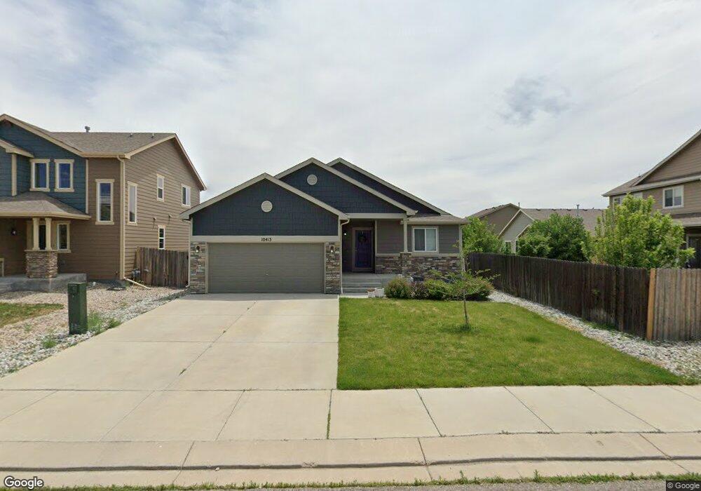
10413 Declaration Dr Colorado Springs, CO 80925
Widefield NeighborhoodEstimated Value: $440,803 - $469,000
About This Home
This property is professionally managed by AMH, a leading single-family rental company. We work to simplify your rental experience by offering self-guided tours and a streamlined leasing process you can complete all online, all on your own schedule. Once moved in, we provide maintenance support that you can rely on, so you can enjoy your weekends stress-free. We look forward to welcoming you home! See Today, Sign Today™ Take a self-guided tour of this property using our Let Yourself In® service to view the space on your own schedule, without an agent. And if your documents are in order, you might even view a home and sign a lease on the same day! Utilities, taxes, and other fees may apply. Please verify and confirm all information before signing a lease. If you have questions, don’t hesitate to contact us at the telephone number on this property listing. All lease applications, documentation, and initial payments for this property, must be submitted directly through or by phone. The photos, renderings, or other images of the properties on our website, are for illustrative purposes only, and may vary from the features, amenities, or phase of construction. We do not advertise properties on Craigslist, Facebook Marketplace, or other classified advertising websites. If you believe one of our residences is listed there, please notify us. For further description of applicable fees, please go to our website.
Ownership History
Purchase Details
Purchase Details
Home Financials for this Owner
Home Financials are based on the most recent Mortgage that was taken out on this home.Purchase Details
Home Financials for this Owner
Home Financials are based on the most recent Mortgage that was taken out on this home.Home Values in the Area
Average Home Value in this Area
Purchase History
| Date | Buyer | Sale Price | Title Company |
|---|---|---|---|
| Ah4r Properties Two Llc | $447,000 | Fidelity National Title | |
| Carter Rebecca | $305,000 | -- | |
| Whitman Robert | -- | Heritage Title |
Mortgage History
| Date | Status | Borrower | Loan Amount |
|---|---|---|---|
| Previous Owner | Carter Rebecca | $311,557 | |
| Previous Owner | Carter Rebecca | -- | |
| Previous Owner | Whitman Robert | $273,961 |
Property History
| Date | Event | Price | List to Sale | Price per Sq Ft |
|---|---|---|---|---|
| 09/22/2025 09/22/25 | Off Market | $2,740 | -- | -- |
| 09/10/2025 09/10/25 | Price Changed | $2,740 | -2.0% | $1 / Sq Ft |
| 09/10/2025 09/10/25 | For Rent | $2,795 | 0.0% | -- |
| 08/20/2025 08/20/25 | Off Market | $2,795 | -- | -- |
| 08/04/2025 08/04/25 | For Rent | $2,795 | -- | -- |
Tax History Compared to Growth
Tax History
| Year | Tax Paid | Tax Assessment Tax Assessment Total Assessment is a certain percentage of the fair market value that is determined by local assessors to be the total taxable value of land and additions on the property. | Land | Improvement |
|---|---|---|---|---|
| 2025 | $4,229 | $30,690 | -- | -- |
| 2024 | $4,183 | $31,830 | $6,040 | $25,790 |
| 2022 | $3,195 | $23,080 | $4,810 | $18,270 |
| 2021 | $3,326 | $23,740 | $4,950 | $18,790 |
| 2020 | $3,170 | $22,390 | $4,330 | $18,060 |
| 2019 | $3,160 | $22,390 | $4,330 | $18,060 |
| 2018 | $2,700 | $18,840 | $4,360 | $14,480 |
| 2017 | $2,757 | $18,840 | $4,360 | $14,480 |
| 2016 | $2,648 | $20,460 | $4,380 | $16,080 |
| 2015 | $1,196 | $8,770 | $8,770 | $0 |
| 2014 | $1,474 | $10,860 | $10,860 | $0 |
Map
- 10405 Abrams Dr
- 6572 Justice Way
- 10394 Abrams Dr
- 10442 Abrams Dr
- 10634 Abrams Dr
- 10525 Abrams Dr
- 10604 Deer Meadow Cir
- 10670 Abrams Dr
- 10648 Desert Bloom Way
- 10732 Deer Meadow Cir
- 10202 Abrams Dr
- 10568 Kalama Dr
- 6579 Lamine Dr
- 10208 Abrams Dr
- 10420 Deer Meadow Cir
- 10721 Yuba Dr
- 10179 Seawolf Dr
- 6484 Chaplin Dr
- 6225 Laurel Grass Range Trail
- 10463 Desert Bloom Way
- 6501 Justice Way
- 10419 Declaration Dr
- 10425 Declaration Dr
- 10408 Declaration Dr
- 6521 Justice Way
- 10431 Declaration Dr
- 10420 Declaration Dr
- 10402 Declaration Dr
- 6541 Justice Way
- 10426 Declaration Dr
- 10437 Declaration Dr
- 6502 Justice Way
- 6512 Justice Way
- 10432 Declaration Dr
- 6522 Justice Way
- 10390 Declaration Dr
- 6532 Justice Way
- 10393 Abrams Dr
- 10438 Declaration Dr
- 10417 Abrams Dr