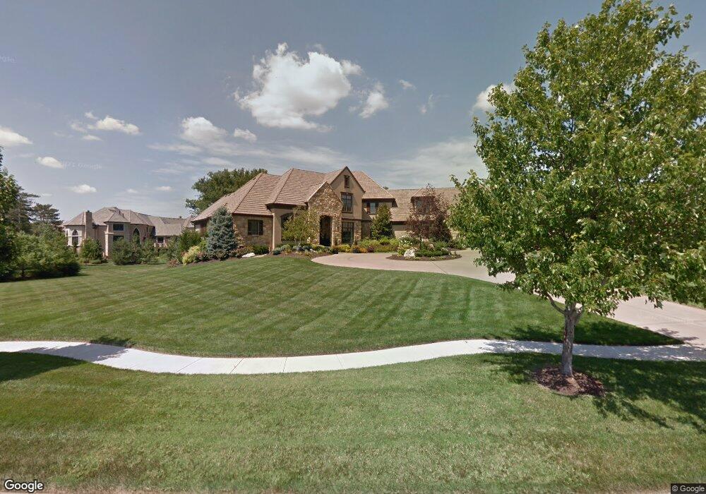
10414 Mohawk Rd Leawood, KS 66206
Estimated Value: $1,739,000 - $3,431,445
6
Beds
9
Baths
5,956
Sq Ft
$434/Sq Ft
Est. Value
About This Home
This home is located at 10414 Mohawk Rd, Leawood, KS 66206 and is currently estimated at $2,585,223, approximately $434 per square foot. 10414 Mohawk Rd is a home located in Johnson County with nearby schools including Brookwood Elementary School, Shawnee Mission South High School, and Indian Woods Middle School.
Ownership History
Date
Name
Owned For
Owner Type
Purchase Details
Closed on
Feb 23, 2005
Sold by
Saddie Properties Llc
Bought by
Boatman Randall J and Boatman Jamie M
Current Estimated Value
Home Financials for this Owner
Home Financials are based on the most recent Mortgage that was taken out on this home.
Original Mortgage
$300,000
Outstanding Balance
$147,977
Interest Rate
5.71%
Mortgage Type
New Conventional
Estimated Equity
$2,437,246
Create a Home Valuation Report for This Property
The Home Valuation Report is an in-depth analysis detailing your home's value as well as a comparison with similar homes in the area
Home Values in the Area
Average Home Value in this Area
Purchase History
| Date | Buyer | Sale Price | Title Company |
|---|---|---|---|
| Boatman Randall J | -- | First American Title |
Source: Public Records
Mortgage History
| Date | Status | Borrower | Loan Amount |
|---|---|---|---|
| Open | Boatman Randall J | $300,000 |
Source: Public Records
Tax History
| Year | Tax Paid | Tax Assessment Tax Assessment Total Assessment is a certain percentage of the fair market value that is determined by local assessors to be the total taxable value of land and additions on the property. | Land | Improvement |
|---|---|---|---|---|
| 2025 | $31,564 | $302,002 | $84,308 | $217,694 |
| 2024 | $31,564 | $292,238 | $84,308 | $207,930 |
| 2023 | $31,268 | $289,559 | $84,308 | $205,251 |
| 2022 | $29,821 | $276,495 | $84,308 | $192,187 |
| 2021 | $30,190 | $270,158 | $84,308 | $185,850 |
| 2020 | $29,650 | $261,418 | $84,308 | $177,110 |
| 2019 | $27,593 | $243,903 | $68,374 | $175,529 |
| 2018 | $26,974 | $237,578 | $68,374 | $169,204 |
| 2017 | $27,147 | $235,371 | $56,983 | $178,388 |
| 2016 | $27,636 | $236,532 | $50,575 | $185,957 |
| 2015 | $26,474 | $228,367 | $50,574 | $177,793 |
| 2013 | -- | $218,500 | $50,574 | $167,926 |
Source: Public Records
Map
Nearby Homes
- 10531 Mission Rd Unit 204B
- 4001 W 126th St
- 2700 W 104th Terrace
- 10316 Howe Dr
- 10332 Cherokee Ln
- 10505 Belinder Rd
- 2309 W 104th St
- 3905 W 101st Terrace
- 10308 Granada Ln
- 10315 High Dr
- 2301 W 103rd St
- 9815 Belinder Rd
- 2615 W 98th St
- 9919 High Dr
- 2341 W 98th St
- 11425 Canterbury Cir
- 9815 Overbrook Rd
- 10013 Briar Dr
- 5308 W 103rd Terrace
- 10300 Nall Ave
- 10410 Mohawk Rd
- 3744 W 105th Terrace
- 10421 Howe Ln
- 3745 W 105th Terrace
- 10411 Mohawk Rd
- 3748 W 105th Terrace
- 3749 W 105th Terrace
- 10417 Howe Ln
- 3756 W 105th Terrace
- 3753 W 105th Terrace
- 10407 Mohawk Rd
- 10350 Mohawk Rd
- 3760 W 105th Terrace
- 3757 W 105th Terrace
- 3764 W 105th Terrace
- 10420 Mohawk Ln
- 3768 W 105th Terrace
- 10412 Mohawk Ln
- 10424 Mohawk Ln
- 10408 Mohawk Ln
Your Personal Tour Guide
Ask me questions while you tour the home.