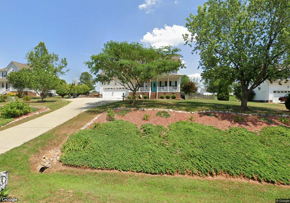
1042 Black Angus Dr Garner, NC 27529
Estimated Value: $400,956 - $418,000
3
Beds
3
Baths
2,230
Sq Ft
$184/Sq Ft
Est. Value
About This Home
This home is located at 1042 Black Angus Dr, Garner, NC 27529 and is currently estimated at $409,239, approximately $183 per square foot. 1042 Black Angus Dr is a home located in Johnston County with nearby schools including West View Elementary School, Cleveland Middle School, and West Johnston High School.
Ownership History
Date
Name
Owned For
Owner Type
Purchase Details
Closed on
Sep 24, 2012
Sold by
Applewhite Sherry Lee
Bought by
Applewhite Robert D and Applewhite Robin
Current Estimated Value
Home Financials for this Owner
Home Financials are based on the most recent Mortgage that was taken out on this home.
Original Mortgage
$156,000
Outstanding Balance
$108,684
Interest Rate
3.64%
Mortgage Type
New Conventional
Estimated Equity
$300,555
Purchase Details
Closed on
Nov 8, 2002
Sold by
Applewhite Sherry Lee
Bought by
Ashley Turner Building Co Inc
Purchase Details
Closed on
Aug 9, 2002
Sold by
Ashley Turner Building Co Inc
Bought by
Ashley Turner Enterprises Inc
Purchase Details
Closed on
Jul 16, 2002
Sold by
Ashley Turner Enterprises Inc
Bought by
Carolina Packers Inc
Create a Home Valuation Report for This Property
The Home Valuation Report is an in-depth analysis detailing your home's value as well as a comparison with similar homes in the area
Home Values in the Area
Average Home Value in this Area
Purchase History
| Date | Buyer | Sale Price | Title Company |
|---|---|---|---|
| Applewhite Robert D | $145,500 | Fidelity Natl Title Ins Co | |
| Ashley Turner Building Co Inc | $148,500 | -- | |
| Ashley Turner Enterprises Inc | -- | -- | |
| Carolina Packers Inc | -- | -- |
Source: Public Records
Mortgage History
| Date | Status | Borrower | Loan Amount |
|---|---|---|---|
| Open | Applewhite Robert D | $156,000 |
Source: Public Records
Tax History
| Year | Tax Paid | Tax Assessment Tax Assessment Total Assessment is a certain percentage of the fair market value that is determined by local assessors to be the total taxable value of land and additions on the property. | Land | Improvement |
|---|---|---|---|---|
| 2025 | $2,572 | $405,090 | $80,000 | $325,090 |
| 2024 | $1,976 | $243,990 | $46,000 | $197,990 |
| 2023 | $1,909 | $243,990 | $46,000 | $197,990 |
| 2022 | $1,962 | $238,500 | $46,000 | $192,500 |
| 2021 | $1,962 | $238,500 | $46,000 | $192,500 |
| 2020 | $1,986 | $238,500 | $46,000 | $192,500 |
| 2019 | $1,986 | $238,500 | $46,000 | $192,500 |
| 2018 | $1,608 | $188,650 | $35,500 | $153,150 |
| 2017 | $1,608 | $188,650 | $35,500 | $153,150 |
| 2016 | $1,608 | $188,650 | $35,500 | $153,150 |
| 2015 | $1,608 | $188,650 | $35,500 | $153,150 |
| 2014 | $1,608 | $188,650 | $35,500 | $153,150 |
Source: Public Records
Map
Nearby Homes
- 866 Black Angus Dr
- 58 Trailblazer Ln
- 205 Alice Dr
- 421 Danielle Dr
- Lot 2a S Shiloh Rd
- 3694 S Shiloh Rd
- 908 Olive Dr
- 236 Fieldtrial Cir
- 41 Gladwood Way
- 356 Fieldtrial Cir
- 209 Timber Wolf Crossing
- 242 Thornwhistle Place
- 403 Airedale Trail
- 181 Fawn Hill Ct
- 119 Fairbanks Ave
- 77 Fairbanks Ave
- 97 Fairbanks Ave
- 208 Fairbanks Ave
- 57 Fairbanks Ave
- 111 Artic Cir
- 1020 Black Angus Dr
- 1064 Black Angus Dr
- 1084 Black Angus Dr
- 996 Black Angus Dr
- 68 Longhorn Dr
- 46 Longhorn Dr
- 94 Longhorn Dr
- 36 Brahma Dr
- 1033 Black Angus Dr
- 37 Brahma Dr
- 1106 Black Angus Dr
- 974 Black Angus Dr
- 30 Longhorn Dr
- 1097 Black Angus Dr
- 120 Longhorn Dr
- 1003 Black Angus Dr
- 971 Black Angus Dr
- 1130 Black Angus Dr
- 952 Black Angus Dr
- 33 Longhorn Dr
Your Personal Tour Guide
Ask me questions while you tour the home.