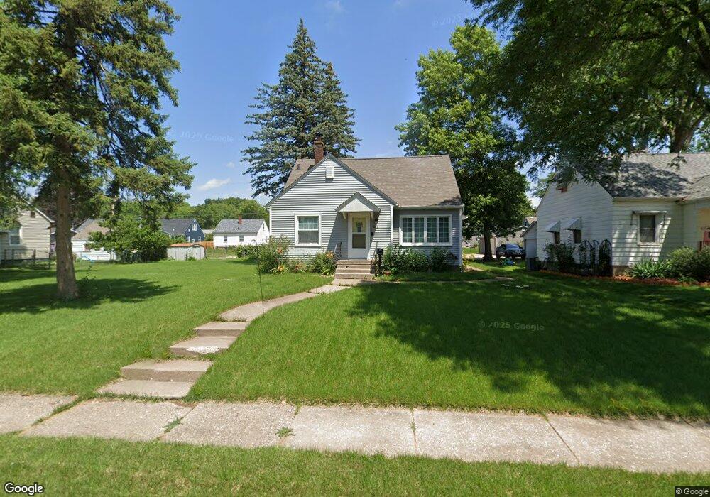
1042 Jones St Bettendorf, IA 52722
Downtown Bettendorf NeighborhoodEstimated Value: $223,197 - $250,000
2
Beds
2
Baths
1,867
Sq Ft
$127/Sq Ft
Est. Value
About This Home
This home is located at 1042 Jones St, Bettendorf, IA 52722 and is currently estimated at $237,799, approximately $127 per square foot. 1042 Jones St is a home located in Scott County with nearby schools including Bettendorf Middle School, Bettendorf High School, and Lourdes Catholic School.
Ownership History
Date
Name
Owned For
Owner Type
Purchase Details
Closed on
Jun 17, 2021
Sold by
Holeman Kristy
Bought by
Holeman Michael and Holeman Michael J
Current Estimated Value
Home Financials for this Owner
Home Financials are based on the most recent Mortgage that was taken out on this home.
Original Mortgage
$135,000
Outstanding Balance
$112,465
Interest Rate
2.9%
Mortgage Type
New Conventional
Estimated Equity
$125,334
Purchase Details
Closed on
Jun 19, 2009
Sold by
Porter Dawn Anne
Bought by
Holeman Michael J
Home Financials for this Owner
Home Financials are based on the most recent Mortgage that was taken out on this home.
Original Mortgage
$98,800
Interest Rate
4.86%
Mortgage Type
Purchase Money Mortgage
Create a Home Valuation Report for This Property
The Home Valuation Report is an in-depth analysis detailing your home's value as well as a comparison with similar homes in the area
Home Values in the Area
Average Home Value in this Area
Purchase History
| Date | Buyer | Sale Price | Title Company |
|---|---|---|---|
| Holeman Michael | -- | None Available | |
| Holeman Michael J | $104,000 | None Available |
Source: Public Records
Mortgage History
| Date | Status | Borrower | Loan Amount |
|---|---|---|---|
| Open | Holeman Michael | $135,000 | |
| Closed | Holeman Michael J | $98,800 |
Source: Public Records
Tax History Compared to Growth
Tax History
| Year | Tax Paid | Tax Assessment Tax Assessment Total Assessment is a certain percentage of the fair market value that is determined by local assessors to be the total taxable value of land and additions on the property. | Land | Improvement |
|---|---|---|---|---|
| 2025 | $2,902 | $208,500 | $37,400 | $171,100 |
| 2024 | $2,880 | $187,600 | $23,500 | $164,100 |
| 2023 | $2,628 | $187,600 | $23,500 | $164,100 |
| 2022 | $2,602 | $149,270 | $23,500 | $125,770 |
| 2021 | $2,602 | $149,270 | $23,500 | $125,770 |
| 2020 | $2,532 | $139,570 | $23,500 | $116,070 |
| 2019 | $2,544 | $136,190 | $23,500 | $112,690 |
| 2018 | $2,544 | $136,190 | $23,500 | $112,690 |
| 2017 | $758 | $136,190 | $23,500 | $112,690 |
| 2016 | $2,308 | $123,730 | $0 | $0 |
| 2015 | $2,308 | $118,720 | $0 | $0 |
| 2014 | $2,242 | $118,720 | $0 | $0 |
| 2013 | $2,194 | $0 | $0 | $0 |
| 2012 | -- | $124,490 | $23,500 | $100,990 |
Source: Public Records
Map
Nearby Homes
- 1037 Holmes St
- 918 Jones St
- 5 Riverview Park Dr
- 740 Mississippi Blvd
- 358 Madison Dr
- 704 River Dr
- 1104 Kimberly Rd Unit 1110
- 605 16th St
- 1360 Kimberly Ridge Rd Unit 111
- 1319 Heights Ct
- 1327 Heights Ct
- 904 17th St
- 1360 Heights Ct
- 1637 Broadlawn Ave
- 248 River Dr
- 229 Brown St
- 1708 Eastmere Dr
- 1504 Parklane Dr
- 2007 Mississippi Blvd
- 204 Greenwood Ave