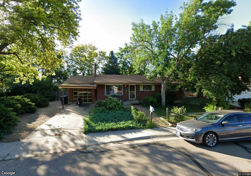
1042 Kane Dr Longmont, CO 80501
Southmoor NeighborhoodEstimated Value: $513,000 - $553,000
3
Beds
3
Baths
1,449
Sq Ft
$364/Sq Ft
Est. Value
About This Home
This home is located at 1042 Kane Dr, Longmont, CO 80501 and is currently estimated at $527,230, approximately $363 per square foot. 1042 Kane Dr is a home located in Boulder County with nearby schools including Burlington Elementary School, Sunset Middle School, and Niwot High School.
Ownership History
Date
Name
Owned For
Owner Type
Purchase Details
Closed on
Jul 10, 2000
Sold by
Tobias Stridde Rob and Tobias Susan
Bought by
Herreid Sally
Current Estimated Value
Home Financials for this Owner
Home Financials are based on the most recent Mortgage that was taken out on this home.
Original Mortgage
$148,000
Outstanding Balance
$52,847
Interest Rate
8.2%
Estimated Equity
$474,383
Purchase Details
Closed on
Aug 10, 1998
Sold by
Lacey Lutz Geoffrey W and Lacey Tammy L
Bought by
Stridde Rob
Home Financials for this Owner
Home Financials are based on the most recent Mortgage that was taken out on this home.
Original Mortgage
$111,100
Interest Rate
6.94%
Purchase Details
Closed on
Jul 26, 1993
Bought by
Herreid Sally
Purchase Details
Closed on
Jul 26, 1971
Bought by
Herreid Sally
Create a Home Valuation Report for This Property
The Home Valuation Report is an in-depth analysis detailing your home's value as well as a comparison with similar homes in the area
Home Values in the Area
Average Home Value in this Area
Purchase History
| Date | Buyer | Sale Price | Title Company |
|---|---|---|---|
| Herreid Sally | $185,000 | -- | |
| Stridde Rob | $138,900 | -- | |
| Herreid Sally | $109,900 | -- | |
| Herreid Sally | $26,500 | -- |
Source: Public Records
Mortgage History
| Date | Status | Borrower | Loan Amount |
|---|---|---|---|
| Open | Herreid Sally | $148,000 | |
| Previous Owner | Stridde Rob | $111,100 |
Source: Public Records
Tax History Compared to Growth
Tax History
| Year | Tax Paid | Tax Assessment Tax Assessment Total Assessment is a certain percentage of the fair market value that is determined by local assessors to be the total taxable value of land and additions on the property. | Land | Improvement |
|---|---|---|---|---|
| 2025 | $3,056 | $32,863 | $16,394 | $16,469 |
| 2024 | $3,056 | $32,863 | $16,394 | $16,469 |
| 2023 | $3,014 | $31,946 | $20,462 | $15,169 |
| 2022 | $2,684 | $27,119 | $14,463 | $12,656 |
| 2021 | $2,718 | $27,899 | $14,879 | $13,020 |
| 2020 | $2,281 | $23,481 | $12,012 | $11,469 |
| 2019 | $2,245 | $23,481 | $12,012 | $11,469 |
| 2018 | $2,095 | $22,054 | $8,280 | $13,774 |
| 2017 | $2,066 | $24,381 | $9,154 | $15,227 |
| 2016 | $1,876 | $19,629 | $8,278 | $11,351 |
| 2015 | $1,788 | $16,175 | $4,856 | $11,319 |
| 2014 | $1,511 | $16,175 | $4,856 | $11,319 |
Source: Public Records
Map
Nearby Homes
- 1072 Kane Dr
- 1221 S Main St
- 1208 S Coffman St
- 922 S Coffman St
- 835 Kane Dr Unit E25
- 1328 S Terry St
- 1343 S Coffman St
- 818 S Terry St Unit 98
- 818 S Terry St Unit 85
- 421 Noel Ave
- 1305 Kestrel Ln Unit J
- 9 Seattle Ln
- 832 S Bowen St
- 1240 Wren Ct Unit I
- 1435 Ashcroft Dr
- 1278 Hummingbird Cir Unit C
- 67 Quail Rd
- 1350 S Lincoln St
- 750 Satisfaction Cir
- 710 Satisfaction Cir
- 1048 Kane Dr
- 1036 Kane Dr
- 1041 S Coffman St
- 1047 S Coffman St
- 1035 S Coffman St
- 1065 S Coffman St
- 1059 S Coffman St
- 1030 Kane Dr
- 1033 Kane Dr
- 1054 Kane Dr
- 1071 S Coffman St
- 1053 S Coffman St
- 1029 S Coffman St
- 1040 S Terry St
- 1077 S Coffman St
- 1027 Kane Dr
- 1024 Kane Dr
- 1060 Kane Dr
- 1034 S Terry St
- 1023 S Coffman St