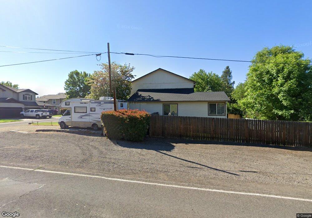
1042 S Shasta Ave Eagle Point, OR 97524
Estimated Value: $420,000 - $629,766
6
Beds
4
Baths
3,226
Sq Ft
$160/Sq Ft
Est. Value
About This Home
This home is located at 1042 S Shasta Ave, Eagle Point, OR 97524 and is currently estimated at $516,192, approximately $160 per square foot. 1042 S Shasta Ave is a home located in Jackson County with nearby schools including Eagle Point Middle School, White Mountain Middle School, and Eagle Point High School.
Ownership History
Date
Name
Owned For
Owner Type
Purchase Details
Closed on
Aug 19, 2019
Sold by
Harris Kenneth M
Bought by
Harris Deborah S
Current Estimated Value
Home Financials for this Owner
Home Financials are based on the most recent Mortgage that was taken out on this home.
Original Mortgage
$150,000
Interest Rate
3.6%
Mortgage Type
New Conventional
Create a Home Valuation Report for This Property
The Home Valuation Report is an in-depth analysis detailing your home's value as well as a comparison with similar homes in the area
Home Values in the Area
Average Home Value in this Area
Purchase History
| Date | Buyer | Sale Price | Title Company |
|---|---|---|---|
| Harris Deborah S | -- | First American Title |
Source: Public Records
Mortgage History
| Date | Status | Borrower | Loan Amount |
|---|---|---|---|
| Closed | Harris Deborah S | $150,000 |
Source: Public Records
Tax History
| Year | Tax Paid | Tax Assessment Tax Assessment Total Assessment is a certain percentage of the fair market value that is determined by local assessors to be the total taxable value of land and additions on the property. | Land | Improvement |
|---|---|---|---|---|
| 2026 | $5,047 | $370,920 | -- | -- |
| 2025 | $4,928 | $360,120 | $65,700 | $294,420 |
| 2024 | $4,928 | $349,640 | $63,790 | $285,850 |
| 2023 | $4,761 | $339,460 | $61,930 | $277,530 |
| 2022 | $4,631 | $339,460 | $61,930 | $277,530 |
| 2021 | $4,494 | $329,580 | $60,120 | $269,460 |
| 2020 | $4,774 | $319,990 | $58,370 | $261,620 |
| 2019 | $4,701 | $301,630 | $55,020 | $246,610 |
| 2018 | $4,611 | $292,850 | $53,420 | $239,430 |
| 2017 | $4,498 | $292,850 | $53,420 | $239,430 |
| 2016 | $4,390 | $276,050 | $50,350 | $225,700 |
| 2015 | $3,892 | $249,300 | $44,360 | $204,940 |
| 2014 | $3,812 | $248,460 | $43,090 | $205,370 |
Source: Public Records
Map
Nearby Homes
- 1065 S Shasta Ave
- 1288 S Shasta Ave
- 1314 S Shasta Ave Unit A
- 91 Morning Dove Trail
- 181 Morning Dove Trail
- 10569 Hannon Rd
- 51 Broken Stone Way
- 179 Skyhawk Dr
- 837 S Royal Ave
- 133 Edith Cir
- 616 Cedarwood Dr
- 0 Crater Lake Hwy
- 135 Hidden Valley Dr
- 620 S Royal Ave
- 16 Portabello Way
- 650 Sarah Ln
- 13 Portabello Way
- 839 St Andrews Way
- 888 Arrowhead Trail
- 0 Echo Way Unit Tax Lot 902
- 1056 S Shasta Ave
- 1024 S Shasta Ave
- 1098 S Shasta Ave
- 1086 S Shasta Ave
- 1096 S Shasta Ave
- 1084 S Shasta Ave
- 1018 S Shasta Ave
- 1076 S Shasta Ave
- 1012 S Shasta 1014 Ave
- 1006 S Shasta Ave
- 1006 S Shasta Ave Unit 1006/1008
- 1128 S Shasta Ave
- 1012 S Shasta Ave
- 1122 S Shasta Ave
- 1131 S Shasta Ave
- 1134 S Shasta Ave
- 232 Arrowhead Trail
- 1140 S Shasta Ave
- 1146 S Shasta Ave
- 1152 S Shasta Ave
Your Personal Tour Guide
Ask me questions while you tour the home.