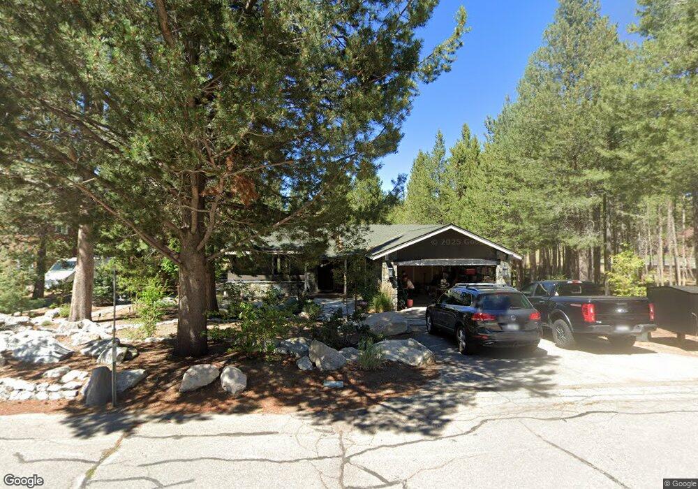
1042 San Diego St South Lake Tahoe, CA 96150
Estimated Value: $538,061 - $729,000
3
Beds
2
Baths
1,400
Sq Ft
$438/Sq Ft
Est. Value
About This Home
This home is located at 1042 San Diego St, South Lake Tahoe, CA 96150 and is currently estimated at $613,265, approximately $438 per square foot. 1042 San Diego St is a home located in El Dorado County with nearby schools including Tahoe Valley Elementary School, South Tahoe Middle School, and South Tahoe High School.
Ownership History
Date
Name
Owned For
Owner Type
Purchase Details
Closed on
Aug 16, 2001
Sold by
Kjelland Richard F and Kjelland Deborah E
Bought by
Kjelland Richard F and Kjelland Deborah E
Current Estimated Value
Purchase Details
Closed on
Jul 9, 1997
Sold by
Kjelland Deborah E
Bought by
Kjelland Richard F
Home Financials for this Owner
Home Financials are based on the most recent Mortgage that was taken out on this home.
Original Mortgage
$93,000
Interest Rate
7.93%
Mortgage Type
Credit Line Revolving
Create a Home Valuation Report for This Property
The Home Valuation Report is an in-depth analysis detailing your home's value as well as a comparison with similar homes in the area
Home Values in the Area
Average Home Value in this Area
Purchase History
| Date | Buyer | Sale Price | Title Company |
|---|---|---|---|
| Kjelland Richard F | -- | -- | |
| Kjelland Richard F | -- | First American Title Co |
Source: Public Records
Mortgage History
| Date | Status | Borrower | Loan Amount |
|---|---|---|---|
| Previous Owner | Kjelland Richard F | $93,000 |
Source: Public Records
Tax History Compared to Growth
Tax History
| Year | Tax Paid | Tax Assessment Tax Assessment Total Assessment is a certain percentage of the fair market value that is determined by local assessors to be the total taxable value of land and additions on the property. | Land | Improvement |
|---|---|---|---|---|
| 2025 | $1,081 | $92,326 | $16,137 | $76,189 |
| 2024 | $1,081 | $90,517 | $15,821 | $74,696 |
| 2023 | $1,063 | $88,743 | $15,511 | $73,232 |
| 2022 | $1,053 | $87,004 | $15,207 | $71,797 |
| 2021 | $1,035 | $85,299 | $14,909 | $70,390 |
| 2020 | $1,024 | $84,426 | $14,757 | $69,669 |
| 2019 | $1,019 | $82,771 | $14,468 | $68,303 |
| 2018 | $998 | $81,149 | $14,185 | $66,964 |
| 2017 | $984 | $79,558 | $13,907 | $65,651 |
| 2016 | $965 | $77,999 | $13,635 | $64,364 |
| 2015 | $956 | $76,830 | $13,431 | $63,399 |
| 2014 | $920 | $75,327 | $13,169 | $62,158 |
Source: Public Records
Map
Nearby Homes
- 1666 Arapahoe St
- 1140 Sioux St
- 1675 Arapahoe St
- 1982 Cherokee St
- 2001 Washoe St
- 2877 Us Highway 50
- 1431 Vanderhoof Rd
- 1940 Apache Ave
- 1442 Vanderhoof Rd
- 1741 Delaware St
- 1935 Apache Ave
- 1580 Boca Raton Dr
- 1871 Normuk St
- 1889 Normuk St
- 1513 Cree St
- 712 Seneca Dr
- 1671 Crystal Air Dr
- 1644 Crystal Air Dr
- 2113 Oaxaco St
- 1876 Bella Coola Dr
- 1048 San Diego St
- 1045 San Diego St
- 1054 San Diego St
- 1676 Bakersfield St
- 1655 Bakersfield St
- 1661 Bakersfield St
- 1684 Bakersfield St
- 1651 Bakersfield St
- 1667 Bakersfield St
- 1063 San Diego St
- 1671 Bakersfield St
- 1060 San Diego St
- 1690 Bakersfield St
- 1677 Bakersfield St
- 1069 San Diego St
- 1066 San Diego St
- 1635 Bakersfield St
- 1271 E San Bernardino Ave
- 1283 E San Bernardino Ave
- 1681 Bakersfield St