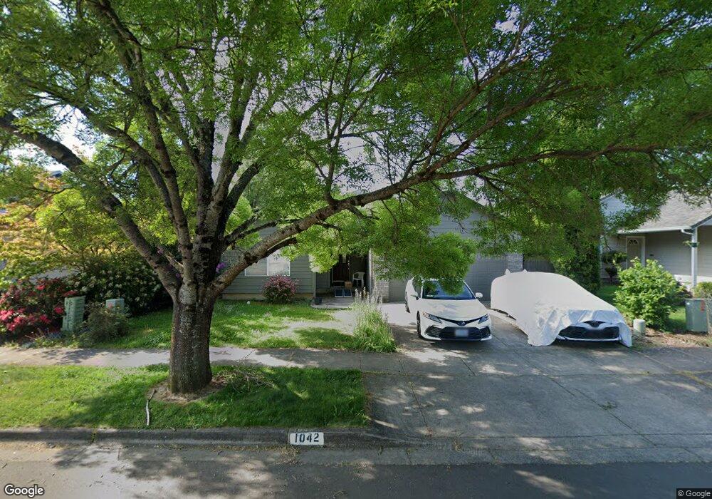
1042 Tyson Ln Eugene, OR 97404
Santa Clara NeighborhoodEstimated Value: $447,359 - $474,000
3
Beds
2
Baths
1,429
Sq Ft
$322/Sq Ft
Est. Value
About This Home
This home is located at 1042 Tyson Ln, Eugene, OR 97404 and is currently estimated at $460,590, approximately $322 per square foot. 1042 Tyson Ln is a home located in Lane County with nearby schools including Irving Elementary School, Shasta Middle School, and Willamette High School.
Ownership History
Date
Name
Owned For
Owner Type
Purchase Details
Closed on
Feb 12, 2025
Sold by
Kelsay Dorris Rhae
Bought by
Kelsay Christopher
Current Estimated Value
Home Financials for this Owner
Home Financials are based on the most recent Mortgage that was taken out on this home.
Original Mortgage
$91,308
Outstanding Balance
$90,689
Interest Rate
6.93%
Mortgage Type
New Conventional
Estimated Equity
$369,901
Purchase Details
Closed on
Sep 6, 2005
Sold by
Monia Jennifer K and Monia Robert J
Bought by
Kelsay Dorris R
Purchase Details
Closed on
Mar 16, 2001
Sold by
Cozy Homes Inc
Bought by
Monia Robert J and Monia Jennifer K
Home Financials for this Owner
Home Financials are based on the most recent Mortgage that was taken out on this home.
Original Mortgage
$136,852
Interest Rate
7.11%
Mortgage Type
FHA
Create a Home Valuation Report for This Property
The Home Valuation Report is an in-depth analysis detailing your home's value as well as a comparison with similar homes in the area
Home Values in the Area
Average Home Value in this Area
Purchase History
| Date | Buyer | Sale Price | Title Company |
|---|---|---|---|
| Kelsay Christopher | -- | None Listed On Document | |
| Kelsay Dorris R | $220,000 | Western Title & Escrow Compa | |
| Monia Robert J | $139,000 | Cascade Title Co |
Source: Public Records
Mortgage History
| Date | Status | Borrower | Loan Amount |
|---|---|---|---|
| Open | Kelsay Christopher | $91,308 | |
| Previous Owner | Monia Robert J | $136,852 |
Source: Public Records
Tax History
| Year | Tax Paid | Tax Assessment Tax Assessment Total Assessment is a certain percentage of the fair market value that is determined by local assessors to be the total taxable value of land and additions on the property. | Land | Improvement |
|---|---|---|---|---|
| 2025 | $4,286 | $246,427 | -- | -- |
| 2024 | $4,178 | $239,250 | -- | -- |
| 2023 | $4,178 | $232,282 | $0 | $0 |
| 2022 | $3,890 | $225,517 | $0 | $0 |
| 2021 | $3,807 | $218,949 | $0 | $0 |
| 2020 | $3,696 | $212,572 | $0 | $0 |
| 2019 | $3,515 | $206,381 | $0 | $0 |
| 2018 | $3,416 | $194,534 | $0 | $0 |
| 2017 | $3,265 | $194,534 | $0 | $0 |
| 2016 | $3,182 | $188,868 | $0 | $0 |
| 2015 | $3,119 | $183,367 | $0 | $0 |
| 2014 | $3,072 | $178,026 | $0 | $0 |
Source: Public Records
Map
Nearby Homes
- 1061 Argon Ave
- 3884 Shenstone Dr
- 1133 Irvington Dr
- 4150 Berrywood Dr
- 161 Lynnbrook Dr
- 579 Sweetwater Ln
- 223 Beringer Ct
- 3307 Arrowhead St
- 3365 Goose Cross Ln
- 229 Mackin Ave
- 158 Mackin Ave
- 4060 Hampshire Ln
- 3470 Cabernet Ln
- 3269 Korbel St
- 1284 Alderbrook Ln
- 204 Carthage Ave
- 835 Bobolink Ave
- 47 van Fossen Ct
- 2923 Maranta St
- 2937 Stark St
Your Personal Tour Guide
Ask me questions while you tour the home.