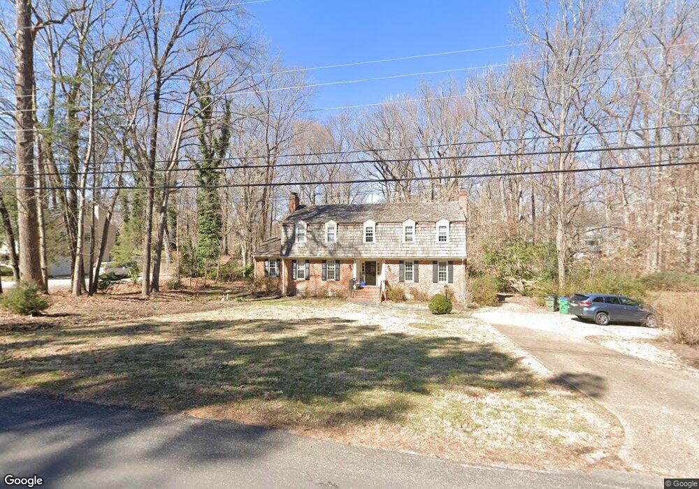
10420 Apache Rd Richmond, VA 23235
Huguenot NeighborhoodEstimated Value: $658,448 - $759,000
4
Beds
3
Baths
3,160
Sq Ft
$227/Sq Ft
Est. Value
About This Home
This home is located at 10420 Apache Rd, Richmond, VA 23235 and is currently estimated at $718,612, approximately $227 per square foot. 10420 Apache Rd is a home located in Richmond City with nearby schools including J.B. Fisher Elementary School, Lucille M. Brown Middle, and Huguenot High School.
Ownership History
Date
Name
Owned For
Owner Type
Purchase Details
Closed on
Apr 17, 1998
Sold by
Musgrove George G and Musgrove Barbara J
Bought by
Abrash Samuel and Katherine Whitby/H W
Current Estimated Value
Home Financials for this Owner
Home Financials are based on the most recent Mortgage that was taken out on this home.
Original Mortgage
$168,900
Outstanding Balance
$32,090
Interest Rate
7.11%
Mortgage Type
New Conventional
Estimated Equity
$686,522
Purchase Details
Closed on
Mar 20, 1996
Sold by
Schul Jeffery L and Bell Patricia E
Bought by
Musgrove George G and Musgrove Barbara J
Home Financials for this Owner
Home Financials are based on the most recent Mortgage that was taken out on this home.
Original Mortgage
$198,000
Interest Rate
6.99%
Mortgage Type
New Conventional
Create a Home Valuation Report for This Property
The Home Valuation Report is an in-depth analysis detailing your home's value as well as a comparison with similar homes in the area
Home Values in the Area
Average Home Value in this Area
Purchase History
| Date | Buyer | Sale Price | Title Company |
|---|---|---|---|
| Abrash Samuel | $259,000 | -- | |
| Abrash Samuel | $259,000 | -- | |
| Musgrove George G | $247,500 | -- |
Source: Public Records
Mortgage History
| Date | Status | Borrower | Loan Amount |
|---|---|---|---|
| Open | Abrash Samuel | $168,900 | |
| Closed | Musgrove George G | $168,900 | |
| Previous Owner | Musgrove George G | $198,000 |
Source: Public Records
Tax History
| Year | Tax Paid | Tax Assessment Tax Assessment Total Assessment is a certain percentage of the fair market value that is determined by local assessors to be the total taxable value of land and additions on the property. | Land | Improvement |
|---|---|---|---|---|
| 2025 | $6,252 | $526,000 | $121,000 | $405,000 |
| 2024 | $6,252 | $521,000 | $117,000 | $404,000 |
| 2023 | $6,096 | $508,000 | $104,000 | $404,000 |
| 2022 | $5,256 | $438,000 | $96,000 | $342,000 |
| 2020 | $4,344 | $362,000 | $67,000 | $295,000 |
| 2019 | $4,212 | $351,000 | $67,000 | $284,000 |
| 2018 | $4,152 | $346,000 | $67,000 | $279,000 |
| 2017 | $3,984 | $332,000 | $67,000 | $265,000 |
| 2016 | $3,912 | $326,000 | $67,000 | $259,000 |
| 2015 | $3,792 | $316,000 | $65,000 | $251,000 |
| 2014 | $3,792 | $316,000 | $65,000 | $251,000 |
Source: Public Records
Map
Nearby Homes
- 3730 Hastings Dr
- 10031 Twin Valley Rd
- 9477 Creek Summit Cir
- 9479 Creek Summit Cir
- 9498 Creek Summit Cir
- 9551 Creek Summit Cir
- 9492 Creek Summit Cir
- 9490 Creek Summit Cir
- 9486 Creek Summit Cir
- 4321 Saratoga Rd
- 10348 Merrigan Rd
- 3430 Old Gun Rd E
- 2910 Shoreham Dr
- 3820 Reeds Landing Cir
- 3139 Stony Point Rd Unit B
- 2721 Penrose Dr
- 2635 Traymore Rd
- 2617 Scarsborough Dr
- 9120 James Riverwatch Dr
- 2550 Cromwell Rd
- 10430 Apache Rd
- 4000 Traylor Dr
- 4100 Denbigh Dr
- 10440 Apache Rd
- 10415 Apache Rd
- 10401 Apache Rd
- 4114 Denbigh Dr
- 3940 Margate Dr
- 3915 Wainfleet Dr
- 4001 Traylor Dr
- 10450 Apache Rd
- 4011 Traylor Dr
- 4100 Traylor Dr
- 3928 Margate Dr
- 3943 Traylor Dr
- 4115 Denbigh Dr
- 3831 Wainfleet Dr
- 3923 Margate Dr
- 4021 Traylor Dr
- 3932 Traylor Dr
Your Personal Tour Guide
Ask me questions while you tour the home.