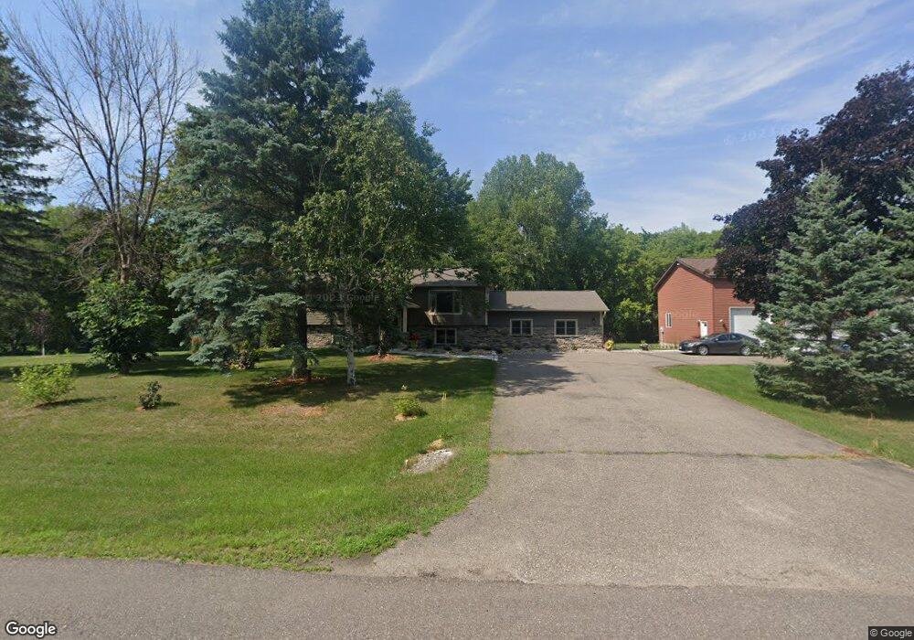
10420 Barnes Way Inver Grove Heights, MN 55077
Estimated Value: $518,000 - $645,000
3
Beds
2
Baths
1,244
Sq Ft
$457/Sq Ft
Est. Value
About This Home
This home is located at 10420 Barnes Way, Inver Grove Heights, MN 55077 and is currently estimated at $568,631, approximately $457 per square foot. 10420 Barnes Way is a home located in Dakota County with nearby schools including Red Pine Elementary School, Rosemount Middle School, and Rosemount Senior High School.
Ownership History
Date
Name
Owned For
Owner Type
Purchase Details
Closed on
Sep 2, 2021
Sold by
Nohava James C and Nohava Kari A
Bought by
Miller Warren F and Miller Lisa M
Current Estimated Value
Purchase Details
Closed on
Oct 22, 1999
Sold by
Nickerson Lance A and Nickerson Virginia M
Bought by
Nohaca James C and Nohaca Kari A
Create a Home Valuation Report for This Property
The Home Valuation Report is an in-depth analysis detailing your home's value as well as a comparison with similar homes in the area
Home Values in the Area
Average Home Value in this Area
Purchase History
| Date | Buyer | Sale Price | Title Company |
|---|---|---|---|
| Miller Warren F | $425,000 | Results Title | |
| Nohaca James C | $195,000 | -- | |
| Miller Warren Warren | $425,000 | -- |
Source: Public Records
Tax History Compared to Growth
Tax History
| Year | Tax Paid | Tax Assessment Tax Assessment Total Assessment is a certain percentage of the fair market value that is determined by local assessors to be the total taxable value of land and additions on the property. | Land | Improvement |
|---|---|---|---|---|
| 2024 | $6,378 | $532,300 | $231,300 | $301,000 |
| 2023 | $6,016 | $508,100 | $225,400 | $282,700 |
| 2022 | $5,960 | $507,400 | $225,200 | $282,200 |
| 2021 | $5,618 | $464,700 | $195,800 | $268,900 |
| 2020 | $5,444 | $433,900 | $186,500 | $247,400 |
| 2019 | $5,064 | $409,600 | $177,600 | $232,000 |
| 2018 | $4,750 | $392,500 | $169,100 | $223,400 |
| 2017 | $4,684 | $369,600 | $161,100 | $208,500 |
| 2016 | $4,517 | $351,900 | $153,500 | $198,400 |
| 2015 | $4,257 | $336,412 | $146,910 | $189,502 |
| 2014 | -- | $323,332 | $140,945 | $182,387 |
| 2013 | -- | $307,200 | $130,754 | $176,446 |
Source: Public Records
Map
Nearby Homes
- 2324 99th St E
- 9649-9665 Cedarwood Ct
- 11025 Courthouse Blvd
- TBd Cahill Blvd Blvd
- 8904 Brunswick Path Unit 2104
- 8789 Branson Dr Unit 72
- 8816 Brunell Way Unit 404
- 8755 Benson Way Unit 101
- 10064 Adam Ave
- 2853 87th St E Unit 29
- 8916 Coffman Path
- 10684 Alameda Ave
- 8827 Coffman Path
- 9380 Aladin Trail
- 10612 Alison Way
- 8124 Clifford Cir
- 10668 Alton Ct
- 8336 Cloman Ave
- 7924 Barbara Ave
- 7910 Banks Path
- 10136 Barnes Trail
- 10429 Barnes Way
- 10409 Barnes Way
- 10130 Barnes Trail
- 10449 Barnes Way
- 10211 Barnes Way
- 10211 Barnes Way
- 10211 10211 Barnes-Avenue-
- 10211 Barnes Ave E
- 10141 Barnes Trail
- 10133 Barnes Trail
- 10265 Blair Ave
- 10362 Barnes Way
- 10129 Blair Ave
- 10185 Barnes Ave
- 2353 105th St E
- 2421 105th St E
- 10189 Barnes Way
- 10333 Barnes Way
- 10469 Barnes Way