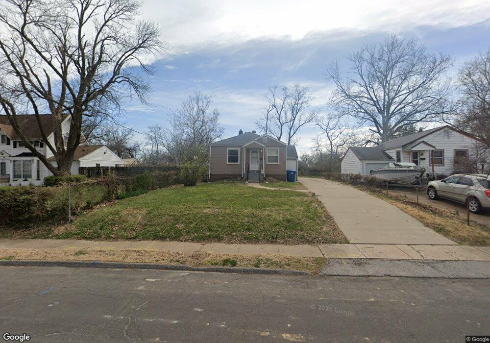
10420 Driver Ave Saint Louis, MO 63114
Estimated Value: $112,000 - $134,992
2
Beds
1
Bath
792
Sq Ft
$154/Sq Ft
Est. Value
About This Home
This home is located at 10420 Driver Ave, Saint Louis, MO 63114 and is currently estimated at $122,248, approximately $154 per square foot. 10420 Driver Ave is a home located in St. Louis County with nearby schools including Iveland Elementary School, Hoech Middle School, and Ritenour Senior High School.
Ownership History
Date
Name
Owned For
Owner Type
Purchase Details
Closed on
Jan 30, 2026
Sold by
Ameling Amy
Bought by
Sterling Jordan
Current Estimated Value
Home Financials for this Owner
Home Financials are based on the most recent Mortgage that was taken out on this home.
Original Mortgage
$132,554
Outstanding Balance
$132,554
Interest Rate
6.18%
Mortgage Type
FHA
Estimated Equity
-$10,306
Purchase Details
Closed on
Sep 30, 2022
Sold by
Growth Developments Llc
Bought by
Ameling Amy
Home Financials for this Owner
Home Financials are based on the most recent Mortgage that was taken out on this home.
Original Mortgage
$75,082
Interest Rate
5.55%
Mortgage Type
New Conventional
Purchase Details
Closed on
Feb 15, 2011
Sold by
Laughing Out Loud Llc
Bought by
Saferite Todd and Saferite Angela
Purchase Details
Closed on
Nov 1, 2010
Sold by
Dortch John W and Dortch Karen S
Bought by
Laughing Out Loud Llc
Create a Home Valuation Report for This Property
The Home Valuation Report is an in-depth analysis detailing your home's value as well as a comparison with similar homes in the area
Home Values in the Area
Average Home Value in this Area
Purchase History
| Date | Buyer | Sale Price | Title Company |
|---|---|---|---|
| Sterling Jordan | -- | True Title | |
| Ameling Amy | -- | -- | |
| Growth Developments Llc | -- | -- | |
| Saferite Todd | $30,000 | Ctc | |
| Laughing Out Loud Llc | $22,750 | None Available |
Source: Public Records
Mortgage History
| Date | Status | Borrower | Loan Amount |
|---|---|---|---|
| Open | Sterling Jordan | $132,554 | |
| Previous Owner | Ameling Amy | $75,082 |
Source: Public Records
Tax History
| Year | Tax Paid | Tax Assessment Tax Assessment Total Assessment is a certain percentage of the fair market value that is determined by local assessors to be the total taxable value of land and additions on the property. | Land | Improvement |
|---|---|---|---|---|
| 2025 | $1,775 | $27,250 | $7,050 | $20,200 |
| 2024 | $1,775 | $20,820 | $3,230 | $17,590 |
| 2023 | $1,736 | $20,820 | $3,230 | $17,590 |
| 2022 | $1,518 | $15,940 | $2,810 | $13,130 |
| 2021 | $1,517 | $15,940 | $2,810 | $13,130 |
| 2020 | $1,711 | $16,620 | $3,190 | $13,430 |
| 2019 | $1,706 | $16,620 | $3,190 | $13,430 |
| 2018 | $1,622 | $14,210 | $2,830 | $11,380 |
| 2017 | $1,547 | $14,210 | $2,830 | $11,380 |
| 2016 | $1,311 | $12,240 | $3,590 | $8,650 |
| 2015 | $1,321 | $12,240 | $3,590 | $8,650 |
| 2014 | $1,502 | $14,190 | $1,820 | $12,370 |
Source: Public Records
Map
Nearby Homes
- 10416 Lackland Rd
- 10508 Scotland Dr
- 10327 Eaglewood Ave
- 10609 Lochness Ct
- 10510 Briston Ct Unit 1C
- 10518 Briston Ct
- 1825 Ashby Rd
- 10239 Driver Ave
- 2412 Silkwood Dr
- 10500 Silkwood Ct
- 2424 Silkwood Dr Unit 14B
- 1805 Uceyle Ave
- 1735 O Connell Ave
- 2454 Prouhet Ave
- 2326 Hennepin Dr
- 10107 Niblic Dr
- 10024 Driver Ave
- 10027 Lackland Rd
- 10201 Midland Blvd
- 10726 Ridge Ave
- 10422 Driver Ave
- 10418 Driver Ave
- 10424 Driver Ave
- 10426 Driver Ave
- 10412 Driver Ave
- 10427 Lackland Rd
- 10428 Driver Ave
- 10417 Lackland Rd
- 10417 Driver Ave
- 10415 Driver Ave
- 10419 Driver Ave
- 10429 Lackland Rd
- 10421 Driver Ave
- 10413 Driver Ave
- 10430 Driver Ave
- 10431 Lackland Rd
- 10423 Driver Ave
- 10411 Driver Ave
- 10407 Lackland Rd
- 10425 Driver Ave
Your Personal Tour Guide
Ask me questions while you tour the home.