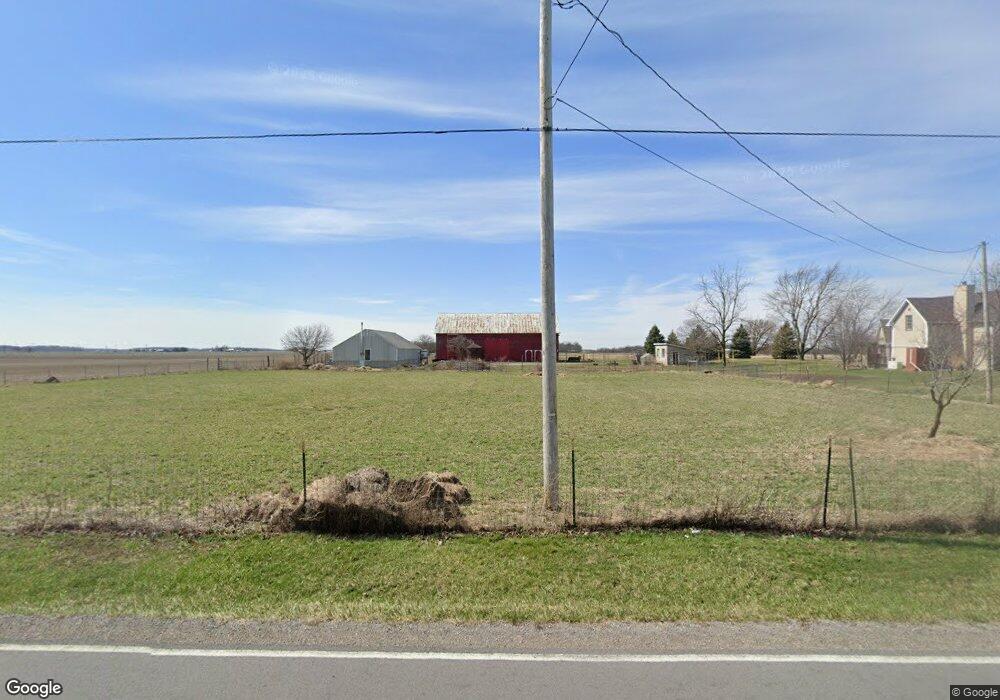
10422 County Road 9 Findlay, OH 45840
Estimated Value: $286,000 - $324,000
3
Beds
2
Baths
1,523
Sq Ft
$203/Sq Ft
Est. Value
About This Home
This home is located at 10422 County Road 9, Findlay, OH 45840 and is currently estimated at $309,285, approximately $203 per square foot. 10422 County Road 9 is a home located in Hancock County with nearby schools including Liberty-Benton Elementary School, Liberty-Benton Middle School, and Liberty-Benton High School.
Ownership History
Date
Name
Owned For
Owner Type
Purchase Details
Closed on
Oct 31, 2019
Sold by
Farmer Michael W and Farmer Rita E
Bought by
Farmer Sean M
Current Estimated Value
Home Financials for this Owner
Home Financials are based on the most recent Mortgage that was taken out on this home.
Original Mortgage
$166,993
Outstanding Balance
$147,057
Interest Rate
3.65%
Mortgage Type
New Conventional
Estimated Equity
$162,228
Purchase Details
Closed on
Feb 8, 1988
Bought by
Farmer Michael W and Farmer Rita E
Create a Home Valuation Report for This Property
The Home Valuation Report is an in-depth analysis detailing your home's value as well as a comparison with similar homes in the area
Home Values in the Area
Average Home Value in this Area
Purchase History
| Date | Buyer | Sale Price | Title Company |
|---|---|---|---|
| Farmer Sean M | $200,000 | Amrock Inc | |
| Farmer Michael W | $47,000 | -- |
Source: Public Records
Mortgage History
| Date | Status | Borrower | Loan Amount |
|---|---|---|---|
| Open | Farmer Sean M | $166,993 |
Source: Public Records
Tax History Compared to Growth
Tax History
| Year | Tax Paid | Tax Assessment Tax Assessment Total Assessment is a certain percentage of the fair market value that is determined by local assessors to be the total taxable value of land and additions on the property. | Land | Improvement |
|---|---|---|---|---|
| 2024 | $2,753 | $73,850 | $18,000 | $55,850 |
| 2023 | $2,688 | $73,850 | $18,000 | $55,850 |
| 2022 | $2,662 | $73,850 | $18,000 | $55,850 |
| 2021 | $2,010 | $48,670 | $15,800 | $32,870 |
| 2020 | $2,006 | $48,670 | $15,800 | $32,870 |
| 2019 | $1,939 | $48,670 | $15,800 | $32,870 |
| 2018 | $1,548 | $43,180 | $13,160 | $30,020 |
| 2017 | $799 | $43,180 | $13,160 | $30,020 |
| 2016 | $1,558 | $43,180 | $13,160 | $30,020 |
| 2015 | $1,569 | $42,640 | $13,160 | $29,480 |
| 2014 | $1,846 | $49,620 | $13,160 | $36,460 |
| 2012 | $1,789 | $46,010 | $13,160 | $32,850 |
Source: Public Records
Map
Nearby Homes
- 10601 County Road 9
- 9653 Early Dr
- 9307 Hiegel Dr
- 0 Bushwillow Dr Unit Lot 154
- 0 Bushwillow Dr Lot 156 Unit 6079046
- 0 Rock Candy Rd Lot 162 Unit 6079070
- 0 Bushwillow Dr Unit Lot 156
- 0 Bearcat Way Or 0 Rock Candy Rd Lot 167 Unit 6079083
- 0 Bushwillow Dr Lot 154 Unit 6079043
- 0 Rock Candy Rd Lot 171 Unit 6079088
- 0 County Road 99 Lot 2 Unit 6081480
- 0 Rock Candy Rd Lot 159 Unit 6079053
- 0 Bushwillow Dr Or Rock Candy Rd Lot 157 Unit 6079052
- 0 Bushwillow Dr Unit Lot 155
- 0 Rock Candy Rd Or Bushwillow Dr Lot 173 Unit 6079093
- 0 Rock Candy Rd Lot 168 Unit 6079085
- 0 Rock Candy Rd Lot 170 Unit 6079087
- 0 Bushwillow Dr Lot 155 Unit 6079044
- 1609 Foraker Ave
- 9307 W State Route 12
- 10379 County Road 9
- 10509 County Road 9
- 10167 County Road 9
- 10790 County Road 9
- 10822 County Road 9
- 10844 County Road 9
- 10872 County Road 9
- 10882 County Road 9
- 9767 County Road 9
- 9432 County Road 84
- 10954 County Road 9
- 9410 County Road 84
- 10607 Township Road 139
- 9316 County Road 84
- 9270 County Road 84
- 10491 Township Road 139
- 10455 Township Road 139
- 10631 Township Road 139
- 10091 Township Road 139
- 10001 Township Road 139
