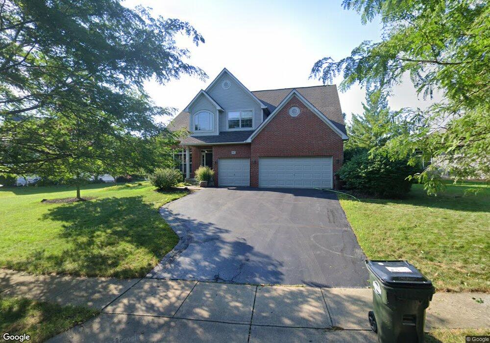
10427 Torrington Dr Powell, OH 43065
Estimated Value: $583,000 - $643,000
4
Beds
4
Baths
2,900
Sq Ft
$209/Sq Ft
Est. Value
About This Home
This home is located at 10427 Torrington Dr, Powell, OH 43065 and is currently estimated at $605,226, approximately $208 per square foot. 10427 Torrington Dr is a home located in Delaware County with nearby schools including Tyler Run Elementary School, Olentangy Liberty Middle School, and Olentangy Liberty High School.
Ownership History
Date
Name
Owned For
Owner Type
Purchase Details
Closed on
May 1, 2001
Sold by
Virginia Homes Ltd
Bought by
Hayes Stephen R Mitchell Susan
Current Estimated Value
Home Financials for this Owner
Home Financials are based on the most recent Mortgage that was taken out on this home.
Original Mortgage
$265,700
Outstanding Balance
$99,212
Interest Rate
7.03%
Mortgage Type
New Conventional
Estimated Equity
$506,014
Purchase Details
Closed on
Nov 16, 2000
Sold by
Boston Dev Co
Bought by
Virginia Homes Ltd
Home Financials for this Owner
Home Financials are based on the most recent Mortgage that was taken out on this home.
Original Mortgage
$161,000
Interest Rate
7.87%
Mortgage Type
New Conventional
Create a Home Valuation Report for This Property
The Home Valuation Report is an in-depth analysis detailing your home's value as well as a comparison with similar homes in the area
Home Values in the Area
Average Home Value in this Area
Purchase History
| Date | Buyer | Sale Price | Title Company |
|---|---|---|---|
| Hayes Stephen R Mitchell Susan | $279,777 | -- | |
| Virginia Homes Ltd | $51,000 | -- |
Source: Public Records
Mortgage History
| Date | Status | Borrower | Loan Amount |
|---|---|---|---|
| Open | Hayes Stephen R Mitchell Susan | $265,700 | |
| Previous Owner | Virginia Homes Ltd | $161,000 |
Source: Public Records
Tax History
| Year | Tax Paid | Tax Assessment Tax Assessment Total Assessment is a certain percentage of the fair market value that is determined by local assessors to be the total taxable value of land and additions on the property. | Land | Improvement |
|---|---|---|---|---|
| 2024 | $9,278 | $177,030 | $34,370 | $142,660 |
| 2023 | $9,314 | $177,030 | $34,370 | $142,660 |
| 2022 | $8,940 | $134,720 | $23,910 | $110,810 |
| 2021 | $8,995 | $134,720 | $23,910 | $110,810 |
| 2020 | $9,038 | $134,720 | $23,910 | $110,810 |
| 2019 | $7,850 | $121,980 | $23,910 | $98,070 |
| 2018 | $7,886 | $121,980 | $23,910 | $98,070 |
| 2017 | $7,303 | $109,310 | $21,390 | $87,920 |
| 2016 | $7,521 | $109,310 | $21,390 | $87,920 |
| 2015 | $6,801 | $109,310 | $21,390 | $87,920 |
| 2014 | $6,895 | $109,310 | $21,390 | $87,920 |
| 2013 | $6,890 | $106,760 | $21,390 | $85,370 |
Source: Public Records
Map
Nearby Homes
- 2288 Benning Dr
- 471 Commons Dr Unit 471
- 1937 Liberty St
- 2672 Sawmill Reserve Dr Unit 2672
- 120 S Liberty St
- 8622 Renford Ct
- 255 Winter Hill Place
- 8292 Breckenridge Way
- 4933 Emerald Lakes Blvd Unit 4903
- 18 Murphys View Place Unit I18
- 7907 Sarahurst Dr
- 8208 Copperfield Dr
- 7898 Sarahurst Dr
- 92 Barrington Place
- 3910 Summit View Rd
- 104 Encore Park Bend
- 130 Barrington Place
- Irving Plan at Encore Park of Powell - Uptown Collection
- Oakley Plan at Encore Park of Powell - Uptown Collection
- 170 Barrington Place
- 10419 Torrington Dr
- 10459 Torrington Dr
- 3162 Ardmore Ct
- 10475 Torrington Dr
- 3148 Ardmore Ct
- 10426 Torrington Dr
- 10422 Torrington Dr
- 10442 Torrington Dr
- 10411 Torrington Dr
- 10430 Torrington Dr
- 10454 Torrington Dr
- 10466 Torrington Dr
- 10416 Torrington Dr
- 3140 Ardmore Ct
- 10482 Torrington Dr
- 3177 Ardmore Ct
- 10511 Torrington Dr
- 10370 Liberty Rd S
- 3248 Camden Ct
- 3155 Ardmore Ct
Your Personal Tour Guide
Ask me questions while you tour the home.