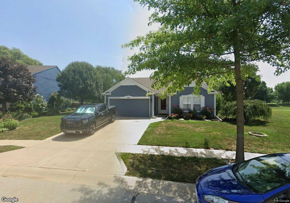
1043 Millstone Ct Franklin, IN 46131
Estimated Value: $267,000 - $339,000
4
Beds
2
Baths
1,434
Sq Ft
$201/Sq Ft
Est. Value
About This Home
This home is located at 1043 Millstone Ct, Franklin, IN 46131 and is currently estimated at $287,874, approximately $200 per square foot. 1043 Millstone Ct is a home located in Johnson County with nearby schools including Needham Elementary School, Franklin Community Middle School, and Custer Baker Intermediate School.
Ownership History
Date
Name
Owned For
Owner Type
Purchase Details
Closed on
Jul 1, 2020
Sold by
Sandlin Pamela L
Bought by
Barnard Kevin and Barnard Sharon
Current Estimated Value
Home Financials for this Owner
Home Financials are based on the most recent Mortgage that was taken out on this home.
Original Mortgage
$105,000
Outstanding Balance
$54,808
Interest Rate
3.1%
Mortgage Type
New Conventional
Estimated Equity
$220,965
Purchase Details
Closed on
Dec 18, 2006
Sold by
Secretary Of Hud
Bought by
Sandlin Pamela L
Home Financials for this Owner
Home Financials are based on the most recent Mortgage that was taken out on this home.
Original Mortgage
$94,500
Interest Rate
6.24%
Mortgage Type
New Conventional
Purchase Details
Closed on
Jun 23, 2006
Sold by
U S Bank Na
Bought by
The Secretary Of Hud
Purchase Details
Closed on
Jun 15, 2006
Sold by
Stewart Amy S and Stewart Jeffrey A
Bought by
U S Bank Na
Create a Home Valuation Report for This Property
The Home Valuation Report is an in-depth analysis detailing your home's value as well as a comparison with similar homes in the area
Home Values in the Area
Average Home Value in this Area
Purchase History
| Date | Buyer | Sale Price | Title Company |
|---|---|---|---|
| Barnard Kevin | -- | None Available | |
| Sandlin Pamela L | -- | Village Title Inc | |
| The Secretary Of Hud | -- | None Available | |
| U S Bank Na | $156,800 | None Available |
Source: Public Records
Mortgage History
| Date | Status | Borrower | Loan Amount |
|---|---|---|---|
| Open | Barnard Kevin | $105,000 | |
| Previous Owner | Sandlin Pamela L | $94,500 |
Source: Public Records
Tax History
| Year | Tax Paid | Tax Assessment Tax Assessment Total Assessment is a certain percentage of the fair market value that is determined by local assessors to be the total taxable value of land and additions on the property. | Land | Improvement |
|---|---|---|---|---|
| 2025 | $2,454 | $233,100 | $31,000 | $202,100 |
| 2024 | $2,454 | $222,300 | $31,000 | $191,300 |
| 2023 | $2,417 | $218,600 | $31,000 | $187,600 |
| 2022 | $2,240 | $201,300 | $31,000 | $170,300 |
| 2021 | $1,893 | $171,100 | $31,000 | $140,100 |
| 2020 | $1,578 | $143,100 | $31,000 | $112,100 |
| 2019 | $1,605 | $145,500 | $18,200 | $127,300 |
| 2018 | $1,362 | $142,300 | $18,200 | $124,100 |
| 2017 | $1,291 | $128,100 | $18,200 | $109,900 |
| 2016 | $1,286 | $130,600 | $18,200 | $112,400 |
| 2014 | $1,266 | $125,600 | $34,300 | $91,300 |
| 2013 | $1,266 | $126,600 | $34,300 | $92,300 |
Source: Public Records
Map
Nearby Homes
- 2159 Somerset Dr
- 2250 Somerset Dr
- 2298 Somerset Dr
- 2139 Bridlewood Dr
- 2148 Heather Glen Way
- 991 Ravine Dr
- 2258 Bridlewood Dr
- 2341 Somerset Cir
- 2388 Cedarmill Dr
- 1908 Porter Dr
- 2425 Bristol Dr
- 2478 Cedarmill Dr
- 2458 Bristol Dr
- 2509 Cedarmill Dr
- 2546 Bridlewood Dr
- 2707 Muirfield St
- 1152 Blackstone Ave
- 1166 Blackstone Ave
- 1190 Blackstone Ave
- 2731 Muirfield St
- 1051 Millstone Ct
- 1035 Millstone Ct
- 1038 Millstone Ct
- 1059 Millstone Ct
- 1027 Millstone Ct
- 1062 Millstone Ct
- 1067 Millstone Ct
- 1016 Millstone Ct
- 1019 Millstone Ct
- 1070 Millstone Ct
- 1006 Millstone Ct
- 1011 Millstone Ct
- 2159 Cedarmill Dr
- 1075 Millstone Ct
- 1078 Millstone Ct
- 1003 Millstone Ct
- 1088 Millstone Ct
- 2171 Cedarmill Dr
- 1083 Millstone Ct
Your Personal Tour Guide
Ask me questions while you tour the home.