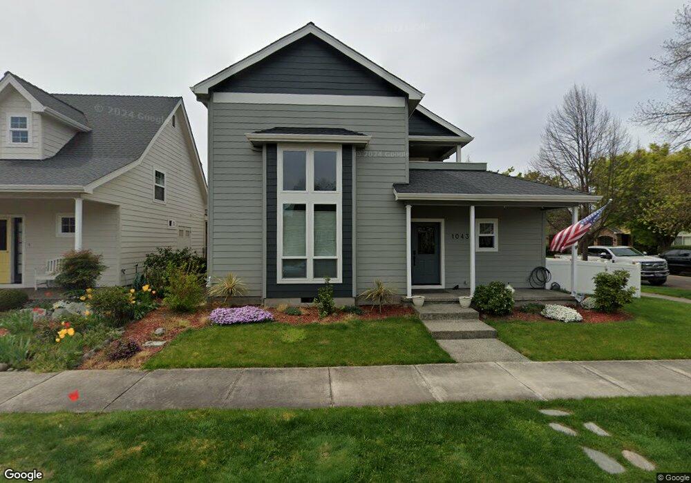
1043 Sandoz St Central Point, OR 97502
Estimated Value: $490,473 - $624,000
4
Beds
3
Baths
2,272
Sq Ft
$239/Sq Ft
Est. Value
About This Home
This home is located at 1043 Sandoz St, Central Point, OR 97502 and is currently estimated at $543,868, approximately $239 per square foot. 1043 Sandoz St is a home located in Jackson County with nearby schools including Richardson Elementary School, Scenic Middle School, and Crater High School.
Ownership History
Date
Name
Owned For
Owner Type
Purchase Details
Closed on
Mar 19, 2021
Sold by
Lewis Paul D and Lewis Gail M
Bought by
Kocina James H and Kocina Karla M
Current Estimated Value
Home Financials for this Owner
Home Financials are based on the most recent Mortgage that was taken out on this home.
Original Mortgage
$352,000
Outstanding Balance
$313,553
Interest Rate
2.73%
Mortgage Type
New Conventional
Estimated Equity
$230,315
Purchase Details
Closed on
Aug 9, 2006
Sold by
Wl Moore Construction Llc
Bought by
Lewis Paul D and Lewis Gail M
Home Financials for this Owner
Home Financials are based on the most recent Mortgage that was taken out on this home.
Original Mortgage
$38,500
Interest Rate
6.7%
Mortgage Type
Credit Line Revolving
Create a Home Valuation Report for This Property
The Home Valuation Report is an in-depth analysis detailing your home's value as well as a comparison with similar homes in the area
Purchase History
| Date | Buyer | Sale Price | Title Company |
|---|---|---|---|
| Kocina James H | -- | None Listed On Document | |
| Lewis Paul D | $385,000 | Lawyers Title Ins | |
| Wl Moore Construction Llc | $116,850 | Lawyers Title Ins |
Source: Public Records
Mortgage History
| Date | Status | Borrower | Loan Amount |
|---|---|---|---|
| Open | Kocina James H | $352,000 | |
| Previous Owner | Wl Moore Construction Llc | $38,500 | |
| Previous Owner | Lewis Paul D | $308,000 |
Source: Public Records
Tax History
| Year | Tax Paid | Tax Assessment Tax Assessment Total Assessment is a certain percentage of the fair market value that is determined by local assessors to be the total taxable value of land and additions on the property. | Land | Improvement |
|---|---|---|---|---|
| 2026 | $4,709 | $284,540 | -- | -- |
| 2025 | $4,593 | $276,260 | $86,600 | $189,660 |
| 2024 | $4,593 | $268,220 | $84,070 | $184,150 |
| 2023 | $4,445 | $260,410 | $81,620 | $178,790 |
| 2022 | $4,342 | $260,410 | $81,620 | $178,790 |
| 2021 | $4,218 | $252,830 | $79,240 | $173,590 |
| 2020 | $4,095 | $245,470 | $76,930 | $168,540 |
| 2019 | $3,994 | $231,390 | $72,510 | $158,880 |
| 2018 | $3,872 | $224,660 | $70,400 | $154,260 |
| 2017 | $3,775 | $224,660 | $70,400 | $154,260 |
| 2016 | $3,665 | $211,770 | $66,360 | $145,410 |
| 2015 | $3,511 | $211,770 | $66,360 | $145,410 |
| 2014 | $3,422 | $199,630 | $62,550 | $137,080 |
Source: Public Records
Map
Nearby Homes
- 650 Golden Peak Dr
- 545 Bridge Creek Dr
- 1407 Rustler Peak St
- 0 Boulder Ridge St
- 1134 Steamboat Dr
- 626 Griffin Oaks Dr
- 4626 N Pacific Hwy
- 356 Marian Ave Unit 40
- 407 Silver Creek Dr
- 404 Silver Creek Dr
- 1860 Cottonwood Dr
- 1855 Nancy Ave
- 55 Crater Ln
- 342 Hazel St
- 5030 Del Mar Dr
- 420 Mayberry Ln
- 166 Nadine Ln
- 884 Mendolia Way
- 348 N 6th St
- 833 Hazel St
- 1033 Sandoz St
- 1027 Sandoz St
- 1040 Buck Point St
- 1034 Buck Point St
- 1136 Grouse Ridge Dr
- 1044 Sandoz St
- 1132 Grouse Ridge Dr
- 1040 Sandoz St
- 1140 Grouse Ridge Dr
- 1028 Buck Point St
- 1128 Grouse Ridge Dr
- 1130 Grouse Ridge Dr
- 1034 Sandoz St
- 1144 Grouse Ridge Dr
- 1019 Sandoz St
- 1028 Sandoz St
- 1118 Twin Creeks Crossing
- 1022 Sandoz St
- 1091 Rustler Peak St
- 1083 Rustler Peak St
Your Personal Tour Guide
Ask me questions while you tour the home.