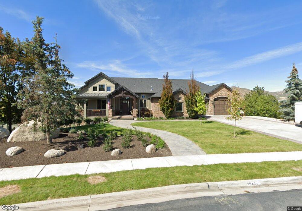
10431 N Iverson Ln Highland, UT 84003
Estimated Value: $1,813,000 - $2,252,250
4
Beds
4
Baths
6,729
Sq Ft
$302/Sq Ft
Est. Value
About This Home
This home is located at 10431 N Iverson Ln, Highland, UT 84003 and is currently estimated at $2,032,625, approximately $302 per square foot. 10431 N Iverson Ln is a home located in Utah County with nearby schools including Freedom Elementary School, Mountain Ridge Junior High School, and Lone Peak High School.
Ownership History
Date
Name
Owned For
Owner Type
Purchase Details
Closed on
Oct 19, 2018
Sold by
Majors General and The Geneal Majors Revocable Tr
Bought by
Norton Steven T and Norton Allison
Current Estimated Value
Home Financials for this Owner
Home Financials are based on the most recent Mortgage that was taken out on this home.
Original Mortgage
$840,000
Outstanding Balance
$724,927
Interest Rate
4.5%
Mortgage Type
New Conventional
Estimated Equity
$1,307,698
Purchase Details
Closed on
Sep 19, 2014
Sold by
Majors Geneal
Bought by
Majors Geneal
Purchase Details
Closed on
Sep 8, 2014
Sold by
Majors Kevin J
Bought by
Majors Geneal
Purchase Details
Closed on
Oct 30, 2012
Sold by
Majors Kevin J and Majors Geneal
Bought by
Majors Kevin J and Majors Geneal
Purchase Details
Closed on
Nov 7, 2011
Sold by
Highland Creek Hollows Llc
Bought by
Majors Kevin J and Majors Geneal
Create a Home Valuation Report for This Property
The Home Valuation Report is an in-depth analysis detailing your home's value as well as a comparison with similar homes in the area
Home Values in the Area
Average Home Value in this Area
Purchase History
| Date | Buyer | Sale Price | Title Company |
|---|---|---|---|
| Norton Steven T | -- | Cottonwood Title Ins Agency | |
| Majors Geneal | -- | None Available | |
| Majors Geneal | -- | None Available | |
| Majors Kevin J | -- | None Available | |
| Majors Kevin J | -- | Affiliated First Title Compa |
Source: Public Records
Mortgage History
| Date | Status | Borrower | Loan Amount |
|---|---|---|---|
| Open | Norton Steven T | $840,000 |
Source: Public Records
Tax History
| Year | Tax Paid | Tax Assessment Tax Assessment Total Assessment is a certain percentage of the fair market value that is determined by local assessors to be the total taxable value of land and additions on the property. | Land | Improvement |
|---|---|---|---|---|
| 2025 | $7,645 | $1,033,450 | -- | -- |
| 2024 | $7,645 | $944,240 | $0 | $0 |
| 2023 | $7,224 | $962,555 | $0 | $0 |
| 2022 | $6,516 | $841,830 | $0 | $0 |
| 2021 | $5,697 | $1,096,400 | $283,500 | $812,900 |
| 2020 | $5,488 | $1,035,700 | $246,500 | $789,200 |
| 2019 | $5,246 | $1,035,700 | $246,500 | $789,200 |
| 2018 | $3,790 | $711,200 | $230,600 | $480,600 |
| 2017 | $3,695 | $370,095 | $0 | $0 |
| 2016 | $3,861 | $361,350 | $0 | $0 |
| 2015 | $4,048 | $359,150 | $0 | $0 |
| 2014 | $3,258 | $286,440 | $0 | $0 |
Source: Public Records
Map
Nearby Homes
- 7088 W Red Hawk Dr
- 10365 N 6960 W
- 975 E 2850 N
- 878 E 3050 N
- 6767 W 10205 N
- 1602 E Center Pointe Dr
- 1610 E Center Pointe Dr
- 1618 E Center Pointe Dr
- 6756 W 10050 N
- 9967 N 6670 W
- 3368 N 700 E
- 3239 N 620 E
- 578 E 3375 N
- 532 E 3270 N
- 10434 N 6400 W
- 4233 N 325 E Unit 1415
- 6347 W 10400 N
- 6576 W 9810 N
- 173 E Forehand Ln
- 1370 N Cedar Hollow Blvd
- 10443 N Iverson Ln
- 10417 N Iverson Ln
- 10442 N Quail Ct
- 10442 N Quail Ct Unit 206
- 10442 N Quail Ct
- 10456 N Quail Ct Unit 207
- 10456 N Quail Ct
- 10418 N Iverson Ln Unit 101
- 10479 N Owl Cir
- 10438 N Iverson Ln
- 10438 Iverson Ln
- 10479 N Owl Cir Unit 318
- 10457 N Iverson Ln
- 10436 N Quail Ct
- 7137 Red Hawk Dr
- 7033 W Iverson Cir
- 10468 N Quail Ct
- 1363 E Damie Ln
- 1363 Damie Ln
- 7123 Red Hawk Dr
Your Personal Tour Guide
Ask me questions while you tour the home.