Estimated Value: $146,000 - $161,000
Studio
--
Bath
1,471
Sq Ft
$104/Sq Ft
Est. Value
About This Home
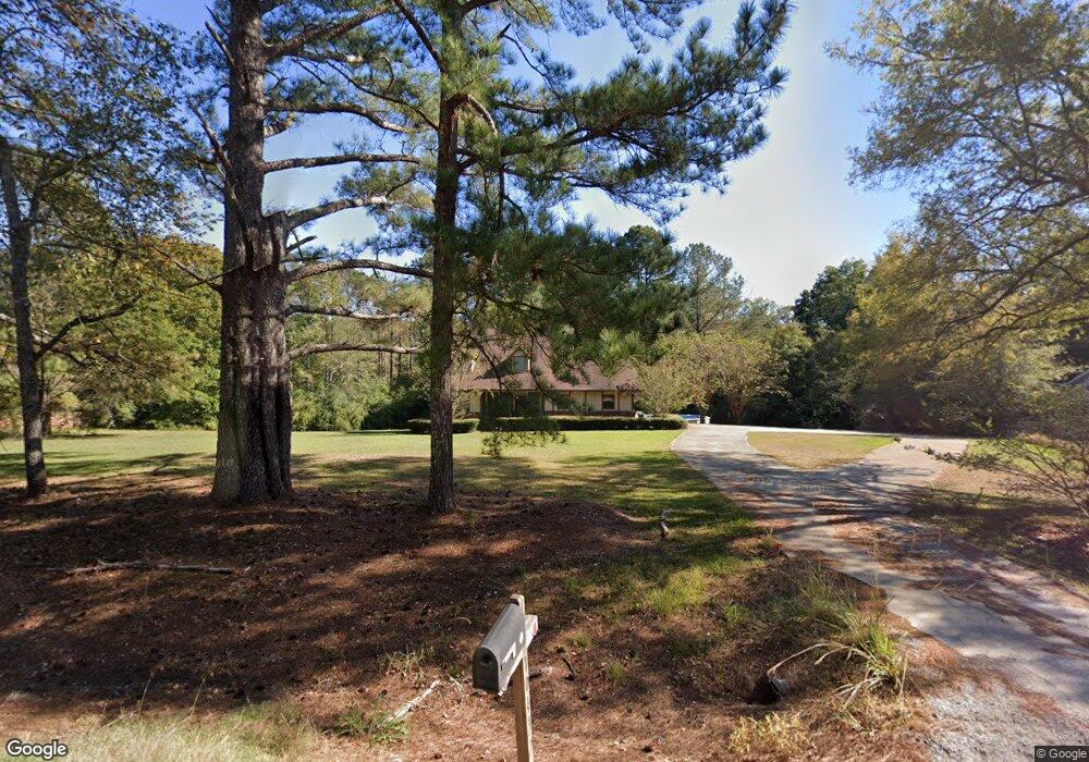
This home is located at 10432 Highway 492 E, Union, MS 39365 and is currently estimated at $152,362, approximately $103 per square foot. 10432 Highway 492 E is a home with nearby schools including Union Elementary School, Union Middle School, and Union High School.
Ownership History
Date
Name
Owned For
Owner Type
Purchase Details
Closed on
Jul 9, 2018
Sold by
Yeager Dustin E and Yeager Amber N
Bought by
Lyons Jamie
Current Estimated Value
Home Financials for this Owner
Home Financials are based on the most recent Mortgage that was taken out on this home.
Original Mortgage
$108,007
Outstanding Balance
$93,602
Interest Rate
4.87%
Mortgage Type
FHA
Estimated Equity
$58,760
Purchase Details
Closed on
Oct 16, 2011
Sold by
Winstead Perry Glenn and Winstead Terrell E
Bought by
Kilpatrick Christopher and Kilpatrick Stephanie
Home Financials for this Owner
Home Financials are based on the most recent Mortgage that was taken out on this home.
Original Mortgage
$89,637
Interest Rate
4.16%
Create a Home Valuation Report for This Property
The Home Valuation Report is an in-depth analysis detailing your home's value as well as a comparison with similar homes in the area
Purchase History
| Date | Buyer | Sale Price | Title Company |
|---|---|---|---|
| Lyons Jamie | -- | -- | |
| Kilpatrick Christopher | -- | -- |
Source: Public Records
Mortgage History
| Date | Status | Borrower | Loan Amount |
|---|---|---|---|
| Open | Lyons Jamie | $108,007 | |
| Previous Owner | Kilpatrick Christopher | $89,637 |
Source: Public Records
Tax History
| Year | Tax Paid | Tax Assessment Tax Assessment Total Assessment is a certain percentage of the fair market value that is determined by local assessors to be the total taxable value of land and additions on the property. | Land | Improvement |
|---|---|---|---|---|
| 2025 | $669 | $9,209 | $0 | $0 |
| 2024 | $687 | $9,183 | $0 | $0 |
| 2023 | $1,399 | $12,632 | $0 | $0 |
| 2022 | $633 | $8,421 | $0 | $0 |
| 2021 | $634 | $8,421 | $0 | $0 |
| 2020 | $617 | $8,421 | $0 | $0 |
| 2019 | $547 | $7,746 | $0 | $0 |
| 2018 | $587 | $7,746 | $0 | $0 |
| 2017 | $587 | $7,746 | $0 | $0 |
| 2016 | $589 | $7,746 | $0 | $0 |
| 2015 | -- | $7,595 | $0 | $0 |
| 2014 | -- | $7,595 | $0 | $0 |
Source: Public Records
Map
Nearby Homes
- 12061 Highway 21 S
- 0 Mississippi 15
- 702 E Jackson Rd
- 704 E Jackson Rd
- 201 5th St
- 408 North St
- 10300 Road 286
- 4188 Greenland Rd
- 000 Greenland Rd
- 0 Lakeview Dr
- 26 Lakeview Dr
- Hwy 15 Union Unit MS 39365
- 0 Highway 19 Unit 26-240
- 1421 Chesney Town Rd
- 10470 Road 2238
- 327 Stamper Pond Rd
- 365 Stamper Pond Rd
- 4 County Road 444
- 1 County Road 444
- 3 County Road 347
- 10430 Highway 492 E
- 10450 Highway 492 E
- 10441 Highway 492 E
- 12030 Highway 492 E
- 10470 Highway 492 E
- 12170 Highway 492 E
- 12170 Highway 492 E
- 10481 Highway 492 E
- 11620 Highway 492 E
- 10490 Highway 492 E
- 11570 Highway 492 E
- 10391 Road 503
- 10461 Highway 492 E
- 11370 Highway 492 E
- 10311 Highway 492 E
- 11090 Road 262
- 11081 Road 262
- 9546 Gum Log Rd
- 10010 Road 272
- 10051 Road 503
Your Personal Tour Guide
Ask me questions while you tour the home.