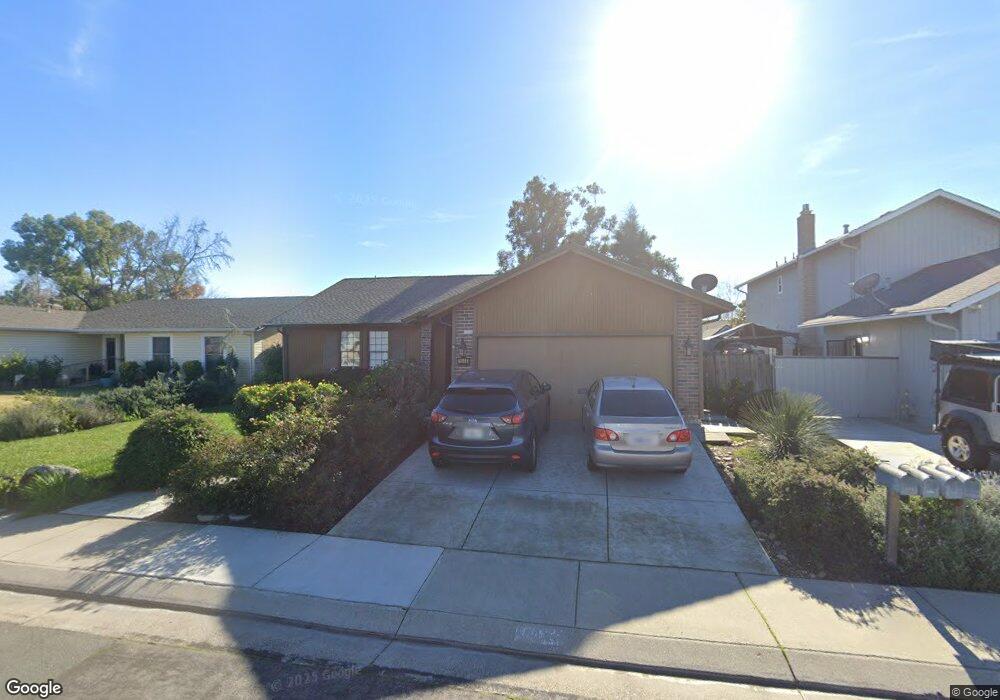
1044 Bradford Cir Lodi, CA 95240
Central Lodi NeighborhoodEstimated Value: $353,000 - $529,000
3
Beds
2
Baths
1,694
Sq Ft
$279/Sq Ft
Est. Value
About This Home
This home is located at 1044 Bradford Cir, Lodi, CA 95240 and is currently estimated at $472,890, approximately $279 per square foot. 1044 Bradford Cir is a home located in San Joaquin County with nearby schools including Beckman Elementary School, Lodi Middle School, and Tokay High School.
Ownership History
Date
Name
Owned For
Owner Type
Purchase Details
Closed on
Aug 10, 2023
Sold by
Thompson Scott W and Thompson Dorothy L
Bought by
Scott And Dorothy Thompson Family Trust and Thompson
Current Estimated Value
Purchase Details
Closed on
Feb 9, 2010
Sold by
Thompson Scott W and Thompson Dorothy L
Bought by
Thompson Scott W and Thompson Dorothy L
Home Financials for this Owner
Home Financials are based on the most recent Mortgage that was taken out on this home.
Original Mortgage
$94,000
Interest Rate
5.02%
Mortgage Type
New Conventional
Create a Home Valuation Report for This Property
The Home Valuation Report is an in-depth analysis detailing your home's value as well as a comparison with similar homes in the area
Home Values in the Area
Average Home Value in this Area
Purchase History
| Date | Buyer | Sale Price | Title Company |
|---|---|---|---|
| Scott And Dorothy Thompson Family Trust | -- | None Listed On Document | |
| Thompson Scott W | -- | Old Republic Title Company |
Source: Public Records
Mortgage History
| Date | Status | Borrower | Loan Amount |
|---|---|---|---|
| Previous Owner | Thompson Scott W | $94,000 |
Source: Public Records
Tax History
| Year | Tax Paid | Tax Assessment Tax Assessment Total Assessment is a certain percentage of the fair market value that is determined by local assessors to be the total taxable value of land and additions on the property. | Land | Improvement |
|---|---|---|---|---|
| 2025 | $2,178 | $206,095 | $51,781 | $154,314 |
| 2024 | $2,117 | $202,055 | $50,766 | $151,289 |
| 2023 | $2,082 | $198,094 | $49,771 | $148,323 |
| 2022 | $2,034 | $194,211 | $48,796 | $145,415 |
| 2021 | $2,070 | $190,404 | $47,840 | $142,564 |
| 2020 | $2,015 | $188,453 | $47,350 | $141,103 |
| 2019 | $1,973 | $184,759 | $46,422 | $138,337 |
| 2018 | $1,944 | $181,137 | $45,512 | $135,625 |
| 2017 | $1,900 | $177,586 | $44,620 | $132,966 |
| 2016 | $1,779 | $174,104 | $43,745 | $130,359 |
| 2014 | $1,735 | $168,130 | $42,244 | $125,886 |
Source: Public Records
Map
Nearby Homes
- 1050 Bradford Cir
- 2457 Rockingham Cir
- 2524 Winchester Dr Unit 10
- 2573 Canal Dr
- 0 E Harney Ln Unit 225091522
- 1623 Richmond Ln
- 210 Ridge Dr
- 615 Marsala Ct
- 70 Solera Dr
- 77 Solera Dr
- 2114 Alpine Dr
- 76 Solera Dr
- 82 Solera Dr
- 1300 Burgundy Ln
- 2606 Barrique Dr
- 2624 Barrique Dr
- 2636 Barrique Dr
- 2706 Barrique Dr
- 2718 Barrique Dr
- 13101 West Ln
- 1038 Bradford Cir
- 1105 W Harney Ln
- 1032 Bradford Cir
- 1021 W Harney Ln
- 1111 W Harney Ln
- 1056 Bradford Cir
- 1049 Bradford Cir
- 1015 W Harney Ln
- 1117 W Harney Ln
- 1043 Bradford Cir
- 1026 Bradford Cir
- 1037 Bradford Cir
- 1007 W Harney Ln
- 1073 Bradford Cir
- 1062 Bradford Cir
- 1031 Bradford Cir
- 1123 W Harney Ln
- 1068 Bradford Cir
- 1020 Bradford Cir
- 1001 W Harney Ln
Your Personal Tour Guide
Ask me questions while you tour the home.