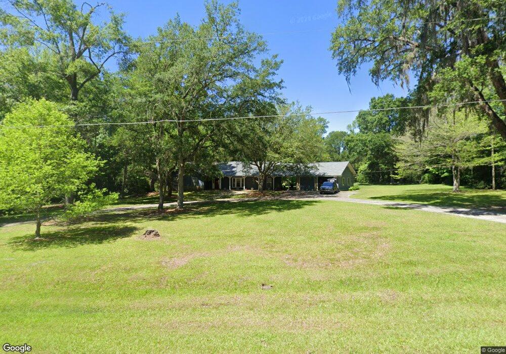
1044 Canarvon Dr Tallahassee, FL 32317
Miccosukee NeighborhoodEstimated Value: $394,000 - $508,000
4
Beds
3
Baths
2,371
Sq Ft
$186/Sq Ft
Est. Value
About This Home
This home is located at 1044 Canarvon Dr, Tallahassee, FL 32317 and is currently estimated at $441,042, approximately $186 per square foot. 1044 Canarvon Dr is a home located in Leon County with nearby schools including Chaires Elementary School, Swift Creek Middle School, and Lincoln High School.
Ownership History
Date
Name
Owned For
Owner Type
Purchase Details
Closed on
Nov 5, 2004
Sold by
Waldo James E and Waldo Connie J
Bought by
Mason David W and Mason Sandra K
Current Estimated Value
Home Financials for this Owner
Home Financials are based on the most recent Mortgage that was taken out on this home.
Original Mortgage
$219,240
Outstanding Balance
$108,459
Interest Rate
5.65%
Mortgage Type
VA
Estimated Equity
$332,583
Purchase Details
Closed on
Jul 28, 2000
Sold by
Tudor Jessie B and Tudor Kathleen F
Bought by
Waldo James E and Waldo Connie J
Create a Home Valuation Report for This Property
The Home Valuation Report is an in-depth analysis detailing your home's value as well as a comparison with similar homes in the area
Home Values in the Area
Average Home Value in this Area
Purchase History
| Date | Buyer | Sale Price | Title Company |
|---|---|---|---|
| Mason David W | $236,000 | -- | |
| Waldo James E | $160,000 | -- |
Source: Public Records
Mortgage History
| Date | Status | Borrower | Loan Amount |
|---|---|---|---|
| Open | Mason David W | $219,240 |
Source: Public Records
Tax History Compared to Growth
Tax History
| Year | Tax Paid | Tax Assessment Tax Assessment Total Assessment is a certain percentage of the fair market value that is determined by local assessors to be the total taxable value of land and additions on the property. | Land | Improvement |
|---|---|---|---|---|
| 2024 | $3,007 | $235,418 | -- | -- |
| 2023 | $2,922 | $228,561 | $0 | $0 |
| 2022 | $2,786 | $221,904 | $0 | $0 |
| 2021 | $2,769 | $215,441 | $0 | $0 |
| 2020 | $2,680 | $212,466 | $0 | $0 |
| 2019 | $2,647 | $207,689 | $0 | $0 |
| 2018 | $2,620 | $203,816 | $0 | $0 |
| 2017 | $2,597 | $199,624 | $0 | $0 |
| 2016 | $2,630 | $198,610 | $0 | $0 |
| 2015 | $2,630 | $192,622 | $0 | $0 |
| 2014 | $2,630 | $192,915 | $0 | $0 |
Source: Public Records
Map
Nearby Homes
- 1020 Baum Rd
- 10571 Valentine Rd N
- 10609 Valentine Rd N
- 941 Cap Tram Rd
- 13-19-20-019-0000 Robinson Farms Rd
- 0 Tung Grove Rd Unit 390038
- 10515 Faye Way
- 954 Cap Tram Rd
- 126 Pendleton Ave
- 0 Mossy Oak Trail Unit LOT 2 OF A 3 LOT 2.1
- 000 Reddick Ln
- 9025 Buck Lake Rd
- 2727 Chaires Cross Rd
- 9249 Oakfair Dr
- 10050 Mahan Dr
- 10080 Mahan Dr
- 0040 Driftwood Ln
- 0030 Driftwood Ln
- 2500 Lakefair Dr
- lot 4 Powderhorn Ave
- 1016 Canarvon Dr
- 1032 Canarvon Dr
- 1039 Canarvon Dr
- 1023 Canarvon Dr
- 1008 Canarvon Dr
- 1040 Canarvon Dr
- 1046 Epping Forest Dr
- 11456 Buck Lake Rd
- 1013 Canarvon Dr
- 1038 Epping Forest Dr
- 1065 Green Hill Trace Unit II
- 1055 Green Hill Trace
- 1061 Epping Forest Dr
- 1047 Epping Forest Dr
- 1047 Epping Forest Dr Unit 2
- 1017 Green Hill Trace
- 1002 Epping Forest Dr
- 1057 Epping Forest Dr
- 1043 Epping Forest Dr
- 1017 Epping Forest Dr