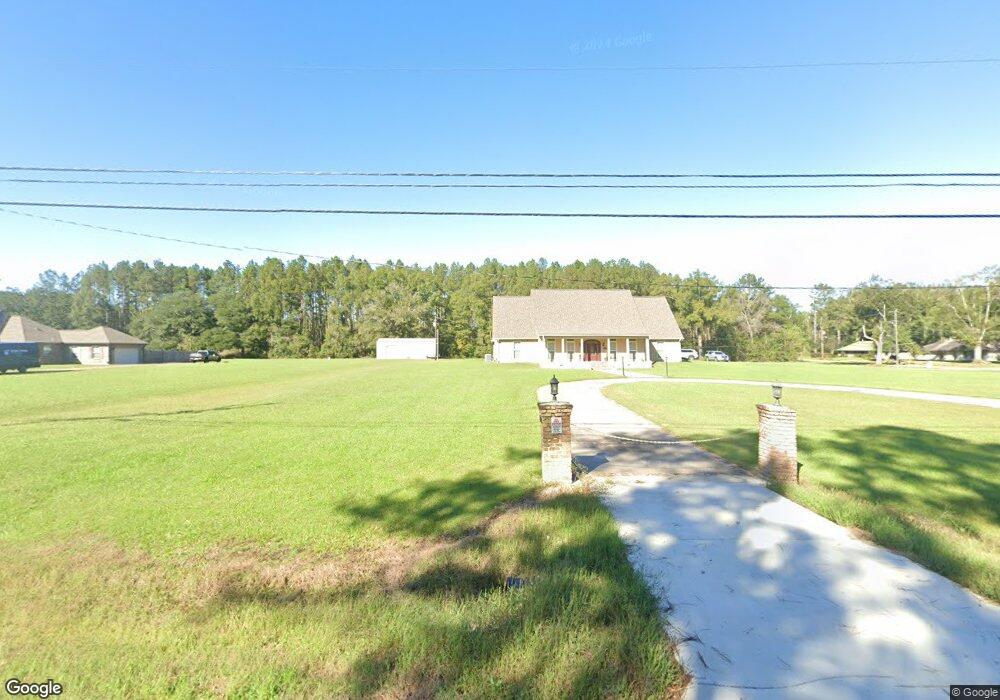
10449 Highway 1064 Tickfaw, LA 70466
Estimated Value: $297,000 - $601,253
4
Beds
4
Baths
2,770
Sq Ft
$157/Sq Ft
Est. Value
About This Home
This home is located at 10449 Highway 1064, Tickfaw, LA 70466 and is currently estimated at $434,063, approximately $156 per square foot. 10449 Highway 1064 is a home located in Tangipahoa Parish with nearby schools including Lucille Nesom Memorial School and Independence High Magnet.
Ownership History
Date
Name
Owned For
Owner Type
Purchase Details
Closed on
Nov 3, 2008
Sold by
L Jerry Kinchen Inc
Bought by
Hardley Howard J and Hardley Lisa H
Current Estimated Value
Purchase Details
Closed on
Jun 11, 2007
Sold by
Bankston Kinchen Jerry C and Bankston Kinchen Carol
Bought by
Hadley Lisa Herbert and Moses Samantha Lindsay
Purchase Details
Closed on
Jan 20, 2006
Sold by
Kinchen Jerry G and Kinchen Carol Bankston
Bought by
Hadley Howard Joseph and Hadley Lisa Hebert
Create a Home Valuation Report for This Property
The Home Valuation Report is an in-depth analysis detailing your home's value as well as a comparison with similar homes in the area
Home Values in the Area
Average Home Value in this Area
Purchase History
| Date | Buyer | Sale Price | Title Company |
|---|---|---|---|
| Hardley Howard J | $32,000 | Midtown Title | |
| Hadley Lisa Herbert | $35,000 | None Available | |
| Hadley Howard Joseph | $329,250 | Hammond Title Co Inc |
Source: Public Records
Tax History Compared to Growth
Tax History
| Year | Tax Paid | Tax Assessment Tax Assessment Total Assessment is a certain percentage of the fair market value that is determined by local assessors to be the total taxable value of land and additions on the property. | Land | Improvement |
|---|---|---|---|---|
| 2024 | $2,708 | $31,374 | $1,654 | $29,720 |
| 2023 | $2,747 | $31,540 | $1,538 | $30,002 |
| 2022 | $2,747 | $31,540 | $1,538 | $30,002 |
| 2021 | $2,099 | $31,540 | $1,538 | $30,002 |
| 2020 | $2,747 | $31,540 | $1,538 | $30,002 |
| 2019 | $2,632 | $30,328 | $1,538 | $28,790 |
| 2018 | $2,642 | $30,328 | $1,538 | $28,790 |
| 2017 | $2,642 | $30,328 | $1,538 | $28,790 |
| 2016 | $2,642 | $30,328 | $1,538 | $28,790 |
| 2015 | $2,098 | $31,561 | $1,538 | $30,023 |
| 2014 | $1,953 | $31,561 | $1,538 | $30,023 |
Source: Public Records
Map
Nearby Homes
- 10204 Crystal Ln
- 10215 Crystal Ln
- 10205 Pearl Ln
- 11169 Griffin Ln
- 10172 Pearl Ln
- 10199 Crystal Ln
- Eastwood Plan at Rivers Edge
- Birch Plan at Rivers Edge
- 10179 Pearl Ln
- 10188 Pearl Ln
- Hickory Plan at Rivers Edge
- Aspen. Plan at Rivers Edge
- 10171 Pearl Ln
- Evergreen Plan at Rivers Edge
- 10188 Crystal Ln
- Cameron Plan at Rivers Edge
- 11081 Martin Ln
- 48351 Woodhaven Rd
- 30890 Highway 1064
- 10433 Highway 1064
- 48030 Woodhaven Rd
- 10458 Highway 1064
- 11013 Louisiana 1064
- 11013 Highway 1064
- 48038 Woodhaven Rd
- 48048 Woodhaven Rd
- 10422 Highway 1064
- 10432 Highway 1064
- 10414 Highway 1064
- 47393 Durbin Rd
- 11033 Highway 1064
- 48076 Woodhaven Rd
- 11049 Highway 1064
- 47357 Durbin Rd
- 11059 Highway 1064
- 48088 Woodhaven Rd
- 10341 Highway 1064
- 11043 Pine Dr