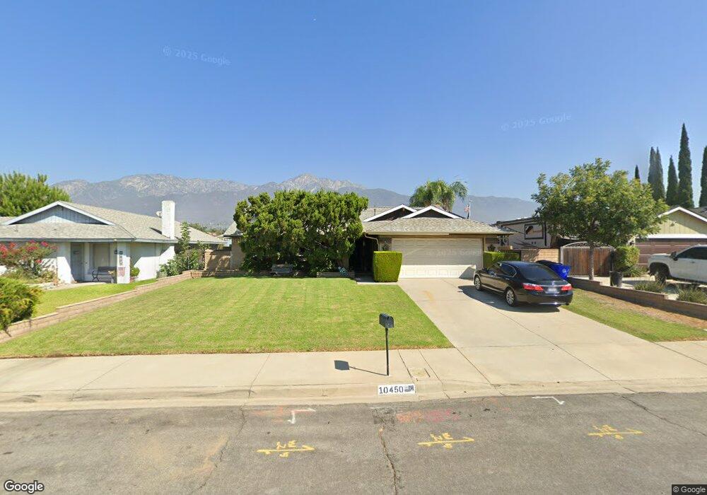
10450 La Mesa Dr Rancho Cucamonga, CA 91701
Estimated Value: $734,517 - $785,000
3
Beds
2
Baths
1,600
Sq Ft
$477/Sq Ft
Est. Value
About This Home
This home is located at 10450 La Mesa Dr, Rancho Cucamonga, CA 91701 and is currently estimated at $762,879, approximately $476 per square foot. 10450 La Mesa Dr is a home located in San Bernardino County with nearby schools including Deer Canyon Elementary, Vineyard Junior High, and Los Osos High.
Ownership History
Date
Name
Owned For
Owner Type
Purchase Details
Closed on
Dec 22, 2015
Sold by
Garcia Erica Marie
Bought by
Garcia Michael A and Garcia Erica M
Current Estimated Value
Home Financials for this Owner
Home Financials are based on the most recent Mortgage that was taken out on this home.
Original Mortgage
$125,000
Interest Rate
3.92%
Mortgage Type
New Conventional
Purchase Details
Closed on
Apr 22, 2015
Sold by
Garcia Erica Marie
Bought by
Garcia Erica Marie
Purchase Details
Closed on
Mar 25, 2004
Sold by
Gonzalez John J
Bought by
Gonzalez Joseph J and Gonzalez Joslyn
Create a Home Valuation Report for This Property
The Home Valuation Report is an in-depth analysis detailing your home's value as well as a comparison with similar homes in the area
Home Values in the Area
Average Home Value in this Area
Purchase History
| Date | Buyer | Sale Price | Title Company |
|---|---|---|---|
| Garcia Michael A | -- | Ticor Title Company Of Ca | |
| Garcia Erica Marie | -- | None Available | |
| Gonzalez Joseph J | -- | -- |
Source: Public Records
Mortgage History
| Date | Status | Borrower | Loan Amount |
|---|---|---|---|
| Closed | Garcia Michael A | $125,000 |
Source: Public Records
Tax History Compared to Growth
Tax History
| Year | Tax Paid | Tax Assessment Tax Assessment Total Assessment is a certain percentage of the fair market value that is determined by local assessors to be the total taxable value of land and additions on the property. | Land | Improvement |
|---|---|---|---|---|
| 2025 | $2,710 | $247,706 | $61,924 | $185,782 |
| 2024 | $2,710 | $242,849 | $60,710 | $182,139 |
| 2023 | $2,650 | $238,088 | $59,520 | $178,568 |
| 2022 | $2,643 | $233,420 | $58,353 | $175,067 |
| 2021 | $2,642 | $228,843 | $57,209 | $171,634 |
| 2020 | $2,534 | $226,496 | $56,622 | $169,874 |
| 2019 | $2,563 | $222,055 | $55,512 | $166,543 |
| 2018 | $2,506 | $217,701 | $54,424 | $163,277 |
| 2017 | $2,393 | $213,432 | $53,357 | $160,075 |
| 2016 | $2,328 | $209,247 | $52,311 | $156,936 |
| 2015 | $2,314 | $206,104 | $51,525 | $154,579 |
| 2014 | $2,249 | $202,067 | $50,516 | $151,551 |
Source: Public Records
Map
Nearby Homes
- 7208 Marine Ave
- 10350 Base Line Rd
- 10350 Base Line Rd Unit 192
- 7314 Greenhaven Ave Unit 74
- 7175 Summerfield Place
- 10650 Grandview Dr
- 6959 Center Ave
- 10627 Wildrose Dr
- 7055 Mango St
- 7224 Parkside Place
- 10669 Wildrose Dr
- 7355 Ambrosia Rd
- 10210 Baseline Rd Unit 62
- 10210 Baseline Rd Unit 115
- 10210 Baseline Rd Unit 289
- 6842 Palm Dr
- 10487 Balsa St
- 10414 Hamilton St
- 10456 Hamilton St
- 10815 Plumas Rd
- 10440 La Mesa Dr
- 10460 La Mesa Dr
- 10430 La Mesa Dr
- 7200 Mesada St
- 7201 Marine Ave
- 10470 La Mesa Dr
- 10420 La Mesa Dr
- 7210 Mesada St
- 7193 Mesada St
- 7211 Marine Ave
- 7201 Mesada St
- 7220 Mesada St
- 7190 Marine Ave
- 7221 Marine Ave
- 7211 Mesada St
- 7198 Marine Ave
- 7230 Mesada St
- 7221 Mesada St
- 7231 Marine Ave
- 7218 Marine Ave