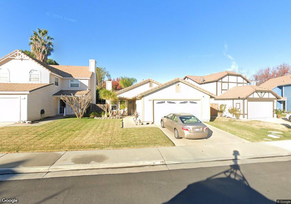
10450 Rhondda St Redlands, CA 92374
Estimated Value: $488,780 - $613,000
3
Beds
2
Baths
1,348
Sq Ft
$401/Sq Ft
Est. Value
About This Home
This home is located at 10450 Rhondda St, Redlands, CA 92374 and is currently estimated at $541,195, approximately $401 per square foot. 10450 Rhondda St is a home located in San Bernardino County with nearby schools including Mission Elementary School, Cope Middle School, and Redlands Senior High School.
Ownership History
Date
Name
Owned For
Owner Type
Purchase Details
Closed on
Jul 24, 1995
Sold by
Ryan William W and Davidson Ryan Sylvia
Bought by
Harris Shelby and Harris Claudia
Current Estimated Value
Home Financials for this Owner
Home Financials are based on the most recent Mortgage that was taken out on this home.
Original Mortgage
$99,591
Interest Rate
7.71%
Mortgage Type
FHA
Create a Home Valuation Report for This Property
The Home Valuation Report is an in-depth analysis detailing your home's value as well as a comparison with similar homes in the area
Home Values in the Area
Average Home Value in this Area
Purchase History
| Date | Buyer | Sale Price | Title Company |
|---|---|---|---|
| Harris Shelby | $100,000 | First American Title Ins Co |
Source: Public Records
Mortgage History
| Date | Status | Borrower | Loan Amount |
|---|---|---|---|
| Closed | Harris Shelby | $99,591 |
Source: Public Records
Tax History Compared to Growth
Tax History
| Year | Tax Paid | Tax Assessment Tax Assessment Total Assessment is a certain percentage of the fair market value that is determined by local assessors to be the total taxable value of land and additions on the property. | Land | Improvement |
|---|---|---|---|---|
| 2025 | $2,139 | $176,091 | $41,529 | $134,562 |
| 2024 | $2,139 | $172,639 | $40,715 | $131,924 |
| 2023 | $2,137 | $169,254 | $39,917 | $129,337 |
| 2022 | $2,107 | $165,935 | $39,134 | $126,801 |
| 2021 | $2,144 | $162,682 | $38,367 | $124,315 |
| 2020 | $2,113 | $161,014 | $37,974 | $123,040 |
| 2019 | $2,057 | $157,856 | $37,229 | $120,627 |
| 2018 | $2,008 | $154,761 | $36,499 | $118,262 |
| 2017 | $1,992 | $151,726 | $35,783 | $115,943 |
| 2016 | $1,970 | $148,751 | $35,081 | $113,670 |
| 2015 | $1,956 | $146,517 | $34,554 | $111,963 |
| 2014 | $1,923 | $143,647 | $33,877 | $109,770 |
Source: Public Records
Map
Nearby Homes
- 26397 Redlands Blvd Unit 24
- 26200 Redlands Blvd Unit 68
- 26200 Redlands Blvd Unit 4
- 26200 Redlands Blvd Unit 96
- 26149 Park Ave Unit 6
- 10851 Pala Bells St
- 10857 Pala Bells St
- 10852 Pala Bells St
- 26349 Tangelo Way
- 10871 Pala Bells St
- 10866 Pala Bells St
- 26111 Mercury Dr
- 26125 Mercury Dr
- 26147 Mercury Dr
- 26109 Mercury Dr
- 26113 Mercury Dr
- 10957 Frink Ranch Rd
- Residence 2 Plan at The Groves - Sierra Crest
- Residence 3 Plan at The Groves - Sierra Crest
- Residence 1 Plan at The Groves - Sierra Crest
- 10456 Rhondda St
- 10442 Rhondda St
- 10462 Rhondda St
- 10436 Rhondda St
- 26277 Cardigan Place
- 10468 Rhondda St
- 26276 Snowden Ave
- 10430 Rhondda St
- 26283 Cardigan Place
- 26282 Snowden Ave
- 26270 Cardigan Place
- 26289 Cardigan Place
- 26276 Cardigan Place
- 26288 Snowden Ave
- 26284 Cardigan Place
- 26295 Cardigan Place
- 26294 Snowden Ave
- 26288 Cardigan Place
- 26277 Snowden Ave
- 26283 Snowden Ave