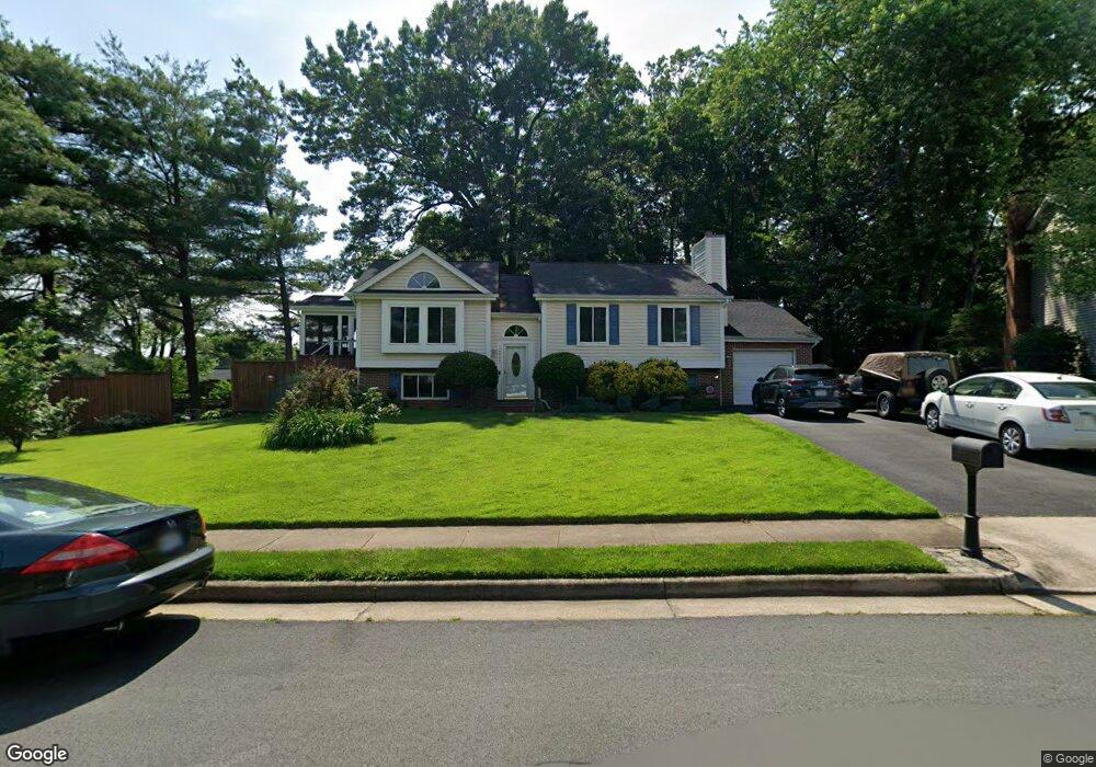
10452 Brackets Ford Cir Manassas, VA 20110
Old Town Manassas NeighborhoodEstimated Value: $540,724 - $582,000
5
Beds
3
Baths
1,130
Sq Ft
$495/Sq Ft
Est. Value
About This Home
This home is located at 10452 Brackets Ford Cir, Manassas, VA 20110 and is currently estimated at $559,681, approximately $495 per square foot. 10452 Brackets Ford Cir is a home located in Manassas City with nearby schools including George Carr Round Elementary School, Mayfield Intermediate School, and Grace E. Metz Middle School.
Ownership History
Date
Name
Owned For
Owner Type
Purchase Details
Closed on
Aug 25, 1997
Sold by
Kish William D and Kish Glenda L
Bought by
Richitt Mark A and Richitt Chana
Current Estimated Value
Home Financials for this Owner
Home Financials are based on the most recent Mortgage that was taken out on this home.
Original Mortgage
$157,260
Outstanding Balance
$24,264
Interest Rate
7.42%
Mortgage Type
FHA
Estimated Equity
$535,417
Create a Home Valuation Report for This Property
The Home Valuation Report is an in-depth analysis detailing your home's value as well as a comparison with similar homes in the area
Home Values in the Area
Average Home Value in this Area
Purchase History
| Date | Buyer | Sale Price | Title Company |
|---|---|---|---|
| Richitt Mark A | $159,500 | -- |
Source: Public Records
Mortgage History
| Date | Status | Borrower | Loan Amount |
|---|---|---|---|
| Open | Richitt Mark A | $157,260 |
Source: Public Records
Tax History Compared to Growth
Tax History
| Year | Tax Paid | Tax Assessment Tax Assessment Total Assessment is a certain percentage of the fair market value that is determined by local assessors to be the total taxable value of land and additions on the property. | Land | Improvement |
|---|---|---|---|---|
| 2024 | $5,889 | $467,400 | $167,000 | $300,400 |
| 2023 | $5,727 | $454,500 | $162,000 | $292,500 |
| 2022 | $5,395 | $402,000 | $141,000 | $261,000 |
| 2021 | $5,012 | $350,700 | $126,000 | $224,700 |
| 2020 | $4,726 | $323,700 | $121,500 | $202,200 |
| 2019 | $4,548 | $307,300 | $118,000 | $189,300 |
| 2018 | $4,338 | $297,100 | $112,500 | $184,600 |
| 2017 | -- | $292,900 | $112,500 | $180,400 |
| 2016 | $3,747 | $267,100 | $0 | $0 |
| 2015 | -- | $253,700 | $112,500 | $141,200 |
| 2014 | -- | $0 | $0 | $0 |
Source: Public Records
Map
Nearby Homes
- 10269 Cedar Ridge Dr
- 10073 Loblolly Trail
- 10878 Peachwood Dr
- 10177 Queens Way
- 10173 Queens Way
- 10170 Queens Way
- 10165 Queens Way
- 10161 Queens Way
- 10102 Queens Way
- 10166 Queens Way
- 10157 Queens Way
- 10106 Queens Way
- 10153 Queens Way
- 10114 Queens Way
- BALMORAL Plan at Kings Landing
- HIGHGROVE Plan at Kings Landing
- 10118 Queens Way
- 10130 Queens Way
- 9432 Deschamp Ct
- 9444 Corey Dr
- 10450 Brackets Ford Cir
- 10300 Almond Tree Ct
- 10453 Brackets Ford Cir
- 10454 Brackets Ford Cir
- 10413 Sorrell Dr
- 10448 Brackets Ford Cir
- 10411 Sorrell Dr
- 10301 Almond Tree Ct
- 10367 Falcon Point Way
- 10455 Brackets Ford Cir
- 10302 Almond Tree Ct
- 10369 Falcon Point Way
- 10456 Brackets Ford Cir
- 10446 Brackets Ford Cir
- 10409 Sorrell Dr
- 10365 Falcon Point Way
- 10303 Almond Tree Ct
- 10410 Sorrell Dr
- 10444 Brackets Ford Cir
- 10408 Sorrell Dr