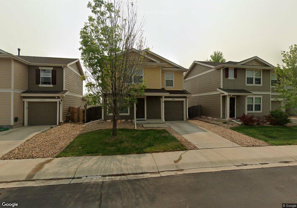
10454 Lower Ridge Rd Longmont, CO 80504
Estimated Value: $398,729 - $422,000
3
Beds
2
Baths
1,110
Sq Ft
$368/Sq Ft
Est. Value
About This Home
This home is located at 10454 Lower Ridge Rd, Longmont, CO 80504 and is currently estimated at $407,932, approximately $367 per square foot. 10454 Lower Ridge Rd is a home located in Weld County with nearby schools including Centennial Elementary School, Coal Ridge Middle School, and Mead High School.
Ownership History
Date
Name
Owned For
Owner Type
Purchase Details
Closed on
Apr 12, 2014
Sold by
Yoshino Ron and Yoshino Adama
Bought by
Yoshino Ron and Yoshino Adama
Current Estimated Value
Home Financials for this Owner
Home Financials are based on the most recent Mortgage that was taken out on this home.
Original Mortgage
$130,780
Outstanding Balance
$99,753
Interest Rate
4.43%
Mortgage Type
FHA
Estimated Equity
$308,179
Purchase Details
Closed on
Nov 22, 2006
Sold by
Kb Home Colorado Inc
Bought by
Yoshino Ron and Dimock Adama
Home Financials for this Owner
Home Financials are based on the most recent Mortgage that was taken out on this home.
Original Mortgage
$140,605
Interest Rate
6.3%
Mortgage Type
FHA
Create a Home Valuation Report for This Property
The Home Valuation Report is an in-depth analysis detailing your home's value as well as a comparison with similar homes in the area
Home Values in the Area
Average Home Value in this Area
Purchase History
| Date | Buyer | Sale Price | Title Company |
|---|---|---|---|
| Yoshino Ron | -- | Ticor Title | |
| Yoshino Ron | $142,813 | Security Title |
Source: Public Records
Mortgage History
| Date | Status | Borrower | Loan Amount |
|---|---|---|---|
| Open | Yoshino Ron | $130,780 | |
| Closed | Yoshino Ron | $140,605 |
Source: Public Records
Tax History Compared to Growth
Tax History
| Year | Tax Paid | Tax Assessment Tax Assessment Total Assessment is a certain percentage of the fair market value that is determined by local assessors to be the total taxable value of land and additions on the property. | Land | Improvement |
|---|---|---|---|---|
| 2025 | $2,166 | $24,290 | $5,380 | $18,910 |
| 2024 | $2,166 | $24,290 | $5,380 | $18,910 |
| 2023 | $2,077 | $27,010 | $5,820 | $21,190 |
| 2022 | $1,846 | $19,590 | $4,450 | $15,140 |
| 2021 | $1,880 | $20,150 | $4,580 | $15,570 |
| 2020 | $1,785 | $19,300 | $3,040 | $16,260 |
| 2019 | $1,805 | $19,300 | $3,040 | $16,260 |
| 2018 | $1,449 | $15,680 | $3,020 | $12,660 |
| 2017 | $1,391 | $15,680 | $3,020 | $12,660 |
| 2016 | $1,120 | $12,540 | $2,150 | $10,390 |
| 2015 | $1,611 | $12,540 | $2,150 | $10,390 |
| 2014 | $1,374 | $10,010 | $1,990 | $8,020 |
Source: Public Records
Map
Nearby Homes
- 10592 Butte Dr
- 10688 Durango Place
- 10691 Durango Place
- 10910 Turner Blvd Unit 203
- 10910 Turner Blvd Unit 127
- 10752 County Road 7
- 4616 Tilbury Ct
- 10555 Aspen St Unit 198
- 0 Del Camino Business Park Lot 1 Unit 986024
- 10529 Bald Eagle Cir Unit 394
- 10529 Bald Eagle Cir
- 10684 Aspen St
- 10684 Aspen St Unit 72
- 4768 Silverleaf Ave
- 4795 Audrey St Unit 260
- 9746 County Road 7
- 10597 Bald Eagle Cir Unit 244
- 10611 Barron Cir Unit 426
- 10574 Bald Eagle Cir
- 3545 Cottonwood Cir
- 10456 Lower Ridge Rd
- 10458 Lower Ridge Rd
- 10450 Lower Ridge Rd
- 10460 Lower Ridge Rd
- 10448 Lower Ridge Rd
- 10441 Durango Place
- 10442 Forester Place
- 10462 Lower Ridge Rd
- 10440 Durango Place
- 10439 Durango Place
- 10440 Forester Place
- 10464 Lower Ridge Rd
- 10438 Durango Place
- 10437 Durango Place
- 10446 Butte Dr
- 10437 Butte Dr
- 10438 Forester Place
- 10436 Durango Place
- 10466 Lower Ridge Rd
- 10435 Durango Place