Estimated Value: $59,000 - $370,000
3
Beds
3
Baths
2,148
Sq Ft
$98/Sq Ft
Est. Value
About This Home
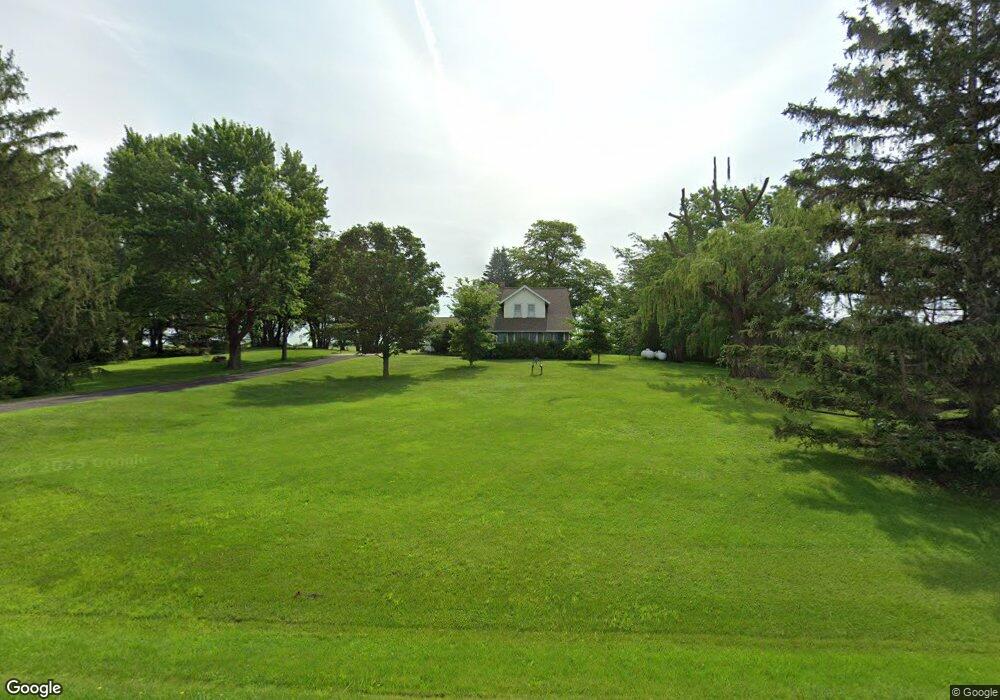
This home is located at 10456 Highway S33 Unit CO, Alden, IA 50006 and is currently estimated at $210,740, approximately $98 per square foot. 10456 Highway S33 Unit CO is a home located in Hardin County with nearby schools including Pineview Elementary School, Rock Run Elementary School, and Riverbend Middle School.
Create a Home Valuation Report for This Property
The Home Valuation Report is an in-depth analysis detailing your home's value as well as a comparison with similar homes in the area
Home Values in the Area
Average Home Value in this Area
Tax History Compared to Growth
Tax History
| Year | Tax Paid | Tax Assessment Tax Assessment Total Assessment is a certain percentage of the fair market value that is determined by local assessors to be the total taxable value of land and additions on the property. | Land | Improvement |
|---|---|---|---|---|
| 2025 | $1,827 | $169,590 | $28,080 | $141,510 |
| 2024 | $1,827 | $152,620 | $28,080 | $124,540 |
| 2023 | $1,712 | $152,620 | $28,080 | $124,540 |
| 2022 | $1,530 | $123,850 | $28,080 | $95,770 |
| 2021 | $10 | $123,850 | $28,080 | $95,770 |
| 2020 | $1,732 | $132,600 | $25,450 | $107,150 |
| 2019 | $1,538 | $132,600 | $0 | $0 |
| 2018 | $1,538 | $120,550 | $0 | $0 |
| 2017 | $1,505 | $109,590 | $0 | $0 |
| 2016 | $1,522 | $109,590 | $0 | $0 |
| 2015 | $1,560 | $109,590 | $0 | $0 |
| 2014 | $1,544 | $109,590 | $0 | $0 |
Source: Public Records
Map
Nearby Homes
- TBD 1.68 acres Thurston Ln
- TBD 1.67 acres Thurston Ln
- 1021 Palisades Ct
- 1015 Palisades Ct
- 1017 Palisades Ct
- 1016 Palisades Ct
- 1012 Palisades Ct
- 2510 Kenison Way
- 1006 Palisades Ct
- 1008 Palisades Ct
- 2517 Kenison Way
- 1004 Palisades Ct
- 1010 Palisades Ct
- 19547 Highway D15
- 2525 Kenison Way
- 2515 Kenison Way
- 1014 Palisades Ct
- 2521 Kenison Way
- 1009 Palisades Ct
- 1013 Palisades Ct