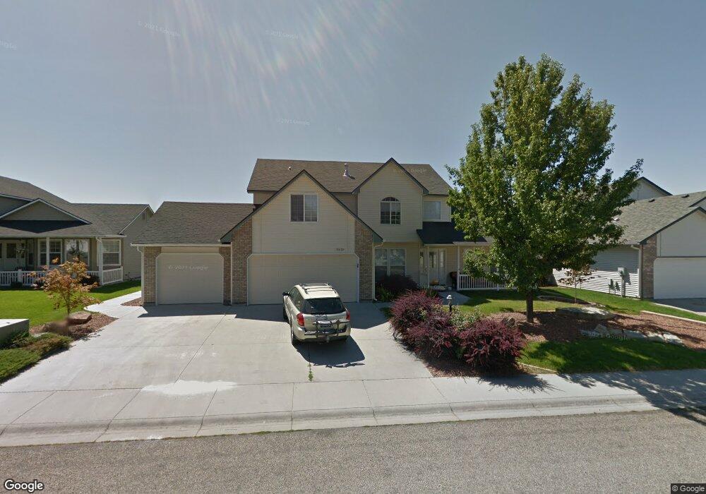
10459 W Shadow Rock St Boise, ID 83714
Outer Northeast Boise NeighborhoodEstimated Value: $646,586 - $723,000
4
Beds
3
Baths
2,484
Sq Ft
$271/Sq Ft
Est. Value
About This Home
This home is located at 10459 W Shadow Rock St, Boise, ID 83714 and is currently estimated at $672,147, approximately $270 per square foot. 10459 W Shadow Rock St is a home located in Ada County with nearby schools including Shadow Hills Elementary School, Riverglen Junior High School, and Capital High School.
Ownership History
Date
Name
Owned For
Owner Type
Purchase Details
Closed on
Mar 26, 2010
Sold by
Hill Ron W
Bought by
Bossart Hill Candance S
Current Estimated Value
Home Financials for this Owner
Home Financials are based on the most recent Mortgage that was taken out on this home.
Original Mortgage
$171,000
Interest Rate
5.01%
Mortgage Type
New Conventional
Purchase Details
Closed on
Jul 16, 2002
Sold by
Brown Jeffrey T and Brown Melinda M
Bought by
Hill Ron W and Bossart Hill Candace Sue
Purchase Details
Closed on
Dec 14, 2000
Sold by
Glenn Johnson Homes Inc
Bought by
Brown Jeffrey T and Brown Melinda M
Home Financials for this Owner
Home Financials are based on the most recent Mortgage that was taken out on this home.
Original Mortgage
$185,000
Interest Rate
7.67%
Mortgage Type
Purchase Money Mortgage
Purchase Details
Closed on
Feb 23, 1999
Sold by
Glenn Johnson Homes Inc
Bought by
Glenn Johnson Homes Inc
Create a Home Valuation Report for This Property
The Home Valuation Report is an in-depth analysis detailing your home's value as well as a comparison with similar homes in the area
Home Values in the Area
Average Home Value in this Area
Purchase History
| Date | Buyer | Sale Price | Title Company |
|---|---|---|---|
| Bossart Hill Candance S | -- | Titleone Eagle | |
| Hill Ron W | -- | First American | |
| Brown Jeffrey T | -- | First American | |
| Glenn Johnson Homes Inc | -- | First American |
Source: Public Records
Mortgage History
| Date | Status | Borrower | Loan Amount |
|---|---|---|---|
| Closed | Bossart Hill Candance S | $171,000 | |
| Previous Owner | Brown Jeffrey T | $185,000 |
Source: Public Records
Tax History Compared to Growth
Tax History
| Year | Tax Paid | Tax Assessment Tax Assessment Total Assessment is a certain percentage of the fair market value that is determined by local assessors to be the total taxable value of land and additions on the property. | Land | Improvement |
|---|---|---|---|---|
| 2025 | $2,752 | $604,000 | -- | -- |
| 2024 | $2,727 | $553,300 | -- | -- |
| 2023 | $2,727 | $517,700 | $0 | $0 |
| 2022 | $2,864 | $580,700 | $0 | $0 |
| 2021 | $2,751 | $468,100 | $0 | $0 |
| 2020 | $2,641 | $378,000 | $0 | $0 |
| 2019 | $2,608 | $359,000 | $0 | $0 |
| 2018 | $2,217 | $301,300 | $0 | $0 |
| 2017 | $1,959 | $270,600 | $0 | $0 |
| 2016 | $1,913 | $254,700 | $0 | $0 |
| 2015 | $2,377 | $236,200 | $0 | $0 |
| 2012 | -- | $188,900 | $0 | $0 |
Source: Public Records
Map
Nearby Homes
- 10410 W Blackstone St
- 10290 N Blacktail Ave
- 10601 N Horseshoe Bend Rd Sp #47 Unit 47
- 10484 N Palisades Way
- 10102 W Lariat Dr
- 10601 N Horseshoe Bend Rd Unit 1
- 10601 Horseshoe Bend Rd
- 9605 N Horseshoe Bend Rd
- 65 N Wooddale Ave
- 7754 W Meltwater Ln
- 255 S Wooddale Ave
- 2391 E Snocreek Dr
- 2473 E Clackamas Ct
- 1214 N Trail Creek Ln
- 10031 W Arnold Rd
- 2569 E Timbercreek Ct
- 9993 W Arnold Rd
- The Alderbrook Plan at Sterling Heights
- The Kingston Plan at Sterling Heights
- The Pinehurst Plan at Sterling Heights
- 10435 W Shadow Rock St
- 10483 W Shadow Rock St
- 10460 W Shadow Rock St
- 10411 W Shadow Rock St
- 10484 W Shadow Rock St
- 10436 W Shadow Rock St
- 10508 W Shadow Rock St
- 10412 W Shadow Rock St
- 10115 N Blacktail Ave
- 10081 N Palisades Way
- 10529 W Bonita Hills
- 10133 N Blacktail Ave
- 10097 N Blacktail Ave
- 10063 N Palisades Way
- 10461 W Sawtail St
- 10437 W Sawtail St
- 10532 W Shadow Rock St
- 10485 W Sawtail St
- 10388 W Shadow Rock St
- 10509 W Sawtail St