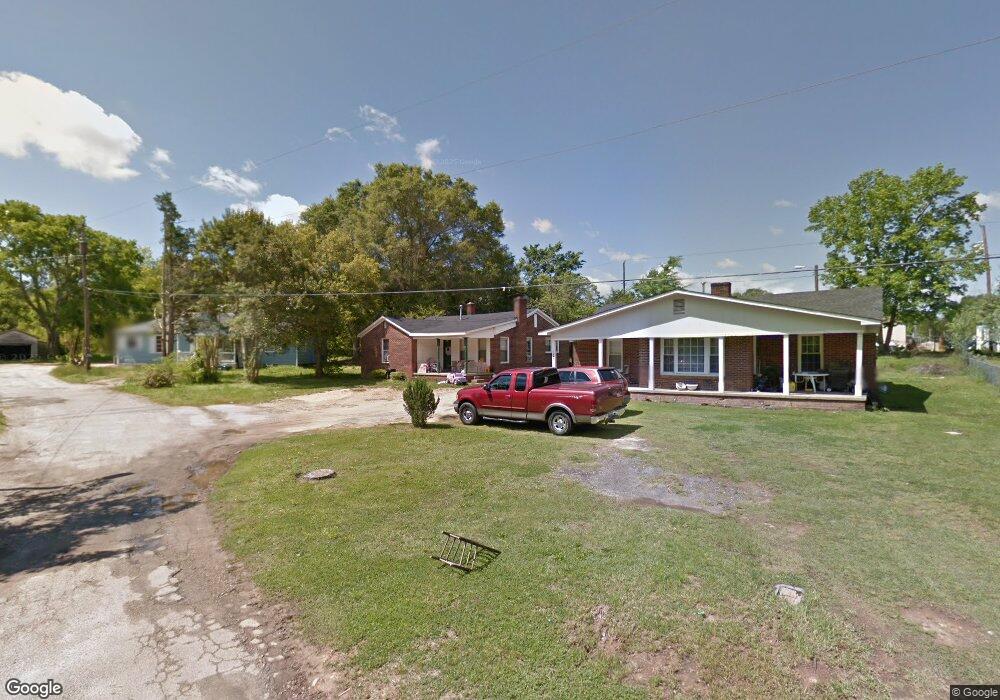
1046 Mullis Cir Lancaster, SC 29720
Estimated Value: $64,632 - $212,000
--
Bed
--
Bath
1,080
Sq Ft
$147/Sq Ft
Est. Value
About This Home
This home is located at 1046 Mullis Cir, Lancaster, SC 29720 and is currently estimated at $158,658, approximately $146 per square foot. 1046 Mullis Cir is a home with nearby schools including Erwin Elementary School, South Middle School, and Lancaster High School.
Ownership History
Date
Name
Owned For
Owner Type
Purchase Details
Closed on
Oct 2, 2025
Sold by
Melgar Maria O and Gavarrete Maria O
Bought by
Gavarrete Maria Oralia Melga and Melgar Maria O
Current Estimated Value
Purchase Details
Closed on
Sep 22, 2016
Sold by
Moree Properties Llc
Bought by
Melgar Gavarrete Maria O
Purchase Details
Closed on
May 6, 2011
Sold by
Estate Of Charles Hoyt Lowery
Bought by
Lowery Glenda R
Purchase Details
Closed on
Sep 26, 2001
Sold by
Mullis Victor and Mullis John C
Bought by
Lowery Charles H and Lowery Glenda R
Create a Home Valuation Report for This Property
The Home Valuation Report is an in-depth analysis detailing your home's value as well as a comparison with similar homes in the area
Home Values in the Area
Average Home Value in this Area
Purchase History
| Date | Buyer | Sale Price | Title Company |
|---|---|---|---|
| Gavarrete Maria Oralia Melga | -- | None Listed On Document | |
| Melgar Gavarrete Maria O | $20,000 | -- | |
| Lowery Glenda R | -- | -- | |
| Lowery Charles H | $7,000 | -- |
Source: Public Records
Tax History Compared to Growth
Tax History
| Year | Tax Paid | Tax Assessment Tax Assessment Total Assessment is a certain percentage of the fair market value that is determined by local assessors to be the total taxable value of land and additions on the property. | Land | Improvement |
|---|---|---|---|---|
| 2024 | $623 | $1,878 | $156 | $1,722 |
| 2023 | $622 | $1,878 | $156 | $1,722 |
| 2022 | $620 | $1,878 | $156 | $1,722 |
| 2021 | $611 | $1,878 | $156 | $1,722 |
| 2020 | $538 | $1,656 | $156 | $1,500 |
| 2019 | $561 | $1,656 | $156 | $1,500 |
| 2018 | $540 | $1,656 | $156 | $1,500 |
| 2017 | $507 | $0 | $0 | $0 |
| 2016 | $654 | $0 | $0 | $0 |
| 2015 | $612 | $0 | $0 | $0 |
| 2014 | $612 | $0 | $0 | $0 |
| 2013 | $612 | $0 | $0 | $0 |
Source: Public Records
Map
Nearby Homes
- 1324 Jefferson St
- 1499 Old Landsford Rd
- TBD Old Landsford Rd
- 1453 Old Landsford Rd
- 1121 W Edgemont Dr
- 422 Plantation Rd
- 5.45 acres Memorial Park Rd
- 3.04 acres Memorial Park Rd
- 1109 W Edgemont Dr
- 1110 W Edgemont Dr
- 1334 Williams Estate Dr
- 1676 Partridge Cir
- 1447 Carmel Rd
- 526 Rock Springs Rd
- 530 Oxford Place
- 1429 Williams Estate Dr
- 1530 Danlee Dr
- 1257 Springdale Rd
- 406 N Pine St
- 1795 Grace Ave
- 1042 Mullis Cir
- 1050 Mullis Cir
- 1036 Mullis Cir
- 1052 Mullis Cir
- 1032 Mullis Cir
- 1037 Mullis Cir
- 1031 Mullis Cir
- 1057 Palidin Rd
- 1031 State Road S-29-424
- 1392 Wade St
- 1355 Westwood Rd
- 1348 Westwood Rd
- 1352 Wade St
- 1341 Westwood Rd
- 1364 State Road S-29-278
- 1340 Wade St
- 1433 W Meeting St
- 105 State Road S-29-424
- 1335 Westwood Rd
- 1338 Westwood Rd