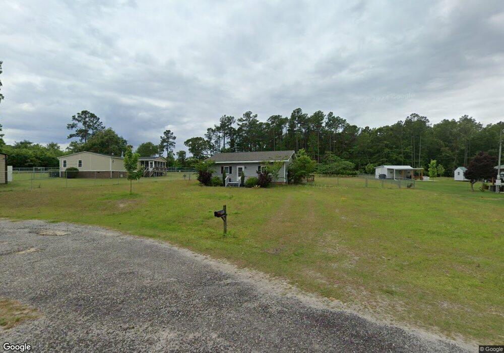
1046 Possum Run Rd Manning, SC 29102
Estimated Value: $141,000 - $187,674
2
Beds
1
Bath
1,020
Sq Ft
$158/Sq Ft
Est. Value
About This Home
This home is located at 1046 Possum Run Rd, Manning, SC 29102 and is currently estimated at $160,669, approximately $157 per square foot. 1046 Possum Run Rd is a home located in Clarendon County with nearby schools including Manning Early Childhood Center, Manning Primary School, and Manning Elementary School.
Ownership History
Date
Name
Owned For
Owner Type
Purchase Details
Closed on
Oct 14, 2023
Sold by
Miller Dennis Iv William
Bought by
Leclair Michael Stephen
Current Estimated Value
Home Financials for this Owner
Home Financials are based on the most recent Mortgage that was taken out on this home.
Original Mortgage
$145,500
Outstanding Balance
$142,639
Interest Rate
7.12%
Mortgage Type
New Conventional
Estimated Equity
$18,030
Purchase Details
Closed on
May 29, 2019
Sold by
Est Ray Lee Timothy
Bought by
Ray Barbara and Ray Lea A
Create a Home Valuation Report for This Property
The Home Valuation Report is an in-depth analysis detailing your home's value as well as a comparison with similar homes in the area
Home Values in the Area
Average Home Value in this Area
Purchase History
| Date | Buyer | Sale Price | Title Company |
|---|---|---|---|
| Leclair Michael Stephen | $150,000 | None Listed On Document | |
| Ray Barbara | -- | -- |
Source: Public Records
Mortgage History
| Date | Status | Borrower | Loan Amount |
|---|---|---|---|
| Open | Leclair Michael Stephen | $145,500 |
Source: Public Records
Tax History Compared to Growth
Tax History
| Year | Tax Paid | Tax Assessment Tax Assessment Total Assessment is a certain percentage of the fair market value that is determined by local assessors to be the total taxable value of land and additions on the property. | Land | Improvement |
|---|---|---|---|---|
| 2024 | $819 | $5,872 | $1,500 | $4,372 |
| 2023 | $291 | $3,204 | $800 | $2,404 |
| 2022 | $288 | $3,204 | $800 | $2,404 |
| 2021 | $149 | $2,784 | $600 | $2,184 |
| 2020 | $1,453 | $2,784 | $600 | $2,184 |
| 2019 | $1,271 | $2,548 | $600 | $1,948 |
| 2018 | $423 | $2,548 | $0 | $0 |
| 2017 | $424 | $2,548 | $0 | $0 |
| 2016 | $410 | $2,548 | $0 | $0 |
| 2015 | $381 | $2,344 | $344 | $2,000 |
| 2014 | $375 | $2,344 | $344 | $2,000 |
| 2013 | -- | $2,344 | $344 | $2,000 |
Source: Public Records
Map
Nearby Homes
- 1649 Lemon Ave
- 1213 Lesesne Dr
- 1075 Mockingbird Ln
- 1401 Charles Dr
- 1583 Wyboo Ave
- 1026 Carolina Way
- 1229 Lemon Ave
- 1015 Carolina Way
- 1001 Carolina Way
- 1339 Nightfall Ln
- 1605 Rowland Rd
- 1343 Morello Rd
- 1083 Copperhead Rd
- 1702 Camp Shelor Rd
- 1390 Nightfall Ln
- 1203 Cypress Pointe Unit A203
- 1311 Cypress Pointe #311
- 2205 Cypress Pointe Unit B 205
- 1211 Pleasure Dr
- 1156 W A Gamble Rd
- 1046 Possum Run
- 2268 Patriot Rd
- 2218 Patriot Rd
- 2234 Patriot Rd
- 2310 Patriot Rd
- 2228 Patriot Rd
- 1167 Rockfish Dr
- 1180 Rockfish Dr
- 1133 Rockfish Dr
- 2178 Patriot Rd
- 1148 Rockfish Dr
- TBD Rockfish Dr
- 0000 Rockfish Dr
- 0 Rockfish Dr Unit 126373
- 0 Rockfish Dr Unit 130826
- 0 Rockfish Dr Unit 119402
- 1315 Rockfish Dr
- 0 Rockfish Dr Unit 97269
- 0 Rockfish Dr Unit 93639
- 156 Rockfish Dr