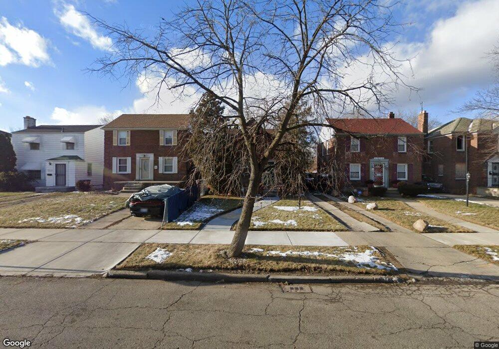
10461 Balfour Rd Detroit, MI 48224
Yorkshire Woods NeighborhoodEstimated Value: $67,000 - $109,000
--
Bed
1
Bath
1,002
Sq Ft
$90/Sq Ft
Est. Value
About This Home
This home is located at 10461 Balfour Rd, Detroit, MI 48224 and is currently estimated at $90,471, approximately $90 per square foot. 10461 Balfour Rd is a home located in Wayne County with nearby schools including Wayne Elementary School, Edward 'Duke' Ellington Conservatory of Music and Art, and Charles L. Spain Elementary-Middle School.
Ownership History
Date
Name
Owned For
Owner Type
Purchase Details
Closed on
Jun 9, 2005
Sold by
Walker Stewart A
Bought by
Walker Stewart A
Current Estimated Value
Home Financials for this Owner
Home Financials are based on the most recent Mortgage that was taken out on this home.
Original Mortgage
$18,000
Interest Rate
5.74%
Mortgage Type
Credit Line Revolving
Create a Home Valuation Report for This Property
The Home Valuation Report is an in-depth analysis detailing your home's value as well as a comparison with similar homes in the area
Home Values in the Area
Average Home Value in this Area
Purchase History
| Date | Buyer | Sale Price | Title Company |
|---|---|---|---|
| Walker Stewart A | -- | Title Source Inc |
Source: Public Records
Mortgage History
| Date | Status | Borrower | Loan Amount |
|---|---|---|---|
| Closed | Walker Stewart A | $18,000 |
Source: Public Records
Tax History Compared to Growth
Tax History
| Year | Tax Paid | Tax Assessment Tax Assessment Total Assessment is a certain percentage of the fair market value that is determined by local assessors to be the total taxable value of land and additions on the property. | Land | Improvement |
|---|---|---|---|---|
| 2025 | $927 | $31,200 | $0 | $0 |
| 2024 | $927 | $28,800 | $0 | $0 |
| 2023 | $898 | $23,200 | $0 | $0 |
| 2022 | $976 | $18,700 | $0 | $0 |
| 2021 | $953 | $15,200 | $0 | $0 |
| 2020 | $944 | $14,200 | $0 | $0 |
| 2019 | $931 | $12,600 | $0 | $0 |
| 2018 | $804 | $11,500 | $0 | $0 |
| 2017 | $178 | $9,400 | $0 | $0 |
| 2016 | $1,118 | $14,600 | $0 | $0 |
| 2015 | $1,460 | $14,600 | $0 | $0 |
| 2013 | $2,024 | $20,244 | $0 | $0 |
| 2010 | -- | $29,680 | $1,215 | $28,465 |
Source: Public Records
Map
Nearby Homes
- 10595 Somerset Ave
- 10551 Somerset Ave
- 10446 Balfour Rd
- 10731 Somerset Ave
- 10319 Mckinney St
- 10818 Nottingham Rd
- 10612 Nottingham Rd
- 10253 Mckinney St
- 10817 Nottingham Rd
- 10842 Nottingham Rd
- 10823 Nottingham Rd
- 10862 Nottingham Rd
- 10508 Nottingham Rd
- 10851 Nottingham Rd
- 10857 Nottingham Rd
- 10390 Somerset Ave
- 10800 Somerset Ave
- 10773 Beaconsfield St
- 10898 Nottingham Rd
- 10468 Nottingham Rd
- 10469 Balfour Rd
- 10455 Balfour Rd
- 10562 Somerset Ave
- 10556 Somerset Ave
- 10570 Somerset Ave
- 10473 Balfour Rd
- 10447 Balfour Rd
- 10550 Somerset Ave Unit Bldg-Unit
- 10550 Somerset Ave
- 10483 Balfour Rd
- 10544 Somerset Ave
- 10441 Balfour Rd
- 10584 Somerset Ave
- 10536 Somerset Ave
- 10489 Balfour Rd
- 10433 Balfour Rd
- 10592 Somerset Ave
- 10427 Balfour Rd
- 10530 Somerset Ave
- 10497 Balfour Rd