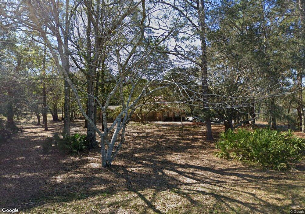
10465 Tower Ridge Rd Pensacola, FL 32526
Beulah NeighborhoodEstimated Value: $349,000 - $429,000
--
Bed
2
Baths
2,184
Sq Ft
$176/Sq Ft
Est. Value
About This Home
This home is located at 10465 Tower Ridge Rd, Pensacola, FL 32526 and is currently estimated at $383,518, approximately $175 per square foot. 10465 Tower Ridge Rd is a home located in Escambia County with nearby schools including Kingsfield Elementary School, Beulah Middle School, and J.M. Tate Senior High School.
Ownership History
Date
Name
Owned For
Owner Type
Purchase Details
Closed on
May 18, 2015
Sold by
White David L and White Theresa S
Bought by
White Brian L and White Laura M
Current Estimated Value
Home Financials for this Owner
Home Financials are based on the most recent Mortgage that was taken out on this home.
Original Mortgage
$160,000
Outstanding Balance
$59,826
Interest Rate
3.8%
Mortgage Type
New Conventional
Estimated Equity
$323,692
Purchase Details
Closed on
Apr 13, 2000
Sold by
White David L and White Theresa S
Bought by
Escambia Cty Fl
Create a Home Valuation Report for This Property
The Home Valuation Report is an in-depth analysis detailing your home's value as well as a comparison with similar homes in the area
Home Values in the Area
Average Home Value in this Area
Purchase History
| Date | Buyer | Sale Price | Title Company |
|---|---|---|---|
| White Brian L | $200,000 | First Intl Title Inc | |
| Escambia Cty Fl | -- | -- |
Source: Public Records
Mortgage History
| Date | Status | Borrower | Loan Amount |
|---|---|---|---|
| Open | White Brian L | $160,000 |
Source: Public Records
Tax History Compared to Growth
Tax History
| Year | Tax Paid | Tax Assessment Tax Assessment Total Assessment is a certain percentage of the fair market value that is determined by local assessors to be the total taxable value of land and additions on the property. | Land | Improvement |
|---|---|---|---|---|
| 2024 | $1,609 | $156,701 | -- | -- |
| 2023 | $1,609 | $152,137 | $0 | $0 |
| 2022 | $1,566 | $147,706 | $0 | $0 |
| 2021 | $1,560 | $143,404 | $0 | $0 |
| 2020 | $1,519 | $141,425 | $0 | $0 |
| 2019 | $1,489 | $138,246 | $0 | $0 |
| 2018 | $1,484 | $135,669 | $0 | $0 |
| 2017 | $1,478 | $132,879 | $0 | $0 |
| 2016 | $1,465 | $130,146 | $0 | $0 |
| 2015 | $1,181 | $110,977 | $0 | $0 |
| 2014 | $1,171 | $110,097 | $0 | $0 |
Source: Public Records
Map
Nearby Homes
- 9773 Windy Hill Rd
- 9769 Windy Hill Rd
- The Riverside Plan at Windy Hill South
- The Ozark Plan at Windy Hill South
- 8038 Burnside Loop
- 9777 Windy Hill Rd
- 7990 Burnside Loop
- 7975 Burnside Loop
- 7695 Burnside Loop
- 7708 Burnside Loop
- 14000 Tower Ridge Rd
- 7926 Burnside Loop
- 8211 Spicewood Rd
- 6640 Frank Reeder Rd
- 7616 Burnside Loop
- 6633 Frank Reeder Rd
- 6622 Frank Reeder Rd Unit A
- 7859 Burnside Loop
- 7823 Burnside Loop
- 7822 Burnside Loop
- 10495 Tower Ridge Rd
- 10460 Tower Ridge Rd
- 10460 Tower Ridge Rd Unit South Half
- 10460 Tower Ridge Rd Unit North Half
- 10455 Tower Ridge Rd
- 10450 Tower Ridge Rd
- 10435 Tower Ridge Rd
- 10446 Tower Ridge Rd
- 10375 Tower Ridge Rd
- 10400 Tower Ridge Rd
- 7250 Frank Reeder Rd
- 7230 Frank Reeder Rd
- 7210 Frank Reeder Rd
- 10365 Tower Ridge Rd
- 7200 Frank Reeder Rd
- 7150 Frank Reeder Rd
- 7140 Frank Reeder Rd
- 7260 Frank Reeder Rd
- 7254 Frank Reeder Rd
- 7098 Frank Reeder Rd
