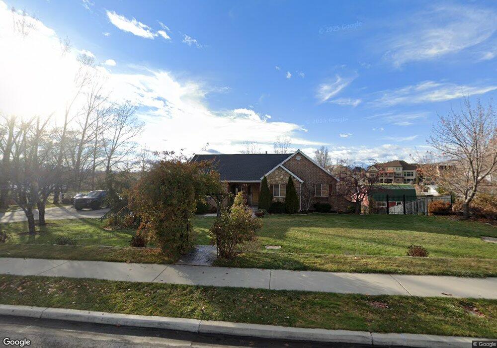
10469 N 6400 W Highland, UT 84003
Estimated Value: $901,000 - $1,132,894
3
Beds
2
Baths
3,112
Sq Ft
$321/Sq Ft
Est. Value
About This Home
This home is located at 10469 N 6400 W, Highland, UT 84003 and is currently estimated at $998,974, approximately $321 per square foot. 10469 N 6400 W is a home located in Utah County with nearby schools including Highland Elementary School, Mountain Ridge Junior High School, and Lone Peak High School.
Ownership History
Date
Name
Owned For
Owner Type
Purchase Details
Closed on
Sep 4, 2025
Sold by
Terrill And Brenda Floyd Family Trust and Floyd Terrill E
Bought by
Floyd Family Trust and Floyd
Current Estimated Value
Purchase Details
Closed on
Jan 28, 2021
Sold by
Floyd Terrill Earl and Floyd Brenda L
Bought by
Floyd Terrill E and Floyd Brenda L
Purchase Details
Closed on
Sep 23, 2019
Sold by
Schoonover Steven T and Schoonover Sandra P
Bought by
Schoonover Steven Todd and Schoonover Sandy
Home Financials for this Owner
Home Financials are based on the most recent Mortgage that was taken out on this home.
Original Mortgage
$150,000
Interest Rate
3.2%
Mortgage Type
New Conventional
Purchase Details
Closed on
Aug 15, 2019
Sold by
Schoonover Steven Todd and Schoonover Sandy
Bought by
Floyd Terrill Earl and Floyd Brenda L
Home Financials for this Owner
Home Financials are based on the most recent Mortgage that was taken out on this home.
Original Mortgage
$150,000
Interest Rate
3.2%
Mortgage Type
New Conventional
Purchase Details
Closed on
May 18, 2018
Sold by
Lee Rex L and Lee Dorothy J
Bought by
Schoonover Steven T and Schoonover Sandra P
Home Financials for this Owner
Home Financials are based on the most recent Mortgage that was taken out on this home.
Original Mortgage
$474,050
Interest Rate
4.4%
Mortgage Type
New Conventional
Purchase Details
Closed on
Nov 30, 2017
Sold by
Rovo River Water Users Association
Bought by
Lee Rex L and Lee Dorothy J
Purchase Details
Closed on
Feb 9, 2010
Sold by
Lee Rex L and Lee Dorothy J
Bought by
Lee Rex L and Lee Dorothy J
Purchase Details
Closed on
Mar 17, 2003
Sold by
Peterson William A and Peterson Amber D
Bought by
Peterson William A and Peterson Amber D
Home Financials for this Owner
Home Financials are based on the most recent Mortgage that was taken out on this home.
Original Mortgage
$167,000
Interest Rate
5.82%
Purchase Details
Closed on
Apr 24, 1997
Sold by
Peterson William and Peterson Amber
Bought by
Peterson William A and Peterson Amber D
Home Financials for this Owner
Home Financials are based on the most recent Mortgage that was taken out on this home.
Original Mortgage
$100,000
Interest Rate
7.86%
Purchase Details
Closed on
Aug 2, 1996
Sold by
Moulton Day Kent R and Moulton Day Nola
Bought by
Peterson William and Peterson Amber
Create a Home Valuation Report for This Property
The Home Valuation Report is an in-depth analysis detailing your home's value as well as a comparison with similar homes in the area
Home Values in the Area
Average Home Value in this Area
Purchase History
| Date | Buyer | Sale Price | Title Company |
|---|---|---|---|
| Floyd Family Trust | -- | None Listed On Document | |
| Floyd Terrill E | -- | None Available | |
| Schoonover Steven Todd | -- | None Available | |
| Floyd Terrill Earl | -- | Provo Land Title Co | |
| Schoonover Steven T | -- | Meridian Title Co | |
| Lee Rex L | -- | None Available | |
| Lee Rex L | -- | None Available | |
| Peterson William A | -- | Atlas Title | |
| Peterson William A | -- | First American Title | |
| Peterson William | -- | -- |
Source: Public Records
Mortgage History
| Date | Status | Borrower | Loan Amount |
|---|---|---|---|
| Previous Owner | Floyd Terrill Earl | $150,000 | |
| Previous Owner | Schoonover Steven T | $474,050 | |
| Previous Owner | Peterson William A | $167,000 | |
| Previous Owner | Peterson William A | $100,000 |
Source: Public Records
Tax History Compared to Growth
Tax History
| Year | Tax Paid | Tax Assessment Tax Assessment Total Assessment is a certain percentage of the fair market value that is determined by local assessors to be the total taxable value of land and additions on the property. | Land | Improvement |
|---|---|---|---|---|
| 2025 | $4,283 | $587,070 | $662,200 | $405,200 |
| 2024 | $4,283 | $528,990 | $0 | $0 |
| 2023 | $3,854 | $513,535 | $0 | $0 |
| 2022 | $3,848 | $497,145 | $0 | $0 |
| 2021 | $3,252 | $625,900 | $375,600 | $250,300 |
| 2020 | $3,018 | $569,600 | $326,600 | $243,000 |
| 2019 | $2,724 | $537,900 | $326,600 | $211,300 |
| 2018 | $2,685 | $503,800 | $292,500 | $211,300 |
| 2017 | $273 | $248,490 | $0 | $0 |
| 2016 | $378 | $250,690 | $0 | $0 |
| 2015 | $714 | $231,935 | $0 | $0 |
| 2014 | $540 | $205,755 | $0 | $0 |
Source: Public Records
Map
Nearby Homes
- 10434 N 6400 W
- 6373 W 10500 N
- 6372 W 10400 N
- 6399 W 10150 N
- 6271 W 10830 St N
- 6190 W 10050 N
- 11337 N 5950 W Unit 7
- 10818 N 6000 W
- 9967 N 6670 W
- 9924 N 6630 W Unit 9
- 1610 E Center Pointe Dr
- 1602 E Center Pointe Dr
- 1602 E Center Pointe Dr Unit 1
- 5973 W 9960 N
- 6692 W 9770 N
- 10197 N 5750 W
- 11124 N 6000 W
- 9780 N 6000 W
- 11248 Hawkstone Way Unit 109
- 6024 Hawkstone Way Unit 108
- 10491 N 6400 W
- 10445 N 6400 W
- 6391 W 10500 N
- 10529 N 6400 W
- 10431 N 6400 W
- 6384 W 10500 N
- 10555 N 6400 W
- 10532 N Avery Ave Unit 6
- 10516 N Avery Ave Unit 5
- 10516 N Avery Ave
- 10516 N Avery Ave Unit 18
- 6388 W 10400 N
- 6499 W Avery Ave Unit 4
- 6362 W 10500 N
- 6345 W 10500 N
- 10565 N 6400 W
- 6389 W 10570 N
- 10558 Avery Ave
- 10558 Avery Ave Unit 7
- 10558 N Avery Ave Unit 7