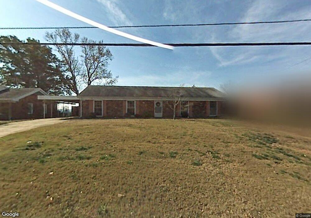
1047 Bunker Hill Rd Columbus, GA 31907
Estimated Value: $178,636 - $201,000
4
Beds
3
Baths
1,964
Sq Ft
$96/Sq Ft
Est. Value
About This Home
This home is located at 1047 Bunker Hill Rd, Columbus, GA 31907 and is currently estimated at $189,409, approximately $96 per square foot. 1047 Bunker Hill Rd is a home located in Muscogee County with nearby schools including Dawson Elementary School, East Columbus Magnet Academy, and Spencer High School.
Ownership History
Date
Name
Owned For
Owner Type
Purchase Details
Closed on
Dec 21, 2017
Sold by
Price Patricia E
Bought by
Rivers Lashonta N
Current Estimated Value
Home Financials for this Owner
Home Financials are based on the most recent Mortgage that was taken out on this home.
Original Mortgage
$94,261
Interest Rate
4.12%
Mortgage Type
FHA
Purchase Details
Closed on
Oct 30, 2007
Sold by
Lesko Patricia E
Bought by
Priest Patricia Eleanor
Home Financials for this Owner
Home Financials are based on the most recent Mortgage that was taken out on this home.
Original Mortgage
$129,200
Interest Rate
6.26%
Mortgage Type
New Conventional
Create a Home Valuation Report for This Property
The Home Valuation Report is an in-depth analysis detailing your home's value as well as a comparison with similar homes in the area
Home Values in the Area
Average Home Value in this Area
Purchase History
| Date | Buyer | Sale Price | Title Company |
|---|---|---|---|
| Rivers Lashonta N | $96,000 | -- | |
| Priest Patricia Eleanor | -- | Chicago Title |
Source: Public Records
Mortgage History
| Date | Status | Borrower | Loan Amount |
|---|---|---|---|
| Open | Rivers Lashonta N | $22,407 | |
| Closed | Rivers Lashonta N | $94,261 | |
| Previous Owner | Priest Patricia Eleanor | $129,200 | |
| Previous Owner | Priest Patricia Eleanor | $30,000 |
Source: Public Records
Tax History Compared to Growth
Tax History
| Year | Tax Paid | Tax Assessment Tax Assessment Total Assessment is a certain percentage of the fair market value that is determined by local assessors to be the total taxable value of land and additions on the property. | Land | Improvement |
|---|---|---|---|---|
| 2025 | $1,160 | $51,916 | $12,528 | $39,388 |
| 2024 | $1,159 | $51,916 | $12,528 | $39,388 |
| 2023 | $472 | $51,916 | $12,528 | $39,388 |
| 2022 | $1,209 | $43,836 | $12,528 | $31,308 |
| 2021 | $1,202 | $42,828 | $12,528 | $30,300 |
| 2020 | $1,202 | $42,828 | $12,528 | $30,300 |
| 2019 | $1,208 | $42,828 | $12,528 | $30,300 |
| 2018 | $1,573 | $38,400 | $11,200 | $27,200 |
| 2017 | $1,761 | $42,852 | $12,528 | $30,324 |
| 2016 | $2,551 | $61,847 | $6,000 | $55,847 |
| 2015 | $2,554 | $61,847 | $6,000 | $55,847 |
| 2014 | $2,557 | $61,847 | $6,000 | $55,847 |
| 2013 | -- | $61,847 | $6,000 | $55,847 |
Source: Public Records
Map
Nearby Homes
- 5219 Argonne Dr
- 5328 Gettysburg Way
- 5336 Gettysburg Way
- 906 Bunker Hill Rd
- 849 Bunker Hill Rd
- 5294 Bunker Hill Ct
- 1513 Alamo Dr
- 1521 Alamo Dr
- 4939 Aaron Dr
- 4462 Walking Stick Way
- 4408 Walking Stick Way
- 780 Honey Do Ct
- 811 Pheasant Loop
- 1340 Bunker Ridge Ln
- 4718 Velpoe Dr
- 738 Honey Do Ct
- 4965 Brightstar Ln
- 5713 Germantown Rd
- 1425 Staunton Dr
- 1426 Kings Mountain Rd
- 1055 Bunker Hill Rd
- 1039 Bunker Hill Rd
- 1103 Bunker Hill Rd
- 1044 Bunker Hill Rd
- 1036 Bunker Hill Rd
- 1050 Bunker Hill Rd
- 1114 Antietam Ct
- 1111 Bunker Hill Rd
- 5203 Argonne Dr
- 1031 Bunker Hill Rd
- 1110 Antietam Ct
- 1026 Bunker Hill Rd
- 1119 Bunker Hill Rd
- 1106 Antietam Ct
- 1108 Bunker Hill Rd
- 5211 Argonne Dr
- 5138 Verdun Dr
- 5130 Verdun Dr
- 5144 Verdun Dr
- 1025 Bunker Hill Rd