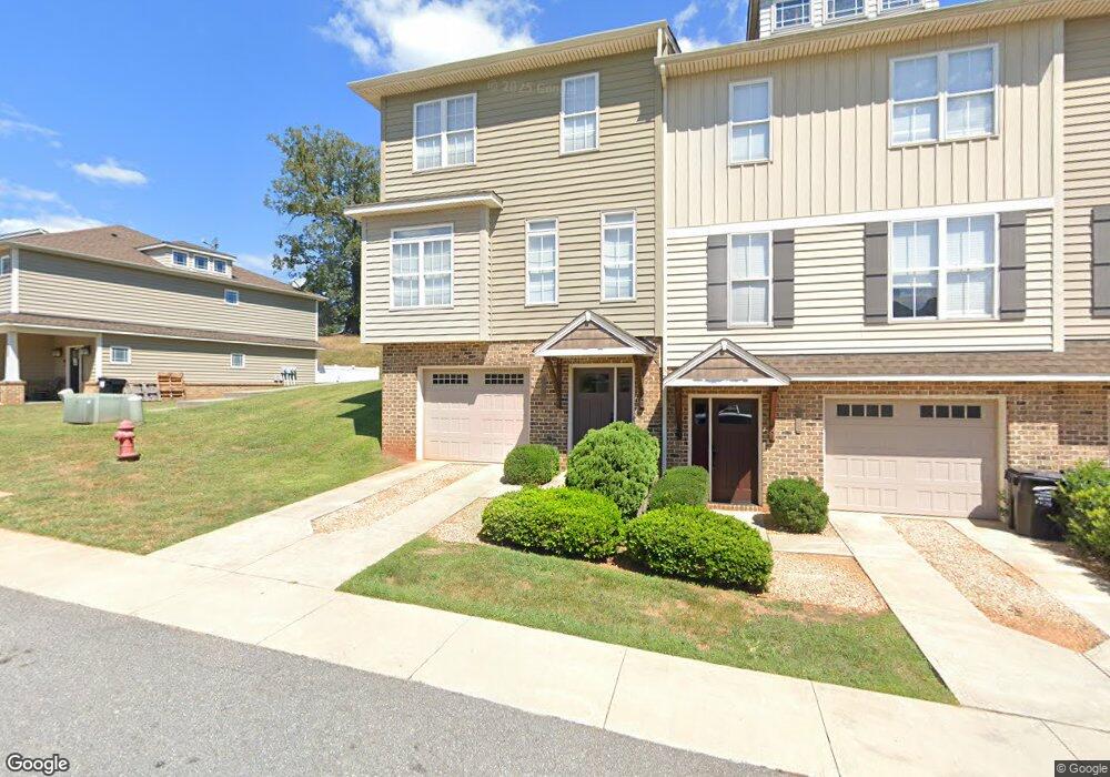
1047 Commonwealth Cir Forest, VA 24551
Estimated Value: $294,000 - $310,000
3
Beds
3
Baths
1,650
Sq Ft
$181/Sq Ft
Est. Value
About This Home
This home is located at 1047 Commonwealth Cir, Forest, VA 24551 and is currently estimated at $299,348, approximately $181 per square foot. 1047 Commonwealth Cir is a home located in Bedford County with nearby schools including Forest Elementary School, Forest Middle School, and Jefferson Forest High School.
Ownership History
Date
Name
Owned For
Owner Type
Purchase Details
Closed on
Feb 19, 2019
Sold by
Rodes James Robert
Bought by
Rodes Charles Alexander
Current Estimated Value
Home Financials for this Owner
Home Financials are based on the most recent Mortgage that was taken out on this home.
Original Mortgage
$125,000
Outstanding Balance
$109,447
Interest Rate
4.3%
Mortgage Type
New Conventional
Estimated Equity
$189,901
Purchase Details
Closed on
Dec 4, 2009
Sold by
Irish Enterprises Llc
Bought by
Rodes James Robert
Home Financials for this Owner
Home Financials are based on the most recent Mortgage that was taken out on this home.
Original Mortgage
$145,800
Interest Rate
5.25%
Mortgage Type
New Conventional
Create a Home Valuation Report for This Property
The Home Valuation Report is an in-depth analysis detailing your home's value as well as a comparison with similar homes in the area
Home Values in the Area
Average Home Value in this Area
Purchase History
| Date | Buyer | Sale Price | Title Company |
|---|---|---|---|
| Rodes Charles Alexander | $175,000 | Mountain View Stlmnt Svcs | |
| Rodes James Robert | -- | Southern Title |
Source: Public Records
Mortgage History
| Date | Status | Borrower | Loan Amount |
|---|---|---|---|
| Open | Rodes Charles Alexander | $125,000 | |
| Previous Owner | Rodes James Robert | $145,800 |
Source: Public Records
Tax History
| Year | Tax Paid | Tax Assessment Tax Assessment Total Assessment is a certain percentage of the fair market value that is determined by local assessors to be the total taxable value of land and additions on the property. | Land | Improvement |
|---|---|---|---|---|
| 2025 | $1,061 | $258,900 | $40,000 | $218,900 |
| 2024 | $1,061 | $258,900 | $40,000 | $218,900 |
| 2023 | $1,061 | $129,450 | $0 | $0 |
| 2022 | $896 | $89,600 | $0 | $0 |
| 2021 | $896 | $179,200 | $35,000 | $144,200 |
| 2020 | $896 | $179,200 | $35,000 | $144,200 |
| 2019 | $896 | $179,200 | $35,000 | $144,200 |
| 2018 | $841 | $161,800 | $35,000 | $126,800 |
| 2017 | $841 | $161,800 | $35,000 | $126,800 |
| 2016 | $841 | $161,800 | $35,000 | $126,800 |
| 2015 | $841 | $161,800 | $35,000 | $126,800 |
| 2014 | $873 | $167,800 | $30,000 | $137,800 |
Source: Public Records
Map
Nearby Homes
- 1175 Helmsdale Dr
- 0 Brewington Dr
- 0 Brewington Dr
- 1043 Lindenshire Dr
- 1603 Helmsdale Dr
- 0 Farmington Dr
- 1543 Farmington Dr
- 0 Dayna Ct
- 0 Whispering Springs Ct
- 0 Whispering Springs Ct
- 0 Whispering Springs Ct
- 1020 Easton Ct
- 1014 Coles Ct
- 1010 Coles Ct
- 1111 Lejack Cir
- 1301 Stoney Ridge Blvd
- 1151 S Westyn Loop
- 1131 S Westyn Loop
- 1300 Stoney Ridge Blvd Unit 208
- 87-LOT S Westyn Loop
- 1043 Commonwealth Cir
- 1041 Commonwealth Cir
- 1069 Commonwealth Cir
- 1037 Commonwealth Cir
- 1033 Commonwealth Cir
- 1077 Commonwealth Cir
- 1073 Commonwealth Cir
- 1029 Commonwealth Cir
- 1025 Commonwealth Cir
- 1081 Commonwealth Cir
- 1050 Commonwealth Cir
- 1050 Commonwealth Cir
- 1044 Commonwealth Cir
- 1040 Commonwealth Cir
- 1021 Commonwealth Cir
- 1209 Commonwealth Cir
- 1070 Commonwealth Cir Unit C2
- 1070 Commonwealth Cir
- 1030 Commonwealth Cir
- 1089 Commonwealth Cir
Your Personal Tour Guide
Ask me questions while you tour the home.