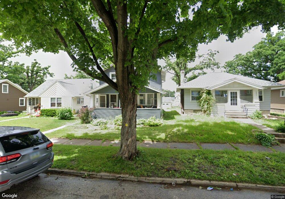
1047 Daniels St NE Cedar Rapids, IA 52402
Mound View NeighborhoodEstimated Value: $155,000 - $184,000
4
Beds
2
Baths
1,568
Sq Ft
$109/Sq Ft
Est. Value
About This Home
This home is located at 1047 Daniels St NE, Cedar Rapids, IA 52402 and is currently estimated at $170,494, approximately $108 per square foot. 1047 Daniels St NE is a home located in Linn County with nearby schools including Garfield Elementary School, Franklin Middle School, and George Washington High School.
Ownership History
Date
Name
Owned For
Owner Type
Purchase Details
Closed on
Dec 29, 2009
Sold by
Hite Anthony M and Hite Michelle M
Bought by
Wagamon Lindsey M
Current Estimated Value
Home Financials for this Owner
Home Financials are based on the most recent Mortgage that was taken out on this home.
Original Mortgage
$116,844
Outstanding Balance
$76,286
Interest Rate
4.84%
Mortgage Type
FHA
Estimated Equity
$94,209
Purchase Details
Closed on
May 21, 1999
Sold by
Pettit Scott M and Pettit Stacy L
Bought by
Hite Anthony M and Hite Michelle M
Home Financials for this Owner
Home Financials are based on the most recent Mortgage that was taken out on this home.
Original Mortgage
$86,784
Interest Rate
6.92%
Mortgage Type
FHA
Create a Home Valuation Report for This Property
The Home Valuation Report is an in-depth analysis detailing your home's value as well as a comparison with similar homes in the area
Home Values in the Area
Average Home Value in this Area
Purchase History
| Date | Buyer | Sale Price | Title Company |
|---|---|---|---|
| Wagamon Lindsey M | $118,500 | None Available | |
| Hite Anthony M | $87,000 | -- |
Source: Public Records
Mortgage History
| Date | Status | Borrower | Loan Amount |
|---|---|---|---|
| Open | Wagamon Lindsey M | $116,844 | |
| Previous Owner | Hite Anthony M | $86,784 |
Source: Public Records
Tax History Compared to Growth
Tax History
| Year | Tax Paid | Tax Assessment Tax Assessment Total Assessment is a certain percentage of the fair market value that is determined by local assessors to be the total taxable value of land and additions on the property. | Land | Improvement |
|---|---|---|---|---|
| 2025 | $2,490 | $160,700 | $20,200 | $140,500 |
| 2024 | $2,550 | $151,200 | $18,200 | $133,000 |
| 2023 | $2,550 | $151,200 | $18,200 | $133,000 |
| 2022 | $2,316 | $129,800 | $18,200 | $111,600 |
| 2021 | $2,258 | $120,800 | $18,200 | $102,600 |
| 2020 | $2,258 | $110,900 | $16,200 | $94,700 |
| 2019 | $1,950 | $99,000 | $16,200 | $82,800 |
| 2018 | $1,892 | $99,000 | $16,200 | $82,800 |
| 2017 | $2,055 | $93,200 | $16,200 | $77,000 |
| 2016 | $2,055 | $96,700 | $16,200 | $80,500 |
| 2015 | $2,219 | $104,281 | $18,180 | $86,101 |
| 2014 | $2,034 | $118,338 | $18,540 | $99,798 |
| 2013 | $2,278 | $118,338 | $18,540 | $99,798 |
Source: Public Records
Map
Nearby Homes
- 1311 I Ave NE
- 1046 12th St NE
- 910 Maplewood Dr NE
- 832 Daniels St NE
- 826 Daniels St NE
- 2000 Sierra Cir NE
- 2011 Sierra Cir NE
- 2006 Sierra Cir NE
- 2015 Sierra Cir NE
- 1060 17th St NE
- 1204 Elmhurst Dr NE
- 2019 Sierra Cir NE
- 2012 Sierra Cir NE
- 2018 Sierra Cir NE
- 2023 Sierra Cir NE
- 2103 Sierra Cir NE
- 2102 Sierra Cir NE
- 2109 Sierra Cir NE
- 2110 Sierra Cir NE
- 2115 Sierra Cir NE
- 1051 Daniels St NE
- 1043 Daniels St NE
- 1041 Daniels St NE
- 1057 Daniels St NE
- 1035 Daniels St NE
- 1061 Daniels St NE
- 1027 Daniels St NE
- 1044 Center Point Rd NE
- 1067 Daniels St NE
- 1038 Center Point Rd NE
- 1052 Center Point Rd NE
- 1036 Center Point Rd NE
- 1023 Daniels St NE
- 1032 Center Point Rd NE
- 1058 Daniels St NE
- 1044 Daniels St NE
- 1052 Daniels St NE
- 1060 Center Point Rd NE
- 1038 Daniels St NE
- 1062 Daniels St NE