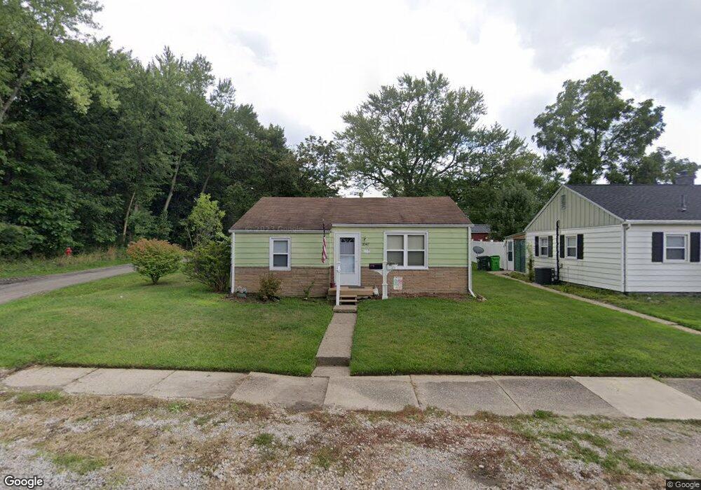
1047 Devine St Alliance, OH 44601
Estimated Value: $45,000 - $108,000
2
Beds
1
Bath
744
Sq Ft
$107/Sq Ft
Est. Value
About This Home
This home is located at 1047 Devine St, Alliance, OH 44601 and is currently estimated at $79,801, approximately $107 per square foot. 1047 Devine St is a home located in Stark County with nearby schools including Alliance Elementary School at Rockhill, Alliance Intermediate School at Northside, and Alliance Middle School.
Ownership History
Date
Name
Owned For
Owner Type
Purchase Details
Closed on
Jun 25, 2003
Sold by
The First National Bank Of Chicago
Bought by
Wilson Jeff and Wilson Teresa J
Current Estimated Value
Purchase Details
Closed on
Oct 23, 2001
Sold by
Hancock Richard L
Bought by
First National Bank Of Chicago and Bankboston Home Equity Loan Trust 1998-1
Purchase Details
Closed on
Oct 12, 2001
Sold by
Hancock Richard L and Hancock Catherine Lynne
Bought by
First National Bank Of Chicago and Bankboston Home Equity Loan Trust 1998-1
Purchase Details
Closed on
Sep 1, 1995
Sold by
Ritchey Gary L
Bought by
Stermer Catherine L
Create a Home Valuation Report for This Property
The Home Valuation Report is an in-depth analysis detailing your home's value as well as a comparison with similar homes in the area
Home Values in the Area
Average Home Value in this Area
Purchase History
| Date | Buyer | Sale Price | Title Company |
|---|---|---|---|
| Wilson Jeff | $17,500 | Land America/Lawyers Title | |
| First National Bank Of Chicago | $30,000 | -- | |
| First National Bank Of Chicago | $30,000 | -- | |
| Stermer Catherine L | $25,000 | -- |
Source: Public Records
Tax History
| Year | Tax Paid | Tax Assessment Tax Assessment Total Assessment is a certain percentage of the fair market value that is determined by local assessors to be the total taxable value of land and additions on the property. | Land | Improvement |
|---|---|---|---|---|
| 2025 | -- | $14,250 | $6,020 | $8,230 |
| 2024 | -- | $14,250 | $6,020 | $8,230 |
| 2023 | $1,160 | $13,030 | $5,780 | $7,250 |
| 2022 | $540 | $13,030 | $5,780 | $7,250 |
| 2021 | $541 | $13,030 | $5,780 | $7,250 |
| 2020 | $498 | $11,200 | $5,040 | $6,160 |
| 2019 | $223 | $11,200 | $5,040 | $6,160 |
Source: Public Records
Map
Nearby Homes
- 1522 Wade Ave
- 834 Devine St
- 1608 S Liberty Ave
- 1823 S Seneca Ave
- 1350 S Freedom Ave
- 935 S Morgan Ave
- 233 Shadyside Ct
- 955 E Summit St
- 22862 Norman Ave
- 2041 Watson Ave
- 167 11th St
- 226 Milner St
- 2408 S Linden Ave
- 231 Rosenberry St
- 134 11th St
- 853 Fairway Dr
- 234 Rosenberry St
- 152 E Mill St
- 452 E Summit St
- 726 S Arch Ave
Your Personal Tour Guide
Ask me questions while you tour the home.