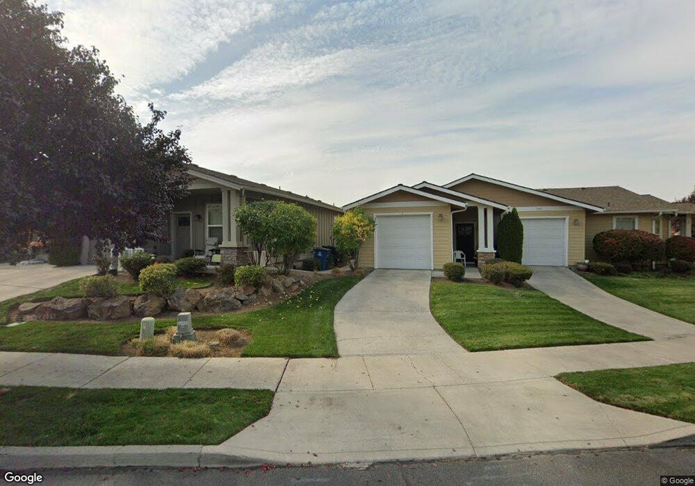
1047 NE Watt Way Bend, OR 97701
Mountain View NeighborhoodEstimated Value: $573,618 - $682,000
4
Beds
3
Baths
1,687
Sq Ft
$375/Sq Ft
Est. Value
About This Home
This home is located at 1047 NE Watt Way, Bend, OR 97701 and is currently estimated at $632,905, approximately $375 per square foot. 1047 NE Watt Way is a home with nearby schools including Juniper Elementary School, Pilot Butte Middle School, and Mountain View Senior High School.
Ownership History
Date
Name
Owned For
Owner Type
Purchase Details
Closed on
Jan 6, 2005
Sold by
Powell Mtn Development Llc
Bought by
Baker Frank H and Baker Kathleen A
Current Estimated Value
Home Financials for this Owner
Home Financials are based on the most recent Mortgage that was taken out on this home.
Original Mortgage
$149,400
Outstanding Balance
$76,260
Interest Rate
6.02%
Mortgage Type
Purchase Money Mortgage
Estimated Equity
$556,645
Create a Home Valuation Report for This Property
The Home Valuation Report is an in-depth analysis detailing your home's value as well as a comparison with similar homes in the area
Home Values in the Area
Average Home Value in this Area
Purchase History
| Date | Buyer | Sale Price | Title Company |
|---|---|---|---|
| Baker Frank H | $140,550 | -- |
Source: Public Records
Mortgage History
| Date | Status | Borrower | Loan Amount |
|---|---|---|---|
| Open | Baker Frank H | $149,400 |
Source: Public Records
Tax History Compared to Growth
Tax History
| Year | Tax Paid | Tax Assessment Tax Assessment Total Assessment is a certain percentage of the fair market value that is determined by local assessors to be the total taxable value of land and additions on the property. | Land | Improvement |
|---|---|---|---|---|
| 2025 | $4,085 | $241,750 | -- | -- |
| 2024 | $3,930 | $234,710 | -- | -- |
| 2023 | $3,643 | $227,880 | $0 | $0 |
| 2022 | $3,399 | $214,810 | $0 | $0 |
| 2021 | $3,404 | $208,560 | $0 | $0 |
| 2020 | $3,230 | $208,560 | $0 | $0 |
| 2019 | $3,140 | $202,490 | $0 | $0 |
| 2018 | $3,051 | $196,600 | $0 | $0 |
| 2017 | $2,962 | $190,880 | $0 | $0 |
| 2016 | $2,825 | $185,330 | $0 | $0 |
| 2015 | $2,746 | $179,940 | $0 | $0 |
| 2014 | $2,666 | $174,700 | $0 | $0 |
Source: Public Records
Map
Nearby Homes
- 940 NE Paula Dr Unit 21
- 940 NE Purcell Blvd
- 1188 NE 27th St Unit 71
- 1188 NE 27th St Unit 19
- 1188 NE 27th St Unit 82
- 1297 NE Dawson Dr Unit A&B
- 2876 NE Forum Dr
- 3023 NE Lansing Ct
- 795 NE Mason Rd
- 21489 Oconnor Way Unit 17
- 21493 Oconnor Way Unit 15
- 21491 Oconnor Way Unit 16
- 21519 Oconnor Way Unit 2
- 21495 Oconnor Way Unit 14
- 2741 NE Laramie Way
- 21323 Oconnor Way
- 62085 Wolcott Place
- 1767 NE Lotus Dr Unit 1 and 2
- 1419 NE Lucinda Ct
- 62001 NE Nates Place
- 1052 NE Rambling Ln
- 1039 NE Watt Way
- 1042 NE Rambling Ln
- 1031 NE Watt Way
- 1034 NE Rambling Ln
- 2398 NE Mary Rose Place
- 1075 NE Watt Way
- 2390 NE Mary Rose Place
- 1023 NE Watt Way Unit 1 & 2
- 1023 NE Watt Way
- 1026 NE Rambling Ln
- 1051 NE Rambling Ln
- 1051 NE Rambling Ln Unit A/B
- 1041 NE Rambling Ln
- 1041 NE Rambling Ln Unit A/B
- 1018 NE Rambling Ln
- 1015 NE Watt Way Unit 1 & 2
- 1015 NE Watt Way
- 1033 NE Rambling Ln