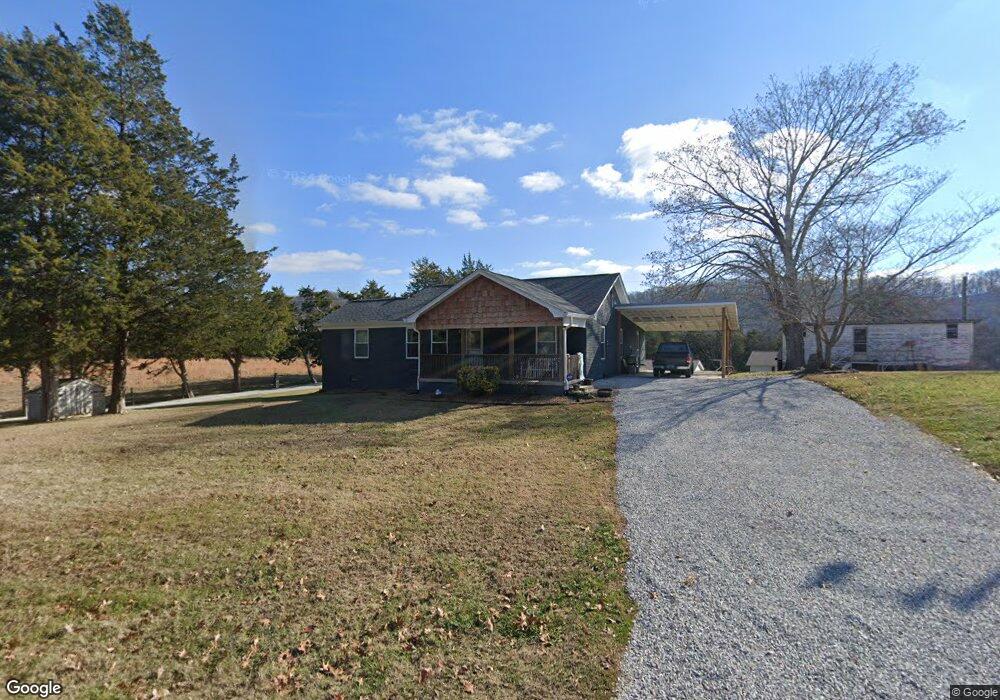
1048 Mountain Rd Clinton, TN 37716
East Clinton NeighborhoodEstimated Value: $192,000 - $338,000
--
Bed
2
Baths
1,479
Sq Ft
$176/Sq Ft
Est. Value
About This Home
This home is located at 1048 Mountain Rd, Clinton, TN 37716 and is currently estimated at $260,803, approximately $176 per square foot. 1048 Mountain Rd is a home located in Anderson County with nearby schools including Norris Elementary School and Norris Middle School.
Ownership History
Date
Name
Owned For
Owner Type
Purchase Details
Closed on
Jan 26, 2022
Sold by
Bailey Bunch Jr
Bought by
Bunch Bailey and Bunch Tabitha Sue
Current Estimated Value
Home Financials for this Owner
Home Financials are based on the most recent Mortgage that was taken out on this home.
Original Mortgage
$73,000
Outstanding Balance
$58,922
Interest Rate
3.56%
Mortgage Type
New Conventional
Estimated Equity
$201,881
Purchase Details
Closed on
Apr 15, 2005
Sold by
Bunch Dicie M
Bought by
Bailey Bunch
Purchase Details
Closed on
Dec 28, 2001
Sold by
Johnson Fletcher
Bought by
Bunch Dicie M
Create a Home Valuation Report for This Property
The Home Valuation Report is an in-depth analysis detailing your home's value as well as a comparison with similar homes in the area
Home Values in the Area
Average Home Value in this Area
Purchase History
| Date | Buyer | Sale Price | Title Company |
|---|---|---|---|
| Bunch Bailey | -- | New Title Company Name | |
| Bailey Bunch | -- | -- | |
| Bunch Dicie M | -- | -- |
Source: Public Records
Mortgage History
| Date | Status | Borrower | Loan Amount |
|---|---|---|---|
| Open | Bunch Bailey | $73,000 |
Source: Public Records
Tax History Compared to Growth
Tax History
| Year | Tax Paid | Tax Assessment Tax Assessment Total Assessment is a certain percentage of the fair market value that is determined by local assessors to be the total taxable value of land and additions on the property. | Land | Improvement |
|---|---|---|---|---|
| 2024 | $791 | $30,100 | $6,875 | $23,225 |
| 2023 | $791 | $30,100 | $0 | $0 |
| 2022 | $791 | $30,100 | $6,875 | $23,225 |
| 2021 | $691 | $30,100 | $6,875 | $23,225 |
| 2020 | $691 | $30,100 | $6,875 | $23,225 |
| 2019 | $691 | $24,775 | $6,100 | $18,675 |
| 2018 | $691 | $24,775 | $6,100 | $18,675 |
| 2017 | $691 | $24,775 | $6,100 | $18,675 |
| 2016 | $691 | $24,775 | $6,100 | $18,675 |
| 2015 | -- | $24,950 | $6,100 | $18,850 |
| 2014 | -- | $24,950 | $6,100 | $18,850 |
| 2013 | -- | $28,125 | $0 | $0 |
Source: Public Records
Map
Nearby Homes
- 285 Joe Owen Rd
- 649 Jade Ct
- 145 Grace Cir
- 174 Flagstone Way
- 2902 Andersonville Hwy
- 208 Cornerstone Cir
- 229 Mossy Rock Rd
- 218 Mossy Rock Rd
- 214 Mossy Rock Rd
- 191 Cornerstone Cir
- 6 Lilac Ct
- 124 Pheasant Rd
- 180 Wallace Farm Ln
- 229 Doe Run Blvd
- 224 Oak Rd
- 604 Bear Cub Ln
- 123 Orchard Rd
- 106 Crescent Rd
- 380 Hillvale Rd
- 390 Hillvale Rd
- 1051 Mountain Rd
- 1040 Mountain Rd
- 1039 Mountain Rd
- 1033 Mountain Rd
- 1027 Mountain Rd
- 1016 Mountain Rd
- 1028 Mountain Rd
- 1015 Mountain Rd
- 1024 Mountain Rd
- 1083 Mountain Rd
- 1006 Mountain Rd
- 1005 Mountain Rd
- 747 Bethel Rd
- 0 Mountain Rd
- 990 Mountain Rd
- 723 Bethel Rd
- 748 Bethel Rd
- 738 Bethel Rd
- 1105 Mountain Rd
- 953 Mountain Rd