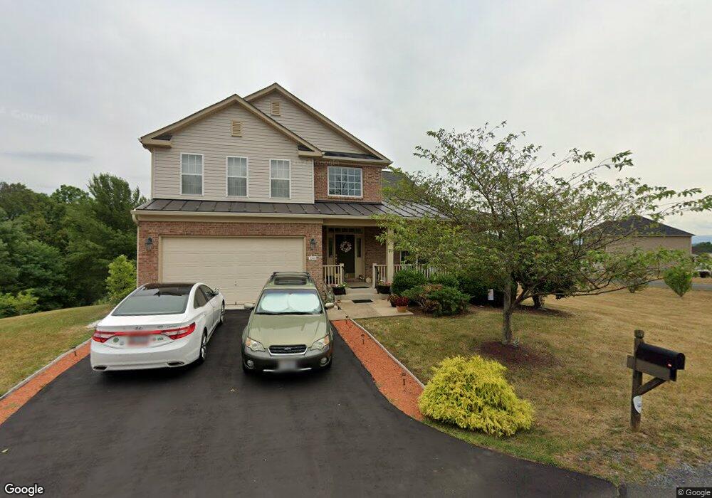
1048 Shadows Dr Front Royal, VA 22630
Estimated Value: $588,732 - $679,000
3
Beds
4
Baths
3,472
Sq Ft
$183/Sq Ft
Est. Value
About This Home
This home is located at 1048 Shadows Dr, Front Royal, VA 22630 and is currently estimated at $635,433, approximately $183 per square foot. 1048 Shadows Dr is a home located in Warren County with nearby schools including Leslie Fox Keyser Elementary School and Warren County High School.
Ownership History
Date
Name
Owned For
Owner Type
Purchase Details
Closed on
Jun 1, 2020
Sold by
Funk Charles G and Funk Geraldine B
Bought by
Gunk Charles G and Gunk Geraldine B
Current Estimated Value
Home Financials for this Owner
Home Financials are based on the most recent Mortgage that was taken out on this home.
Original Mortgage
$332,000
Outstanding Balance
$294,293
Interest Rate
3.2%
Mortgage Type
New Conventional
Estimated Equity
$341,140
Purchase Details
Closed on
Aug 31, 2012
Sold by
Funk Charles G and Funk Geraldine B
Bought by
Funk Charles G and Funk Geraldine B
Purchase Details
Closed on
Aug 31, 2007
Sold by
D R Horton Inc
Bought by
Funk Charles G and Funk Geraldine B
Home Financials for this Owner
Home Financials are based on the most recent Mortgage that was taken out on this home.
Original Mortgage
$394,720
Interest Rate
6.74%
Mortgage Type
New Conventional
Create a Home Valuation Report for This Property
The Home Valuation Report is an in-depth analysis detailing your home's value as well as a comparison with similar homes in the area
Home Values in the Area
Average Home Value in this Area
Purchase History
| Date | Buyer | Sale Price | Title Company |
|---|---|---|---|
| Gunk Charles G | -- | Wfg Lender Services | |
| Funk Charles G | -- | None Available | |
| Funk Charles G | $493,400 | -- |
Source: Public Records
Mortgage History
| Date | Status | Borrower | Loan Amount |
|---|---|---|---|
| Open | Gunk Charles G | $332,000 | |
| Previous Owner | Funk Charles G | $394,720 |
Source: Public Records
Tax History Compared to Growth
Tax History
| Year | Tax Paid | Tax Assessment Tax Assessment Total Assessment is a certain percentage of the fair market value that is determined by local assessors to be the total taxable value of land and additions on the property. | Land | Improvement |
|---|---|---|---|---|
| 2025 | $3,162 | $660,100 | $73,300 | $586,800 |
| 2024 | $2,890 | $545,300 | $74,800 | $470,500 |
| 2023 | $2,672 | $545,300 | $74,800 | $470,500 |
| 2022 | $2,664 | $406,700 | $65,000 | $341,700 |
| 2021 | $2,664 | $406,700 | $65,000 | $341,700 |
| 2020 | $2,664 | $406,700 | $65,000 | $341,700 |
| 2019 | $2,664 | $406,700 | $65,000 | $341,700 |
| 2018 | $2,726 | $413,000 | $65,000 | $348,000 |
| 2017 | $2,685 | $413,000 | $65,000 | $348,000 |
| 2016 | $2,561 | $413,000 | $65,000 | $348,000 |
| 2015 | -- | $413,000 | $65,000 | $348,000 |
| 2014 | -- | $393,700 | $70,000 | $323,700 |
Source: Public Records
Map
Nearby Homes
- Lot 3 Springwood Ln
- 8+/- Acres Winchester Rd
- 43 Little Sorrel Dr
- 167 Cedar Park Ct
- 76 Katie Ln
- 2137 Reliance Rd
- 386 Ashby Station Rd
- 2479 Rockland Rd
- 0 River Ridge Dr Unit VAWR2012826
- 0 River Ridge Dr Unit VAWR2011208
- 836 Bennys Beach Rd
- 89 Pin Oak Rd
- 0 Pin Oak Rd Unit VAWR2006146
- 0 Cherrywood Rd
- 1408 Winchester Pike
- 203 Jenny Wren Dr
- 45 W Duck St
- 43 W Duck St
- 112 Woods Way
- 33 W Duck St