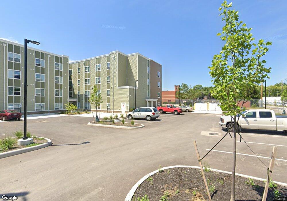
1048 W Broad St Columbus, OH 43222
Franklinton Neighborhood
11
Beds
4
Baths
4,165
Sq Ft
0.5
Acres
About This Home
This home is located at 1048 W Broad St, Columbus, OH 43222. 1048 W Broad St is a home located in Franklin County with nearby schools including Avondale Elementary School, Starling PK-8, and West High School.
Ownership History
Date
Name
Owned For
Owner Type
Purchase Details
Closed on
Apr 6, 2021
Sold by
Ciroli Paul and Ciroli Maria
Bought by
West Broad Street Holdings Llc
Purchase Details
Closed on
Nov 18, 2002
Sold by
Ciroli Paul and Ciroli Maria
Bought by
Ciroli Paul and Ciroli Maria
Purchase Details
Closed on
Jan 27, 1999
Sold by
Cavinee Berl E and Cavinee Barbara K
Bought by
Mc 9000
Purchase Details
Closed on
May 5, 1993
Bought by
Ciroli Paul and Ciroli Maria
Purchase Details
Closed on
Mar 1, 1986
Purchase Details
Closed on
Jul 1, 1979
Create a Home Valuation Report for This Property
The Home Valuation Report is an in-depth analysis detailing your home's value as well as a comparison with similar homes in the area
Home Values in the Area
Average Home Value in this Area
Purchase History
| Date | Buyer | Sale Price | Title Company |
|---|---|---|---|
| West Broad Street Holdings Llc | $375,000 | Star Title Agency Llc | |
| Ciroli Paul | -- | -- | |
| Mc 9000 | -- | -- | |
| Ciroli Paul | $70,000 | -- | |
| -- | $140,000 | -- | |
| -- | $85,000 | -- |
Source: Public Records
Tax History Compared to Growth
Tax History
| Year | Tax Paid | Tax Assessment Tax Assessment Total Assessment is a certain percentage of the fair market value that is determined by local assessors to be the total taxable value of land and additions on the property. | Land | Improvement |
|---|---|---|---|---|
| 2022 | $4,588 | $61,180 | $61,180 | $0 |
| 2021 | $1,369 | $17,120 | $17,120 | $0 |
| 2020 | $1,350 | $17,120 | $17,120 | $0 |
| 2019 | $1,226 | $14,880 | $14,880 | $0 |
| 2018 | $1,212 | $14,880 | $14,880 | $0 |
| 2017 | $1,260 | $14,880 | $14,880 | $0 |
| 2016 | $1,295 | $14,880 | $14,880 | $0 |
| 2015 | $1,202 | $14,880 | $14,880 | $0 |
| 2014 | $1,202 | $14,880 | $14,880 | $0 |
| 2013 | $595 | $14,875 | $14,875 | $0 |
Source: Public Records
Map
Nearby Homes
- 69 Rodgers Ave
- 73 Rodgers Ave
- 61 Dakota Ave
- 1020-1026 Cable Ave
- 72 Avondale Ave
- 53-55 Hawkes Ave
- 112 S Cypress Ave
- 78 Hawkes Ave
- 37-39 S Yale Ave
- 49 S Yale Ave
- 33 N Hartford Ave
- 45 S Hartford Ave
- 49 S Hartford Ave
- 45 N Hartford Ave
- The Summit Plan at Homes on Hartford - Single Family
- 186 Avondale Ave Unit 188
- 116 W Park Ave
- 211 Dakota Ave
- 148 W Park Ave
- 69-69.5 Chicago Ave
- 1042 W Broad St
- 1040 W Broad St
- 1026 W Broad St
- 1034 W Gay St
- 1022 W Broad St
- 27 Rodgers Ave
- 27 Rodgers Ave Unit 1/2
- 29 Rodgers Ave Unit 31
- 29-31 Rodgers Ave
- 15 Rodgers Ave Unit 19
- 1012 W Broad St
- 35 Rodgers Ave
- 1053 W Broad St
- 1084 W Broad St
- 39 Rodgers Ave
- 1055 W Broad St
- 1 Rodgers Ave
- 43 Rodgers Ave Unit 45
- 45 Rodgers Ave
- 43 Rodgers Ave