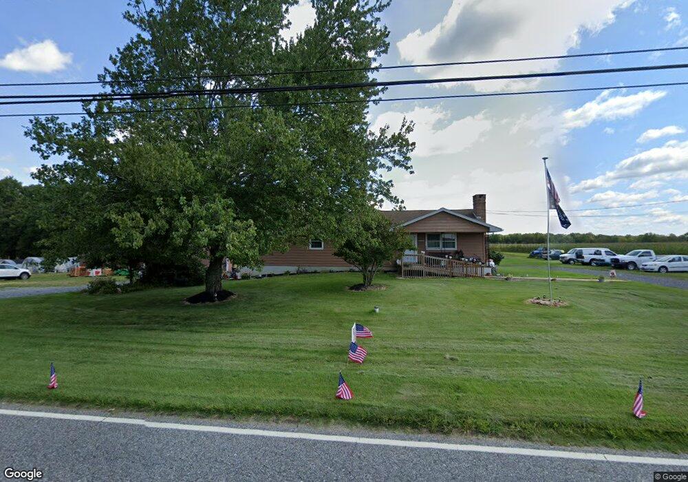
1049 Aura Rd Monroeville, NJ 08343
Elk Township NeighborhoodEstimated Value: $277,000 - $473,000
--
Bed
--
Bath
1,736
Sq Ft
$217/Sq Ft
Est. Value
About This Home
This home is located at 1049 Aura Rd, Monroeville, NJ 08343 and is currently estimated at $375,951, approximately $216 per square foot. 1049 Aura Rd is a home located in Gloucester County with nearby schools including Aura Elementary School, Delsea Regional Middle School, and Delsea Regional High School.
Ownership History
Date
Name
Owned For
Owner Type
Purchase Details
Closed on
Jul 2, 2007
Sold by
Mccann Edward J and Mccann Sarah D
Bought by
Foy Nancy
Current Estimated Value
Home Financials for this Owner
Home Financials are based on the most recent Mortgage that was taken out on this home.
Original Mortgage
$189,000
Outstanding Balance
$118,008
Interest Rate
6.48%
Mortgage Type
Purchase Money Mortgage
Estimated Equity
$257,943
Create a Home Valuation Report for This Property
The Home Valuation Report is an in-depth analysis detailing your home's value as well as a comparison with similar homes in the area
Home Values in the Area
Average Home Value in this Area
Purchase History
| Date | Buyer | Sale Price | Title Company |
|---|---|---|---|
| Foy Nancy | $200,000 | None Available |
Source: Public Records
Mortgage History
| Date | Status | Borrower | Loan Amount |
|---|---|---|---|
| Open | Foy Nancy | $189,000 |
Source: Public Records
Tax History Compared to Growth
Tax History
| Year | Tax Paid | Tax Assessment Tax Assessment Total Assessment is a certain percentage of the fair market value that is determined by local assessors to be the total taxable value of land and additions on the property. | Land | Improvement |
|---|---|---|---|---|
| 2025 | $7,391 | $205,600 | $60,600 | $145,000 |
| 2024 | $7,461 | $205,600 | $60,600 | $145,000 |
| 2023 | $7,461 | $205,600 | $60,600 | $145,000 |
| 2022 | $7,552 | $205,600 | $60,600 | $145,000 |
| 2021 | $7,642 | $205,600 | $60,600 | $145,000 |
| 2020 | $7,568 | $205,600 | $60,600 | $145,000 |
| 2019 | $7,334 | $205,600 | $60,600 | $145,000 |
| 2018 | $7,198 | $205,600 | $60,600 | $145,000 |
| 2017 | $6,999 | $205,600 | $60,600 | $145,000 |
| 2016 | $6,929 | $205,600 | $60,600 | $145,000 |
| 2015 | $6,729 | $205,600 | $60,600 | $145,000 |
| 2014 | $6,421 | $205,600 | $60,600 | $145,000 |
Source: Public Records
Map
Nearby Homes
- L4 Railroad Ave
- 113 22nd Ave
- 26 Silver Lake Dr
- 384 Union St
- 154 Douglass St
- 374 Union St
- 252 Stanger Ave
- 001 Pondview Ct
- 2 Pondview Ct
- 4 Pondview Ct
- 710 Webster Dr
- 3 Pondview Ct
- 745 W Clayton Ave
- 760 W Clayton Ave
- 733 Buck Rd
- 211 Hollywood Ave
- 314 Wilson Ave
- 1447 S Mallard St
- 291 Union St
- 793 Clems Run