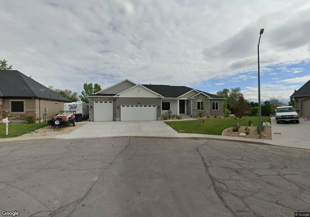
1049 E 200 S Payson, UT 84651
Estimated Value: $632,000 - $819,000
3
Beds
3
Baths
3,774
Sq Ft
$196/Sq Ft
Est. Value
About This Home
This home is located at 1049 E 200 S, Payson, UT 84651 and is currently estimated at $740,427, approximately $196 per square foot. 1049 E 200 S is a home located in Utah County with nearby schools including Barnett Elementary School, Salem Junior High School, and Valley View Middle School.
Ownership History
Date
Name
Owned For
Owner Type
Purchase Details
Closed on
Nov 5, 2018
Sold by
Myob1 Llc
Bought by
Brandt Richard and Brandt Ashley
Current Estimated Value
Home Financials for this Owner
Home Financials are based on the most recent Mortgage that was taken out on this home.
Original Mortgage
$452,500
Outstanding Balance
$397,069
Interest Rate
4.7%
Mortgage Type
New Conventional
Estimated Equity
$343,358
Purchase Details
Closed on
Jul 8, 2017
Sold by
Sotne Ridge Of Payson Llc
Bought by
Myob1 Llc
Create a Home Valuation Report for This Property
The Home Valuation Report is an in-depth analysis detailing your home's value as well as a comparison with similar homes in the area
Home Values in the Area
Average Home Value in this Area
Purchase History
| Date | Buyer | Sale Price | Title Company |
|---|---|---|---|
| Brandt Richard | -- | Gt Title Services | |
| Myob1 Llc | -- | Gt Title Services |
Source: Public Records
Mortgage History
| Date | Status | Borrower | Loan Amount |
|---|---|---|---|
| Open | Brandt Richard | $452,500 |
Source: Public Records
Tax History
| Year | Tax Paid | Tax Assessment Tax Assessment Total Assessment is a certain percentage of the fair market value that is determined by local assessors to be the total taxable value of land and additions on the property. | Land | Improvement |
|---|---|---|---|---|
| 2025 | $3,634 | $403,480 | -- | -- |
| 2024 | $3,634 | $369,875 | $0 | $0 |
| 2023 | $3,651 | $372,625 | $0 | $0 |
| 2022 | $3,554 | $356,675 | $0 | $0 |
| 2021 | $2,706 | $435,700 | $129,300 | $306,400 |
| 2020 | $2,535 | $399,300 | $112,400 | $286,900 |
| 2019 | $2,353 | $379,900 | $93,000 | $286,900 |
| 2018 | $1,578 | $245,500 | $85,300 | $160,200 |
| 2017 | $1,019 | $85,300 | $0 | $0 |
| 2016 | $867 | $72,100 | $0 | $0 |
| 2015 | $685 | $56,600 | $0 | $0 |
| 2014 | $634 | $52,700 | $0 | $0 |
Source: Public Records
Map
Nearby Homes
- 981 E 100 S
- 977 E 100 S
- 1058 E 100 N
- 1298 1670 N
- 1299 E 1670 N Unit 812
- 1299 E 1670 N
- 873 E 200 N
- 412 S Goosenest Dr
- 426 S Goosenest Dr
- 1327 E 320 S
- 283 E 1250 N
- 283 E 1250 N Unit 64
- 862 E 200 S
- 753 N Emery Ln Unit 57
- 678 N Mountain View Dr
- 552 E Longview Dr Unit 29
- 348 E Dr E Unit 26
- 5620 W 8800 S Unit 2
- 643 E Longview Dr Unit 8
- 337 W 100 S
- 199 S Loafer View Dr
- 1033 E 200 S
- 211 S Loafer View Dr Unit 1
- 212 S Loafer View Dr
- 148 S 1100 E
- 190 S 1100 E
- 229 S Loafer View Dr
- 232 S Loafer View Dr
- 138 S 1100 E
- 1056 E 100 S
- 1020 E 100 S
- 1010 E 100 S
- 1063 E 260 S
- 245 S Loafer View Dr
- 1090 E 100 S
- 246 S Loafer View Dr
- 1113 E 180 S
- 1113 E 180 S Unit 7
- 189 S 1100 E
- 964 E 100 S
Your Personal Tour Guide
Ask me questions while you tour the home.