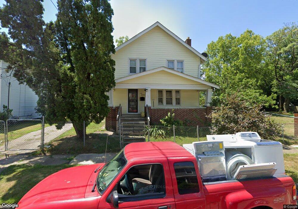
1049 Scott St Columbus, OH 43222
Franklinton NeighborhoodEstimated Value: $159,003 - $217,000
3
Beds
1
Bath
1,560
Sq Ft
$123/Sq Ft
Est. Value
About This Home
This home is located at 1049 Scott St, Columbus, OH 43222 and is currently estimated at $192,001, approximately $123 per square foot. 1049 Scott St is a home located in Franklin County with nearby schools including Avondale Elementary School, Starling PK-8, and West High School.
Ownership History
Date
Name
Owned For
Owner Type
Purchase Details
Closed on
Apr 3, 2009
Sold by
Wells Fargo Bank Na
Bought by
Hernandez Juvencio
Current Estimated Value
Purchase Details
Closed on
Jan 22, 2009
Sold by
Fleming Margaret Frances and Case #08Cve05 6999
Bought by
Wells Fargo Bank Na
Purchase Details
Closed on
Nov 7, 1984
Bought by
Fleming Margaret Frances
Purchase Details
Closed on
Mar 1, 1980
Create a Home Valuation Report for This Property
The Home Valuation Report is an in-depth analysis detailing your home's value as well as a comparison with similar homes in the area
Home Values in the Area
Average Home Value in this Area
Purchase History
| Date | Buyer | Sale Price | Title Company |
|---|---|---|---|
| Hernandez Juvencio | $8,000 | Accutitle Agency Inc | |
| Wells Fargo Bank Na | $26,000 | None Available | |
| Fleming Margaret Frances | $20,000 | -- | |
| -- | $23,500 | -- |
Source: Public Records
Tax History
| Year | Tax Paid | Tax Assessment Tax Assessment Total Assessment is a certain percentage of the fair market value that is determined by local assessors to be the total taxable value of land and additions on the property. | Land | Improvement |
|---|---|---|---|---|
| 2025 | $2,207 | $49,180 | $6,970 | $42,210 |
| 2024 | $2,207 | $49,180 | $6,970 | $42,210 |
| 2023 | $2,179 | $49,175 | $6,965 | $42,210 |
| 2022 | $663 | $12,780 | $2,280 | $10,500 |
| 2021 | $664 | $12,780 | $2,280 | $10,500 |
| 2020 | $665 | $12,780 | $2,280 | $10,500 |
| 2019 | $645 | $10,640 | $1,890 | $8,750 |
| 2018 | $322 | $10,640 | $1,890 | $8,750 |
| 2017 | $645 | $10,640 | $1,890 | $8,750 |
| 2016 | $807 | $12,180 | $2,730 | $9,450 |
| 2015 | $366 | $12,180 | $2,730 | $9,450 |
| 2014 | $734 | $12,180 | $2,730 | $9,450 |
| 2013 | $403 | $13,545 | $3,045 | $10,500 |
Source: Public Records
Map
Nearby Homes
- 69 Rodgers Ave
- 1020-1026 Cable Ave
- 34 S Cypress Ave
- 43 N Jones Ave
- 41 S Cypress Ave
- 85-87 N Yale Ave
- 137 N Yale Ave
- 83 S Cypress Ave
- 158 Wisconsin Ave
- 137 Wisconsin Ave
- 55 S Yale Ave
- 130 Chicago Ave
- 45 S Hartford Ave
- 49 S Hartford Ave
- 149 S Cypress Ave
- 45 N Hartford Ave
- 116 W Park Ave
- 33 S Princeton Ave
- 82 N Princeton Ave
- 113-115 W Park Ave
- 1059 Scott St
- 1043 Scott St
- 1061 Scott St
- 1037 Scott St
- 1063 Scott St Unit 65
- 1033 Scott St
- 1060 Scott St
- 1067 Scott St Unit 69
- 1034 W Gay St
- 43 Rodgers Ave Unit 45
- 45 Rodgers Ave
- 43 Rodgers Ave
- 1046 Scott St Unit 48
- 1046-1048 Scott St
- 1050 Scott St Unit 52
- 1058 Scott St Unit 60
- 43 1/2 Rodgers Ave
- 53 Rodgers Ave
- 47 Rodgers Ave Unit 49
- 1062 Scott St Unit 64
Your Personal Tour Guide
Ask me questions while you tour the home.