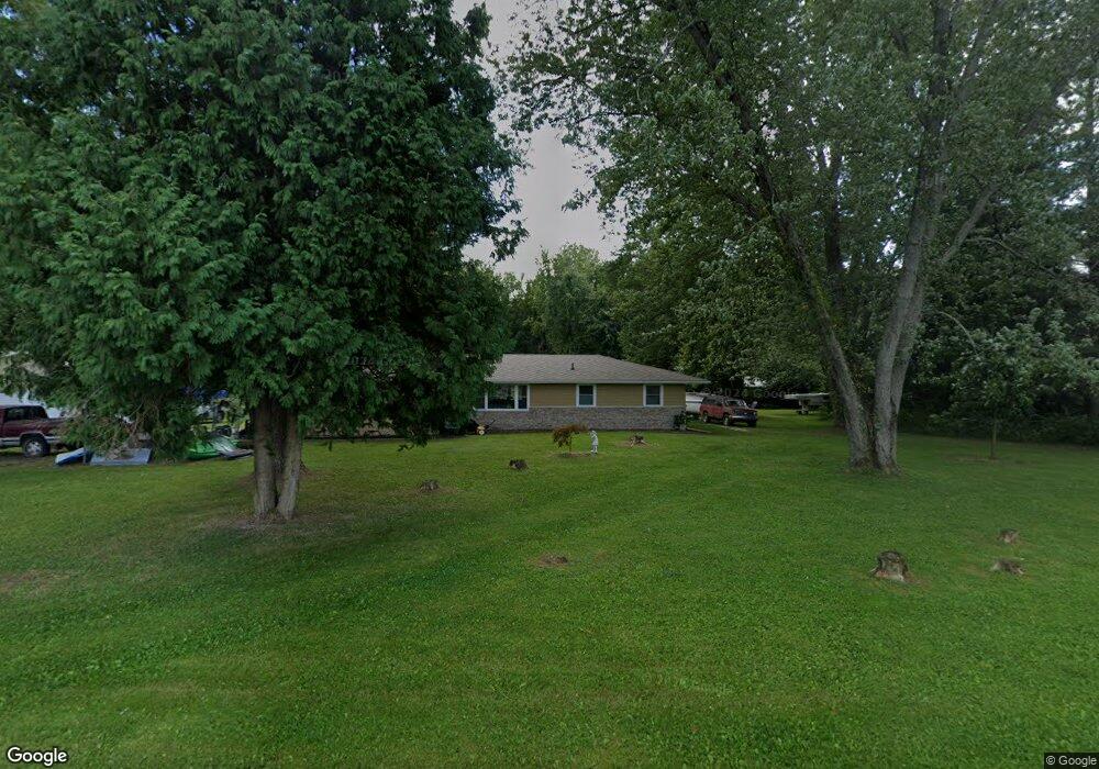
10490 D Dr S Ceresco, MI 49033
Estimated Value: $215,000 - $479,000
3
Beds
2
Baths
1,504
Sq Ft
$206/Sq Ft
Est. Value
About This Home
This home is located at 10490 D Dr S, Ceresco, MI 49033 and is currently estimated at $309,856, approximately $206 per square foot. 10490 D Dr S is a home located in Calhoun County with nearby schools including Harper Creek Middle School and Harper Creek High School.
Ownership History
Date
Name
Owned For
Owner Type
Purchase Details
Closed on
Sep 17, 2009
Sold by
Newland Linda M and Rumsey David
Bought by
Federal Home Loan Mortgage Corp
Current Estimated Value
Purchase Details
Closed on
Oct 15, 2004
Sold by
Carey James M and Carey Barbara J
Bought by
Ramsey David L and Newland Linda M
Home Financials for this Owner
Home Financials are based on the most recent Mortgage that was taken out on this home.
Original Mortgage
$136,000
Interest Rate
5.78%
Mortgage Type
New Conventional
Purchase Details
Closed on
May 6, 2001
Sold by
Carey James M and Carey Barbara J
Bought by
Ramsey David L and Newland Linda M
Purchase Details
Closed on
Jan 7, 2000
Sold by
Schmidt Dennis V and Schmidt Keva
Bought by
Carey James M and Carey Barbara J
Purchase Details
Closed on
Dec 23, 1999
Sold by
Rice Robert
Bought by
Schmidt Dennis and Schmidt Keva
Purchase Details
Closed on
Apr 28, 1997
Bought by
Zajakowski Denise
Create a Home Valuation Report for This Property
The Home Valuation Report is an in-depth analysis detailing your home's value as well as a comparison with similar homes in the area
Purchase History
| Date | Buyer | Sale Price | Title Company |
|---|---|---|---|
| Federal Home Loan Mortgage Corp | $140,945 | None Available | |
| Ramsey David L | $160,000 | Chicago Title | |
| Ramsey David L | $160,000 | -- | |
| Carey James M | $54,000 | -- | |
| Schmidt Dennis | $49,000 | -- | |
| Zajakowski Denise | -- | -- |
Source: Public Records
Mortgage History
| Date | Status | Borrower | Loan Amount |
|---|---|---|---|
| Previous Owner | Ramsey David L | $136,000 | |
| Closed | Ramsey David L | $17,000 |
Source: Public Records
Tax History
| Year | Tax Paid | Tax Assessment Tax Assessment Total Assessment is a certain percentage of the fair market value that is determined by local assessors to be the total taxable value of land and additions on the property. | Land | Improvement |
|---|---|---|---|---|
| 2025 | $3,196 | $109,500 | $0 | $0 |
| 2024 | $2,042 | $102,400 | $0 | $0 |
| 2023 | $2,568 | $93,700 | $0 | $0 |
| 2022 | $2,568 | $88,400 | $0 | $0 |
| 2021 | $2,569 | $82,700 | $0 | $0 |
| 2020 | $2,523 | $76,300 | $0 | $0 |
| 2019 | $0 | $73,500 | $0 | $0 |
| 2018 | $0 | $72,400 | $15,900 | $56,500 |
| 2017 | $0 | $72,700 | $0 | $0 |
| 2016 | $0 | $72,200 | $0 | $0 |
| 2015 | -- | $72,200 | $16,590 | $55,610 |
| 2014 | -- | $72,800 | $16,590 | $56,210 |
Source: Public Records
Map
Nearby Homes
- 10660 D Dr S
- 11445 F Dr S
- 11506 11 Mile Rd
- 9304 I Dr S
- 275 Battle Creek St
- 11754 E Dr N
- 10450 6 Mile Rd
- 14880 C Dr S
- 13028 Harper Crossing
- 11253 Wildwood Dr
- 6185 Willow Run Dr
- 11349 6 Mile Rd
- 1375 Woodland Beach
- 6707 B Dr N
- 15143 H Dr S
- 13084 Hoyt Dr
- VL Beadle Lake Rd
- 0 S N Dr S Unit 26000974
- 5201 12 1 2 Mile Rd
- V/L Cedar Lake
Your Personal Tour Guide
Ask me questions while you tour the home.