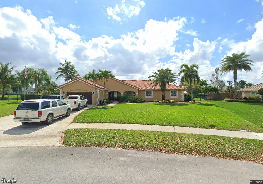
10490 SW 20th St Davie, FL 33324
Outer Davie NeighborhoodEstimated Value: $830,000 - $1,024,000
--
Bed
--
Bath
2,717
Sq Ft
$338/Sq Ft
Est. Value
About This Home
This home is located at 10490 SW 20th St, Davie, FL 33324 and is currently estimated at $919,118, approximately $338 per square foot. 10490 SW 20th St is a home located in Broward County with nearby schools including Fox Trail Elementary School, Indian Ridge Middle School, and Western High School.
Ownership History
Date
Name
Owned For
Owner Type
Purchase Details
Closed on
May 9, 2003
Sold by
Hill Henry D and Goldstein Julie
Bought by
Jones David T and Jones Jacqueline
Current Estimated Value
Home Financials for this Owner
Home Financials are based on the most recent Mortgage that was taken out on this home.
Original Mortgage
$322,000
Interest Rate
5.81%
Mortgage Type
Purchase Money Mortgage
Purchase Details
Closed on
Sep 1, 1992
Sold by
Available Not
Bought by
Available Not
Create a Home Valuation Report for This Property
The Home Valuation Report is an in-depth analysis detailing your home's value as well as a comparison with similar homes in the area
Home Values in the Area
Average Home Value in this Area
Purchase History
| Date | Buyer | Sale Price | Title Company |
|---|---|---|---|
| Jones David T | $430,000 | -- | |
| Available Not | $189,900 | -- |
Source: Public Records
Mortgage History
| Date | Status | Borrower | Loan Amount |
|---|---|---|---|
| Closed | Jones David T | $322,000 | |
| Closed | Jones David T | $85,800 |
Source: Public Records
Tax History Compared to Growth
Tax History
| Year | Tax Paid | Tax Assessment Tax Assessment Total Assessment is a certain percentage of the fair market value that is determined by local assessors to be the total taxable value of land and additions on the property. | Land | Improvement |
|---|---|---|---|---|
| 2025 | $8,467 | $440,510 | -- | -- |
| 2024 | $8,295 | $428,100 | -- | -- |
| 2023 | $8,295 | $415,640 | $0 | $0 |
| 2022 | $7,799 | $403,540 | $0 | $0 |
| 2021 | $7,567 | $391,790 | $0 | $0 |
| 2020 | $7,501 | $386,390 | $0 | $0 |
| 2019 | $7,283 | $377,710 | $0 | $0 |
| 2018 | $7,068 | $370,670 | $0 | $0 |
| 2017 | $6,942 | $363,050 | $0 | $0 |
| 2016 | $6,892 | $355,590 | $0 | $0 |
| 2015 | $7,051 | $353,120 | $0 | $0 |
| 2014 | $7,129 | $350,320 | $0 | $0 |
| 2013 | -- | $350,300 | $152,380 | $197,920 |
Source: Public Records
Map
Nearby Homes
- 10991 Northstar St
- 10345 SW 23rd Ct
- 2001 Meadows Dr
- 2273 Phoenix Ave
- 1736 SW 109th Terrace
- 1636 SW 108th Terrace
- 1541 SW 102nd Terrace
- 1683 SW 109th Terrace
- 11100 SW 17th Manor Unit 190
- 11000 SW 25th St
- 10303 SW 26th St
- 10772 SW 14th Place
- 2400 SW 112th Ave
- 1921 SW 112th Ave
- 9450 Live Oak Place Unit 109
- 9440 Live Oak Place Unit 307
- 1413 SW 109th Way
- 9460 Live Oak Place Unit 309
- 1765 SW 112th Ave
- 2691 SW 110th Way
- 1981 SW 105th Ave
- 10460 SW 20th St
- 1961 SW 105th Ave
- 1988 SW 105th Ave
- 10430 SW 20th St
- 10451 SW 20th St
- 2196 Lynx Ave
- 1941 SW 105th Ave
- 1966 SW 105th Ave
- 2216 Lynx Ave
- 10457 SW 22nd Place
- 10400 SW 20th St
- 1944 SW 105th Ave
- 1921 SW 105th Ave
- 2236 Lynx Ave
- 2235 SW 105th Terrace
- 10401 SW 20th St
- 10437 SW 22nd Place
- 10370 SW 20th St
- 10991 Northstar St Unit 32