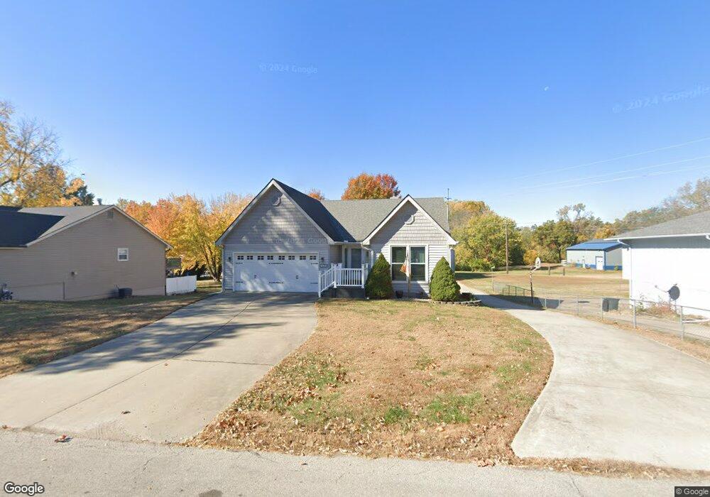
104A Johnson Rd Liberty, MO 64068
Estimated Value: $312,000 - $348,000
2
Beds
2
Baths
1,368
Sq Ft
$242/Sq Ft
Est. Value
About This Home
This home is located at 104A Johnson Rd, Liberty, MO 64068 and is currently estimated at $330,541, approximately $241 per square foot. 104A Johnson Rd is a home located in Clay County with nearby schools including Alexander Doniphan Elementary School, Discovery Middle School, and Liberty High School.
Ownership History
Date
Name
Owned For
Owner Type
Purchase Details
Closed on
Jul 24, 1998
Sold by
Lahay Townsend Karen M and Lahay Bullock Patricia S
Bought by
Osburn Theodore R and Osburn Deborah L
Current Estimated Value
Purchase Details
Closed on
Jul 22, 1998
Sold by
Townsend George N and Townsend Karen M
Bought by
Lahay Townsend Karen M Lahay and Lahay Bullock Patricia G
Purchase Details
Closed on
Apr 30, 1998
Sold by
Townsend Karen M and The Alfred & Eva Lahay Trust
Bought by
Osburn Theodore R and Osburn Deborah L
Home Financials for this Owner
Home Financials are based on the most recent Mortgage that was taken out on this home.
Original Mortgage
$114,000
Interest Rate
5.5%
Create a Home Valuation Report for This Property
The Home Valuation Report is an in-depth analysis detailing your home's value as well as a comparison with similar homes in the area
Home Values in the Area
Average Home Value in this Area
Purchase History
| Date | Buyer | Sale Price | Title Company |
|---|---|---|---|
| Osburn Theodore R | -- | Thomson Title Corp | |
| Lahay Townsend Karen M Lahay | -- | Thomson Title Corp | |
| Lahay Townsend Karen M Lahay | -- | Thomson Title Corp | |
| Osburn Theodore R | -- | Thomson Title Corp |
Source: Public Records
Mortgage History
| Date | Status | Borrower | Loan Amount |
|---|---|---|---|
| Previous Owner | Osburn Theodore R | $114,000 |
Source: Public Records
Tax History Compared to Growth
Tax History
| Year | Tax Paid | Tax Assessment Tax Assessment Total Assessment is a certain percentage of the fair market value that is determined by local assessors to be the total taxable value of land and additions on the property. | Land | Improvement |
|---|---|---|---|---|
| 2025 | $3,410 | $53,070 | -- | -- |
| 2024 | $3,410 | $46,190 | -- | -- |
| 2023 | $3,460 | $46,190 | $0 | $0 |
| 2022 | $3,223 | $42,540 | $0 | $0 |
| 2021 | $3,236 | $42,541 | $8,398 | $34,143 |
| 2020 | $2,955 | $36,650 | $0 | $0 |
| 2019 | $2,957 | $36,650 | $0 | $0 |
| 2018 | $2,756 | $33,550 | $0 | $0 |
| 2017 | $2,727 | $33,550 | $3,760 | $29,790 |
| 2016 | $2,727 | $33,550 | $3,760 | $29,790 |
| 2015 | $2,727 | $33,550 | $3,760 | $29,790 |
| 2014 | $2,600 | $31,920 | $3,760 | $28,160 |
Source: Public Records
Map
Nearby Homes
- 1507 Amesbury Ave
- 1733 Welleslay Ln
- 2116 Winding Woods Dr
- 1323 Amesbury Ave
- 1537 Canterbury Ln
- Lot 2A Oak Crest Dr
- Lot 2 Bent Oaks Dr
- 509 Belmont St
- 420 Belmont St
- 415 Monterey Ave
- 1218 Canterbury Ln
- 1124 Amesbury Ave
- 1327 Easton Ct
- 1991 Harvest Rd
- 2153 Black Walnut Dr
- 2152 Black Walnut Dr
- 2157 Black Walnut Dr
- 1929 Longview Dr
- 2156 Black Walnut Dr
- 1841 Vintage Ln